
E500 Magnetic - Gps Navitel - Free user manual and instructions
Find the device manual for free E500 Magnetic Navitel in PDF.


| Product Type | GPS Navigator |
| Brand | Navitel |
| Model | E500 Magnetic |
| Display | 5" TFT, 800x480 pixels |
| Processor | MStar MSB2531 800 MHz, Cortex-A7 |
| RAM | 128 MB DDR3 |
| Internal Storage | 8 GB |
| External Storage | microSDHC up to 32 GB |
| Operating System | WinCE / Linux |
| GPS Chip | MSR2112 32PIN-QFN |
| GPS Frequency | 1.575 GHz |
| GPS Channels | 66 (search) / 22 (tracking) |
| GPS Sensitivity | -165 dBm |
| Location Accuracy | 10 m (2D RMS), 5 m with WAAS |
| Battery | 950 mAh rechargeable Li-Pol |
| Speaker | 8 Ohm / 1.5 W |
| Audio Jack | 3.5 mm mini jack |
| Connectivity | Mini-USB, microSD slot |
| Mount Type | Magnetic windscreen holder |
| Package Contents | Car holder, stylus, car charger, USB cable, protective case, user manual, warranty card |
| Certifications | CE (RED 2014/53/EU) |
Frequently Asked Questions - E500 Magnetic Navitel
User questions about E500 Magnetic Navitel
0 question about this device. Answer the ones you know or ask your own.
Ask a new question about this device
Download the instructions for your Gps in PDF format for free! Find your manual E500 Magnetic - Navitel and take your electronic device back in hand. On this page are published all the documents necessary for the use of your device. E500 Magnetic by Navitel.
USER MANUAL E500 Magnetic Navitel
natural_image
Technical line drawing of a mechanical assembly with no visible text or symbols
Obsah balení
Obr. 4 Obr. 5 Obr. 6
Obr. 7 Obr. 8 Obr. 9
Obr. 10 Obr. 11 Obr. 12
Obr. 1
Obr. 2 Obr. 3
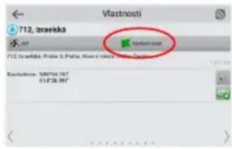
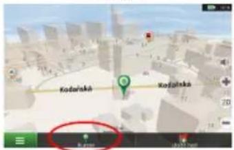
Abb. 3
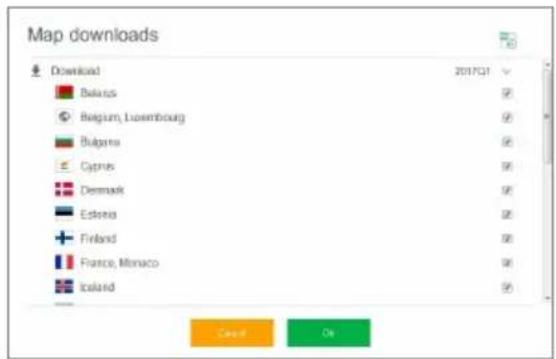
Abb. 4

NAVITEL
UPDATE CENTER - NAVITEL E500 MAGNETIC
Abb. 5 Abb. 6
Car holder (windscreen)
Stylus
Car charger 12/24 V
Mini-USB—USB cable
Protecting case
User manual
Warranty card
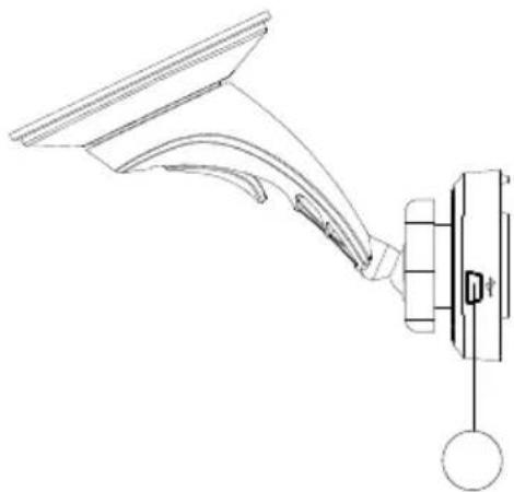
Device Layout
(shown on the page 1).
- On/Off button.
- Battery charge indicator.
- Display.
- 3.5 mm mini jack audio connector.
- microSD slot.
- Mini-USB port.
- Stylus.
- Speaker.
- Magnetic connector
- Reset button.
- Mini-USB for charging.
Safety Information
- Adjust all the settings required before starting to drive. It is extremely dangerous to manage the device and configure its settings while driving. If you need to modify the navigation settings or device parameters, you should park your car in a safe place in accordance with the driving regulations.
- Familiarize yourself with the planned route before moving off. If you happen to miss a voice prompt and you need to take a look at the display to catch up, make sure the road conditions are safe enough for that.
- It is possible that the navigation data and voice prompts don't match the real road condition or driving regulations. You should always pay particular attention to the road conditions, road signs, and pedestrians.
- Do not use the navigator as a tool for precise measurement of speed and covered distance.
- Quality of satellite signal reception may vary depending on position of the device in the vehicle. Quality of the signal may suffer inside a tunnel, near multi-storey buildings, or in a densely built up area. Certain weather conditions, such as heavy mist, may cause a negative effect on reception quality of the signal.
-
It is possible that the GPS signals cannot be received close to where an electromagnetic source is situated or inside buildings.
-
If you have not used the device for a long period, it will take significant amount of time to locate your position even if the GPS receiver is getting good signal.
- Pay particular attention to the place where you intend to install the device. Do not install the device in places where it may interfere with operation of safety bags or block the road view.
- When attaching a holder to the windscreen of your car, pay attention to surface cleanliness. The area should be clear of dust, dirt, and other impurities, there should also be no bubbles under the vacuum cup since it may affect holding strength. Any damages of the device and other objects inside the vehicle caused by detachment of the holder are sole responsibility of the user and are not covered by the warranty certificate.
- Do not subject the device to the long-term exposure to sunlight and high temperatures. Battery overheating may cause explosion.
- Do not expose the device to moisture and quick temperature changes as it may result in water condensation within the device and cause damage. If the device has been exposed to moisture, do not switch it on until it is completely dry.
-
Independent intervention, modification, and opening of the case are prohibited as it may result in the device working incorrectly and in extreme cases can cause damage. Any alterations to the device must be carried out by qualified personnel.
-
The device takes its power from the built-in Li-Pol battery, which can explode or release toxic substances if exploited in an inappropriate way. Do not subject the device to physical impact nor use it close to explosive liquids or gases.
- Ensure normal ventilation conditions for the power adapter during charging since a lot of heat is released in the process. Do not cover the adapter with paper or other objects that may worsen ventilation.
- Do not apply too much force when cleaning the display and other parts of the device. Do not use paper napkins or any hard material that can scratch the device for cleaning. Use soft cloth only.
- Permissible ambient temperature in operating mode: 0 to +35 °C. Storage temperature: +5 to +45 °C. Relative humidity: 5% to 90% without condensation (25 °C).
Using Device in Vehicle
Windscreen holder and battery charger are delivered as part of the product package.
Windscreen holder
ATTENTION! Carefully select a place to attach the holder. Do not attach the holder to the windscreen in a way that limits the driver's line of sight. If the car windscreen contains a built-in heating system or UV protection, the quality of signal reception may be lower than usual.
Setting up the windscreen holder
First remove the protective layer from the vacuum cup. Then, select an appropriate place to attach the holder. Make sure the area is clear of dust, dirt, and moisture, and then secure the vacuum cup on the windscreen. Put the charger cable into the holder. Connect navigator to the holder. Magnetic holder secures reliable attachment of the device.
When connected, the device automatically turns on. If necessary, the device can be easily detached, without removing the holder. After disconnection, device will automatically turn off after 15 seconds..
Device Maintenance
Proper maintenance of the device ensures its long and reliable operation
- Do not keep the device in high humidity and hot conditions;
- Prevent the device from being exposed to sun and UV light;
- Do not put or drop anything on top of the device;
- Do not subject the device to physical impacts such as hits and drops;
- Do not subject the device to moisture and quick temperature changes as it may result in water condensation within the device and cause damage. If the device has been exposed to moisture, do not switch it on until it is fully dried out;
- The display of the device is very sensitive to scratches. Avoid touching the display with sharp objects. You can use a protective layer to prevent the display from scratching;
- Never clean the display when the device is on. When cleaning, use soft cloth only;
- Do not use paper napkin or towels for cleaning the display;
- Do not try to disassemble, fix, or modify the device on your own as it may be dangerous for your health as well as result in incorrect operation of the device. This will also cause termination of the warranty.
Safe Driving
- To safely use the device's functions, please, make sure to follow traffic regulations. Moreover, please, remember the general rules of treating your vehicle like a potentially dangerous object;
- In the first place, these rules are determined by the risk of causing harm to the life or health of third parties, damaging their possessions and pets, and harming the environment;
- Whenever you stop the vehicle, always use the parking brake. Keep the parking brake well functioning so that it is able to prevent the car from any movement;
• Always park your vehicle in an open and well ventilated area; - Keep the sound in the vehicle relatively low so that you can hear everything that happens outside the vehicle;
- Do not carry out any operations in the device that could possibly distract you from driving.
NAVITEL s.r.o. hereby declares that the device NAVITEL E500 MAGNETIC is compatible with the European directive RED 2014/53/EU.
The full text of Declaration of conformity is available at the following internet address:
www.navitel.cz/en/declaration_of_conformity/e500m
Technical Specification
| System Specification | |
| CPU MStar MSB2531 800 MHz,Cortex-A7 | |
| RAM 128 MB, DDR3 | |
| External slot microSDHC up to 32 GB | |
| Internal storage 8 GB | |
| Operating system WinCE / Linux | |
| Basic parameters | |
| Display 5" TFT, 800×480 | |
| Speaker 8 Ohm / 1.5 W | |
| Battery type 950 mAh, rechargeable | |
| GPS parameters | |
| GPS MSR2112 32PIN-QFN | |
| Frequency 1.575 GHz | |
| Channel Qty 66 channels (search positioning) / 22 channels (tracking) | |
| C/A CODE 1.023 MHz chip rate | |
| Sensitivity | -165 dBm |
| Location accuracy | 10 m, 2D RMS; 5 m 2D RMS, WAAS enable |
| Rate | 0.1 m/s |
| Update frequency | 1 Hz |
| Renew time | 0.1 s |
| Hot start | 2 s (Autonomous) |
| Warm start | 32 s (Autonomous) |
| Cold start | 35 s (Autonomous) |
| Max altitude 18,000 m | |
| Max rate | 515 m/s |
| Antenna | Internal ceramic antenna; 18.4 mm × 18.4 mm × 2 mm |
| NMEA | NMEA 0183 standard v3.01 |
| Baud rate | 115,200 bps |
| Port COM1 |
Note. Characteristics of the device and its external appearance can be modified by the manufacturer without preliminary notification.
Introduction
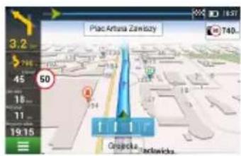
Navitel Navigator is an offline multifunctional navigation application used for efficient route search and planning. Key tasks of the program are identification and display of current position on the map, automatic and manual setting of route points, object search, calculation, display of travel information, and many other things.
Program Interface
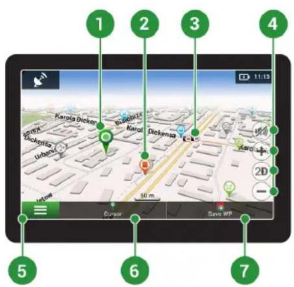
| 1 | Point on the map | Short tapping on the map marks the point for further operations with it, "Cursor" and "Save WP". |
| 2 POI | This is an example | of how points of interest (POI) are displayed in the program.Different categories of POI have different icons. There is a large variety of icons for particular POIs such as shopping centers, brand shops, gas stations etc. |
| 3 SPEEDCAM | This is an example of how icons of the SPEEDCAM function are displayed on the map. Speedcams are special marks on the map that are meant to warn about speed cameras, radars, dangerous crossroads, speed bumps, and other types of potential obstacles on the road. | |
| 4 Map | buttons These are the buttons for controlling the map view modes (2D/3D), map scale, and volume settings. | |
| 5 Main menu | Tapping this button will open the main menu of the program. | |
| 6 Cursor | This button becomes available only when a point is selected on the map. Tapping this button will open the "My route" screen, where you can carry out various operation with the selected point. | |
| 7 | Save WP | This button becomes available only when a point is selected on the map. Tapping this button will cause the selected point to be saved in the form of a waypoint. |
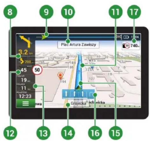
| 8 Upcoming maneuver | The indication of the distance to the next two upcoming maneuvers. Tapping the sign opens a dialog box with a number of configuration settings. | |
| 9 Progress bar This bar indicates the elapsed and remaining part of the route. | ||
| 10 Street after maneuver | The name of a street following the maneuver. Please note that if certain conditions are met, the upcoming traffic lanes will be displayed instead. |
| 11 Route Active route. | |
| 12 Speed Road speed limit | is displayed next to the current car speed. The program will notify the driver in case of any speed deviations – orange colour block for established speeding level (by default its 10 km/h), red one for higher value of speeding. It is possible to set the speeding level for orange notification up to 30 km/h in the Alerts section of Settings. |
| 13 | Information panel By default, displays a set of gauges that provide information on remaining travel time, distance to the point of destination, and estimated arrival time. The selection of gauges can be changed in the program settings. |
| 14 | Current street The name of the current street (active only when connection with satellites is established). If the map does not contain information about the active street name, the direction of movement is displayed instead (North, South, West, and East). |
| 15 GPS cursor Indicates current position of the device when the GPS receiver is turned on. | |
| 16 Indicator of maneuver | When passing the roads with two or more lanes this indicator displays information about the permitted maneuver at the nearest intersection or turning point; progress bar under the indicator displays the distance left to the described maneuver. |
| 17 | Road regulations On the right side of the display program indicates the distance left to the closest driving regulations. When approaching, the program displays the countdown to the closest camera, road sign or marking. |
Route to a point selected on the map
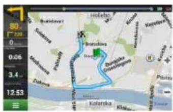
You can have a route planned to a point, which can be found and marked on the map and then set as the destination, while current position of the device, determined by the GPS system becomes the starting point. To plan a route press on the map to mark the point, select "Cursor" [1] and then "Go!" [2]. The program will offer 3 alternative routes [3]. Select the appropriate and press «Go!».
EN
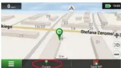
Fig. 1 Fig. 2
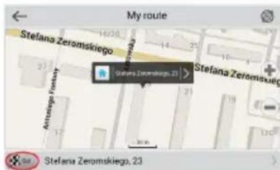
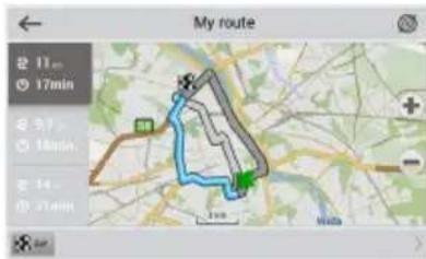
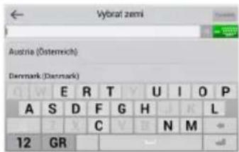
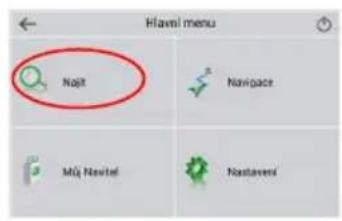
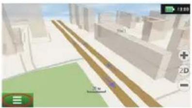
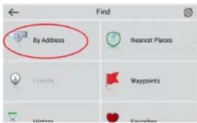
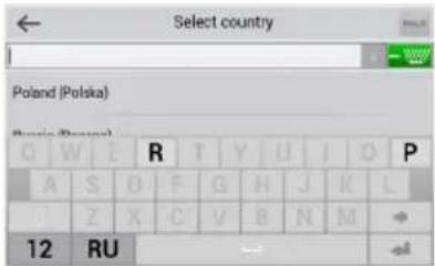
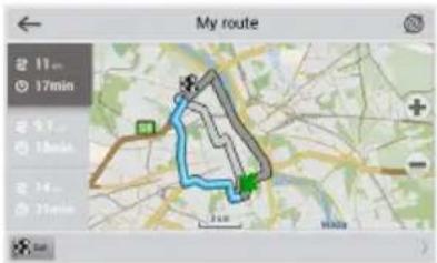
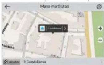
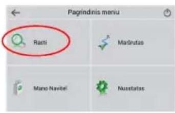
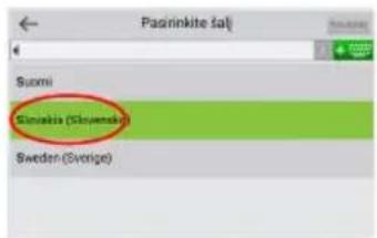
To have a route calculated to a point of a known address, press "Menu" in the bottom left corner of the screen [4] > "Find" [5] > "By address"[6], then press "Select country" and start entering the name of a country [7]. Press the icon in the upper right part of the screen to hide the keyboard. Select the country [8]. "Select city", "Select street" and «Select a building» become active only if the previous fields were filled out [9]. When all information is entered the object will be shown in the screen [10]. Press «Go!». The program will offer 3 route options from a current location to the indicated address [11]. Now you can follow the route [12].

NAVITEL
QUICK START GUIDE – NAVITEL E500 MAGNETIC
natural_image
3D architectural rendering of a city street with buildings, roads, and green spaces (no visible text or symbols)Fig. 4
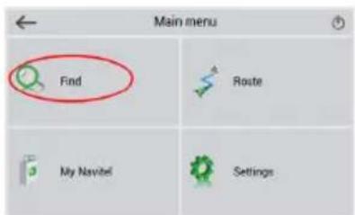
Fig. 5 Fig. 6
![By Address Poland [Select city] [Select street] [Select building] [Select crossing]](/content/2026/05/763594/images/62e36f50e28a222990d05d0e7fbcce23cdbd72c2f8dfc8b9c6909fed78bd9d9b.jpg)
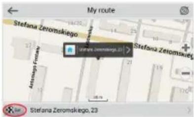
Fig. 10
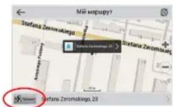
Manual setting of all route points
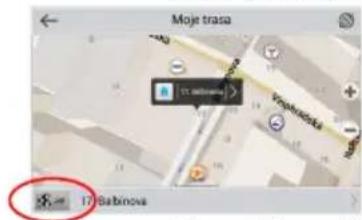
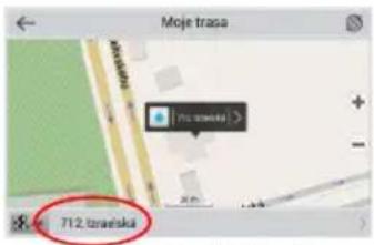
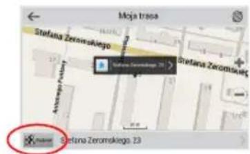
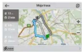
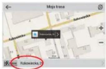
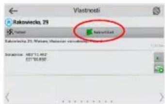
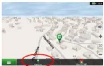
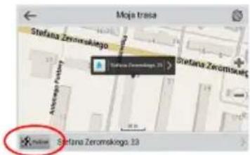
To plan a route, where the starting and the destination points are determined manually, first mark a point on the map where you plan to start and press «Cursor» [1] to proceed to the «My route» screen. Tap on the information panel at the bottom of the screen [2]. Press «Set start» in the «Properties» screen [3]. The GPS-receiver must be switched off. The point will be marked on the map as a starting point. Select a destination point on the map: tap on the map to mark the point, press «Cursor» [4] and then press «Go!» in the «My route» screen [5]. The program will offer 3 alternative routes [6]. Select the appropriate and press «Go!».
EN
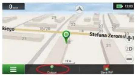
Fig. 1
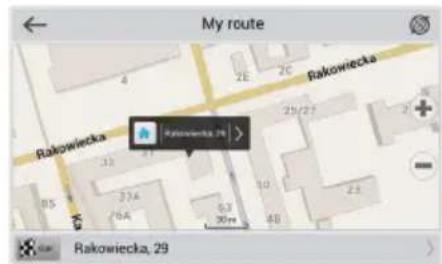
Fig. 2
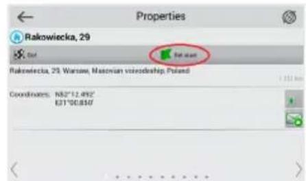
Fig. 3
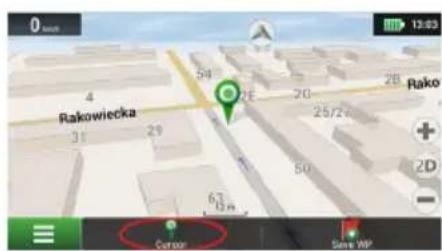
Setting up the Program
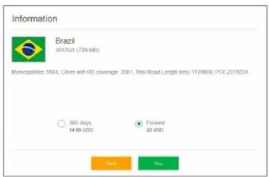
To update your maps and the application, as well as to purchase new maps, you can use a special program that we have designed specifically for these purposes. You can download the program from the "Downloads" section of the official NAVITEL® website. The instructions below will help you to learn how to work with it.
- Install Navitel Navigator Update Center on your PC.
- Connect your device to the PC as a USB Flash Drive/Mass Storage.
- Run Navitel Navigator Update Center. If the device is properly connected, the program will detect it [1].
- If updates are available, Navitel Navigator Update Center will suggest that you update your Navitel Navigator and/or maps [2].
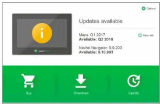
Fig. 1
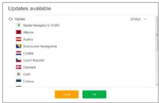
Fig. 2
Keep in mind that the old maps will be deleted during the update. To continue, press "Update", then "OK".
- Navitel Navigator Update Center will download and install the updates on your device.
- After updating, you can download or buy additional maps by pressing "Download" or "Buy" respectively [3].
- To download maps, mark the ones you need in the list and press "OK" [4].

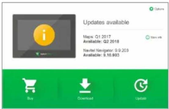
Fig. 3
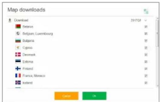
Fig. 4
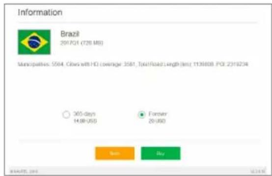
- To buy a map, press on the entry corresponding to the map you want to buy, select subscription length and press "Buy" [5, 6].
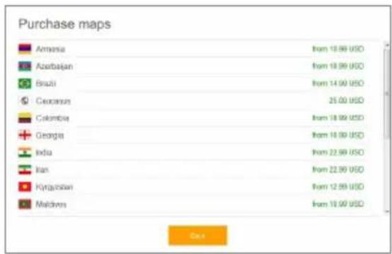
Fig. 5 Fig. 6
- Run Navitel Navigator on your device.

A csomag tartalma
- sz. ábra
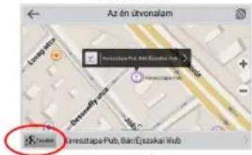
pav. 1 pav. 2 pav. 3
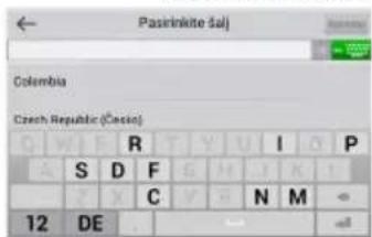
pav. 4 pav. 5 pav. 6
pav. 7 pav. 8 pav. 9
![[Pearlinkte sal]](/content/2026/05/763594/images/59d5b6cdf073548cec9ee2f75c286be9a6042385e6276695a4e3f4bee27bb029.jpg)
![Pagal adresą Slovakia [Paspinkite miesta] [Paspinkite garte] [Paspinkite pustata] [Paspinkite sarkryta]](/content/2026/05/763594/images/20a194a226cb6425828af9dcf90513d7f1c5e1ce28f5c4aae4e1effab51b6df1.jpg)
Navitel Navigator Update Center
pav. 2
att. 2

![[Wybierz państwa] Adres Notes](/content/2026/05/763594/images/15a27bb858e13f0444d1433c8e5e5947e387be7f656b8f6b66ccd83add784c3f.jpg)
Rys. 6
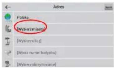
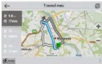
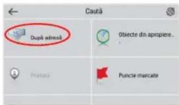
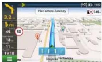
Fig. 1
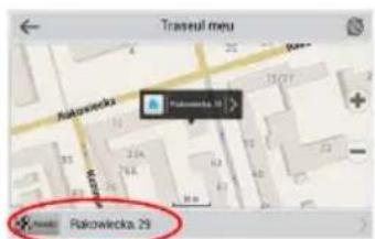
Fig. 2 Fig. 3
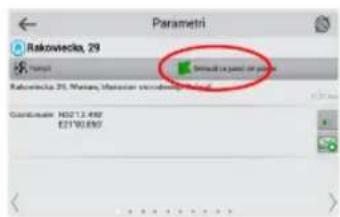
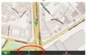
Fig. 4
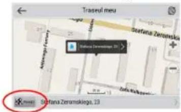
Fig. 5
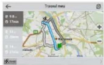
Fig. 6
Navitel Navigator Update Center
Fig. 2
Obr. 1 Obr. 2 Obr. 3
Obr. 1 Obr. 2 Obr. 3
Obr. 4 Obr. 5 Obr. 6
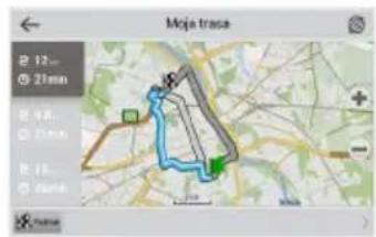
Navitel Navigator Update Center
Рис.4
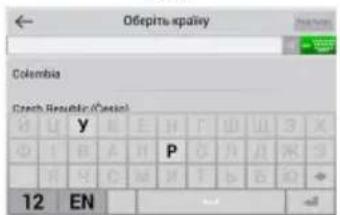
Рис.:
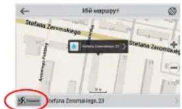
Рис. 10
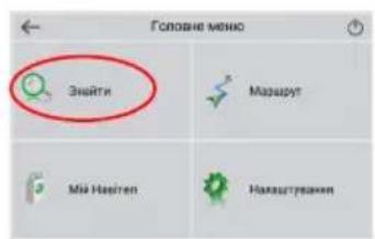
Рис.
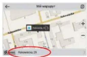
Рис. 2
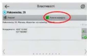
Рис.4
natural_image
Green globe with orbiting rings and star highlights (no text or symbols)NAVITEL
- Obsah balení
- Device Layout
- Safety Information
- Using Device in Vehicle
- Windscreen holder
- Setting up the windscreen holder
- Device Maintenance
- Proper maintenance of the device ensures its long and reliable operation
- Safe Driving
- Introduction
- Route to a point selected on the map
- NAVITEL
- QUICK START GUIDE – NAVITEL E500 MAGNETIC
- Manual setting of all route points
- Setting up the Program
- A csomag tartalma
- Navitel Navigator Update Center
Brand : Navitel
Model : E500 Magnetic
Category : Gps