PathFinder Logger P 3106 - Gps Pentagram - Free user manual and instructions
Find the device manual for free PathFinder Logger P 3106 Pentagram in PDF.


| Product Type | GPS Data Logger |
| Brand | Pentagram |
| Model | PathFinder Logger P 3106 |
| Dimensions | 70 x 40 x 20 mm |
| Weight | 55 g |
| Power Source | Built-in rechargeable lithium battery |
| Battery Life | Up to 24 hours continuous logging |
| Charging Interface | USB 2.0 (Micro-USB) |
| Internal Memory | 64 MB (stores up to 200,000 waypoints) |
| GPS Chipset | SiRFstar III or equivalent |
| Position Accuracy | < 3 meters (typical) |
| Logging Interval | 1 second to 60 minutes (configurable) |
| Supported Protocols | NMEA 0183, SiRF binary |
| Data Output Format | GPX, KML, CSV (via software) |
| Water Resistance | IPX4 (splash-proof) |
| Operating Temperature | -10°C to 50°C |
| Display | No display (LED indicators only) |
| Connectivity | USB for data transfer and charging |
| Software Compatibility | Windows (7/8/10), Mac OS X (via USB storage mode) |
| Mounting | Belt clip or car dashboard (adhesive pad included) |
| Included Accessories | USB cable, car charger, mounting bracket, manual |
| Certifications | CE, FCC, RoHS |
Frequently Asked Questions - PathFinder Logger P 3106 Pentagram
User questions about PathFinder Logger P 3106 Pentagram
0 question about this device. Answer the ones you know or ask your own.
Ask a new question about this device
Download the instructions for your Gps in PDF format for free! Find your manual PathFinder Logger P 3106 - Pentagram and take your electronic device back in hand. On this page are published all the documents necessary for the use of your device. PathFinder Logger P 3106 by Pentagram.
USER MANUAL PathFinder Logger P 3106 Pentagram
APPLICATIONS......EN - 9
SPECIFICATION ...... EN - 10

WPROWADZENIE....PL - 3
BUDOWA URZĄDZENIA PL - 4
PRZYGOTOWANIE DO PRACY....PL - 5
APLIKACJE ......PL - 8
SPECYFIKACJA....PL - 9

NOTE! Any information and technical data are subject to change without prior notification and/or indication in this manual.
© 2009 PENTAGRAM
All rights reserved; copying and reproduction is strictly forbidden.

natural_image
Geometric star symbol with pentagon and triangle design (no text or labels)PENTAGRAM
THE PERFECT SIMPLICITY
Introduction
- For the first time you use the GPS receiver, please charge battery until it is full.
- Don't use GPS receiver in temperatures lower than -10^ or higher than 60^ , or its battery charging capability will decrease. The Lithium inside the GPS receiver should be recycled.
- For a long period not using GPS receiver, take out the battery and store it in dry/cool places.
- While in the hospital, turning off the GPS receiver is strongly recommended. Like other common equipments do, wireless GPS receiver may also affect medical equipment which use radio frequency and make these equipments malfunction.
- For safety, keep the GPS receiver and all accessories out of small children's reach.
- We assume no responsibility for any damages and loss resulting from use of this manual, malfunction, dead battery, or misuse of the product in any way.
- Use only the supplied and approved accessories. Unauthorized accessories, antenna, modifications or attachments could damage the GPS receiver, and may violate regulations governing radio devices.
- Use a dry, clean soft cloth to clean the unit. Do not use harsh cleaning solvents, chemicals, or strong detergents.
- Do not open the GPS receiver by yourself. Unauthorized hacking may damage the unit, and will void your warranty.
Box Contents
- GPS Bluetooth receiver
- USB cable
- Car charger
- Power adapter
- Rechargeable battery
- CD
- User manual
Hardware Description
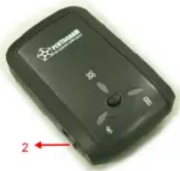
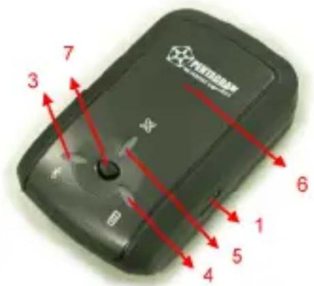
- Power jack
- Mode switch
- Bluetooth status LED (blue)
- Battery status LED (red/green)
- GPS status LED (orange/blue)
- Internal antenna
- Log button
Mode switch
OFF position – Power off.
NAV position – Navigation only.
LOG position – Navigation with logging.
Log button
Push to log Point of Interest, GPS LED will blink 3 times.
LED Indicator
GPS status LED
- Orange (on) – acquiring satellites, GPS position not fixed.
- Orange (blinking) – GPS position fixed, navigation.
- Blue (fast blinking) – LED blinks 3 times, Point of Interest is recorded.
- Blue (slow blinking) – low memory (about 20%).
- Blue (on) – memory full, logging stopped.
Battery status LED
- Red (blinking) - Low battery.
- Green (on) - Battery charging.
- Off - Battery charging completed.
Bluetooth status LED
- Blue (on) – Bluetooth enabled, but connection not established.
- Blue (slow blinking) - Sleep mode.
- Blue (fast blinking) – Bluetooth connection established.
Getting Started
- Install and charge the battery.
- Turn on the GPS Bluetooth receiver.
Switch the mode switch to NAV or LOG position. The GPS status LED turns orange and Bluetooth status LED turns blue (only in NAV mode). - Activate Bluetooth function of your PDA/PC.
Prior to activating the Bluetooth function of your PDA/PC, please make sure the device is equipped with Bluetooth function, and the driver software has been installed. - Activate Bluetooth Manager & Established New Connections. Illustrations using PocketPC:
a. First, find the device with which you wish to establish connection.
b. Open „Bluetooth Manager“ on your PocketPC.
c. Follow the steps below.
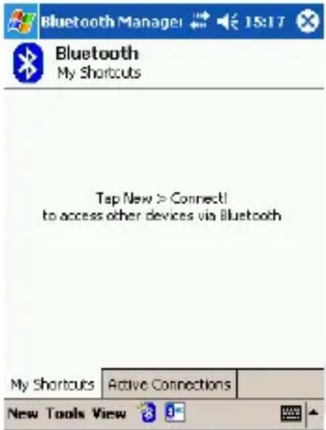
Tap New and then Connect!
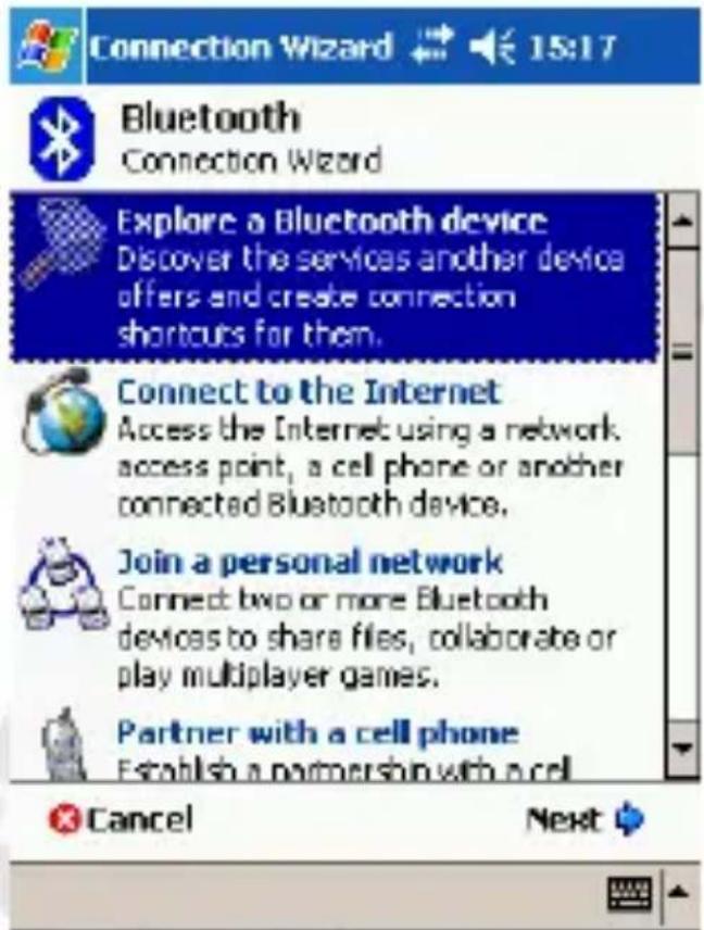
Select above option and tap Next
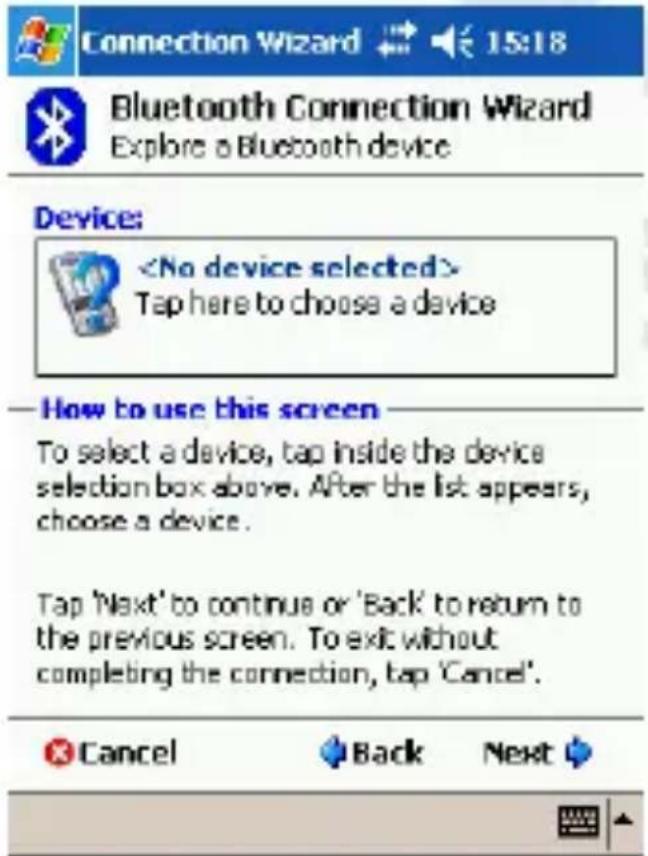
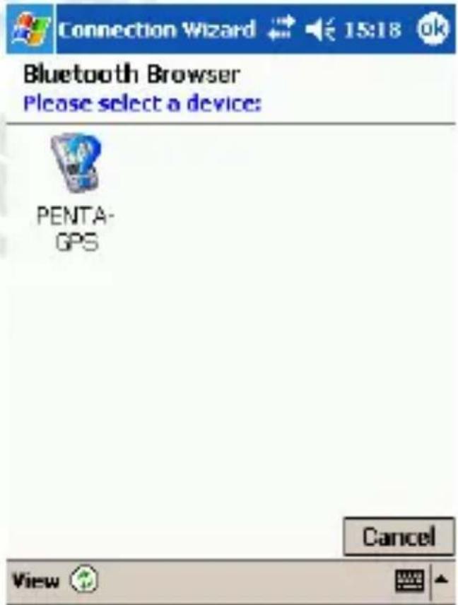
Tap within Device frame
Tap on device

Bluetooth Passkey

15:16


Bluetooth
Authentication
Device:
PENTA-GPS
Passkey:
• • • •
Cancel
How to use this screen
The Bluetooth pairing procedure establishes a secret key that is used in all future connections to authenticate.
![123 1 2 3 4 5 6 7 8 9 0 - = ◆ Tab q w e r t y u i o p [ ] CAP a s d f g h j k l ; ' Shift z x c v b n m , . / ← Cbl áü ` \ ↓ ↑ ← →](/content/2026/05/989936/images/c5c58765f6feed4de021ecbf9f0ce2dab471e80ec43586a3caab45f2e356a86d.jpg)
In Passkey field enter 0000 and tap Enter

Connection Wizard

15:19

Bluetooth Connection Wizard Explore a Bluetooth device

PENTA-GPS
Service Selection

SPP slave
Please select the service(s) offered by this device you would like to create connection shortcuts for.
Security

Use a secure, encrypted connection

Cancel

Back
Next


Select above option and tap Next

Connection Wizard

15:19

Bluetooth Connection Wizard Explore a Bluetooth device

PENTA-GPS
Shortcuts created
Connection shortcut(s) for the service(s) you selected were successfully created.
To connect: From the Bluetooth Manager "My Connections" screen, double-tap the connection. Or tap-and-hold the connection icon and select 'Connect' from the menu.
Finish


Bluetooth Manager

15:20


Bluetooth My Shortcuts

PENTA-GPS: SPP slave
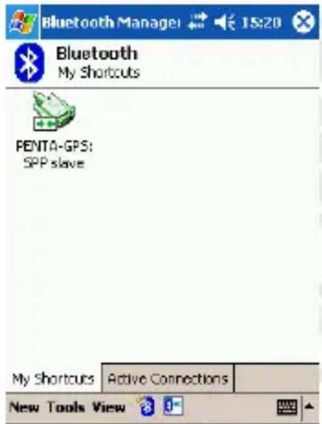
Connection established
Applications
Photo Tagger
- Complete GPS Photo Tagger and USB drivers installation (Refer to CD)
- Download and install Google Earth. Google Earth has free download version, for more information, please visit http://earth.google.com/.
- For further function to use the Photo Tagger software in detail, please refer to Photo Tagger user manual located in Photo Tagger software > Help > User Manual.
- Use attached USB cable to connect the GPS receiver to your PC. Please keep in mind to switch to LOG mode while using Photo Tagger software.
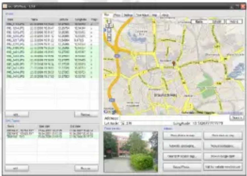
locr GPS Photo
With GPS data logger and locr GPS Photo software, users are allowed to import geotagging adds information to photos. The position (latitude / longitude) can be written into EXIF header for the further application. Also, locr GPS Photo can integrate travel log and digital photos by date/ time to show photos on the map directly. Please find the installation file for Windows XP / Vista on CD, or go to http://www.locr.com for further information.
Specification
GPS Features:
| Chipset | MTK | |
| Frequency | L1, | 1575,42MHz |
| C/A Code 1023MHz | ||
| Channels | 66 | Channels |
| Antenna Built-in low noise antenna | ||
| Sensitivity | To | -165dBm |
Time To First Fix (TTFF)
| Cold Start 36 s, average |
| Warm Start 33 s, average |
| Hot Start 1 s, average |
| Reacquisition < 1 sec |
| Update rate 1 s |
Accuracy
| Position Open sky: < 3 m | ||
| Velocity | 0,1 | m/sec |
| Time ± 50 ns synchronized to GPS time | ||
| Power | ||
Built-in rechargeable 850mAh Li-polymer
| Operation Current < 40mA (Typical) | |
| Input voltage 5 V ±10% | |
| Datum | WGS-84 |
| Dynamic conditions | |
| Altitude | < 18000 m |
| Velocity | < 515 m/sec |
| Acceleration | < 4 G |
Temperatures
| Operating | -10 °C ~ +60 °C |
| Storage | -20 °C ~ +60 °C |
| Dimensions (mm) | 72,2 x 46,5 x 20 (L. x W x H.) |
| Weight | 67 g (battery included) |
Interface
| PC/PDA Bluetooth (class 2); distance 10 m | |
| GPS Protocol | NMEA-0183 V3.01 – GGA, GSA, GSV,RMC, VTG, GLL |
| Data Logging | 32 MB Flash memory, up to 150000navigation points, logging based on time,distance and velocity |

natural_image
Geometric star symbol inside a pentagon with a checkered pattern (no text or labels)PENTAGRAM
THE PERFECT SIMPLICITY
Wprowadzenie
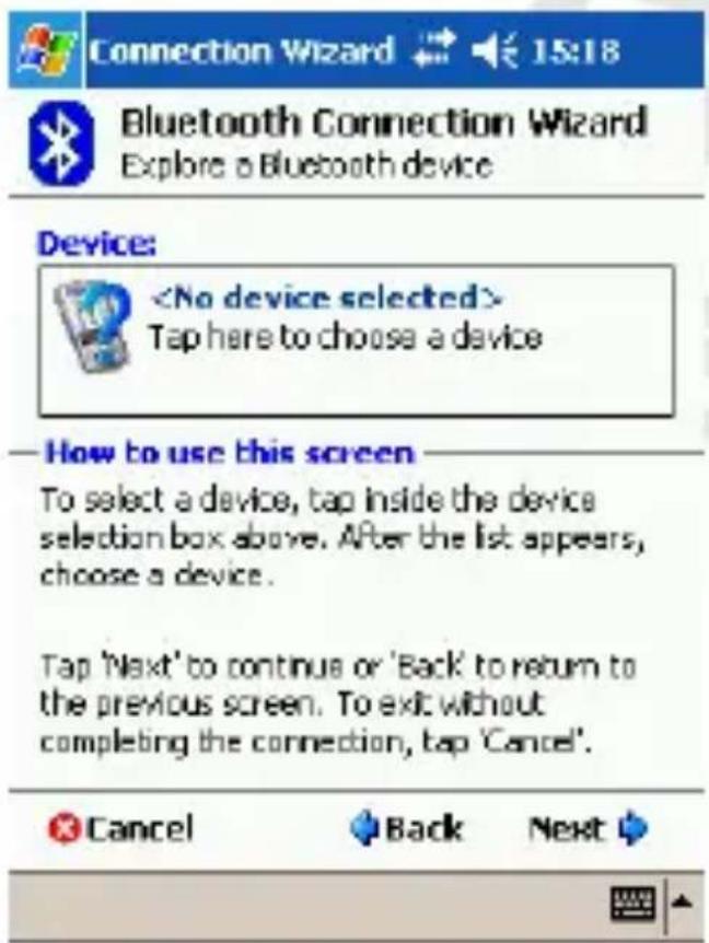
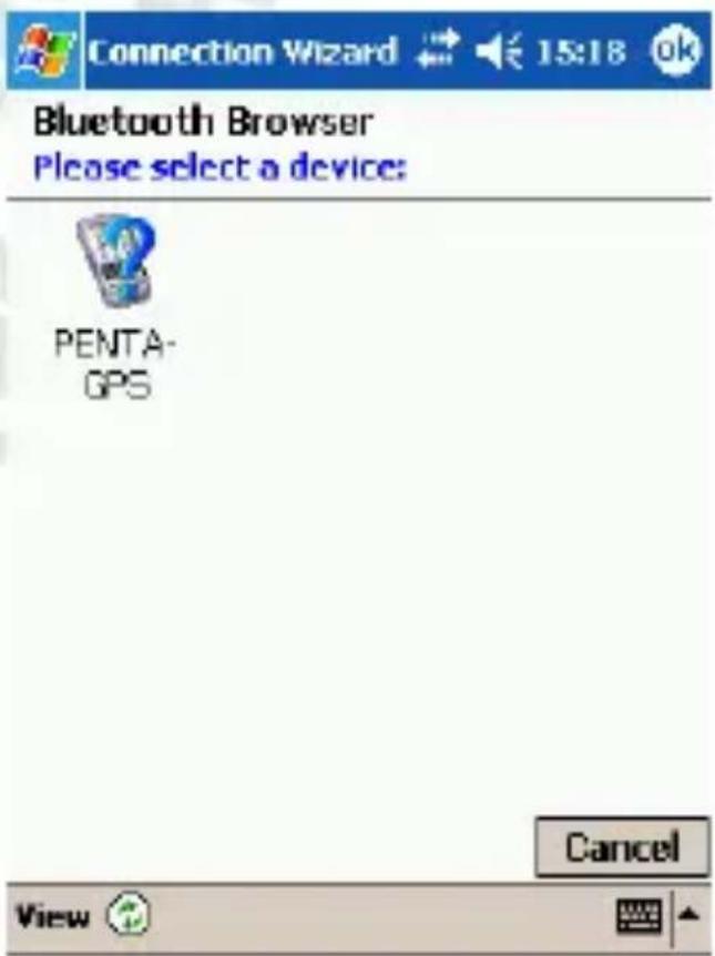
How to use this screen
The Bluetooth pairing procedure establishes a secret key that is used in all future connections to authenticate.
![123 1 2 3 4 5 6 7 8 9 0 - = ◆ Tab q w e r t y u i o p [ ] CAP a s d f g h j k l ; ' Shift z x c v b n m , . / ← Ct äü ` \ ↓ ↑ ← →](/content/2026/05/989936/images/20b0059a828987fbf1bf7cf7dbefda3f321b1f103c1ceab3e68c0d8b659521d4.jpg)
Bluetooth Connection Wizard Explore a Bluetooth device

PENTA-GPS
Shortcuts created
Connection shortcut(s) for the service(s) you selected were successfully created.
To connect: From the Bluetooth Manager "My Connections" screen, double-tap the connection. Or tap-and-hold the connection icon and select 'Connect' from the menu.
Finish

natural_image
Simple gray rectangular shape with a small icon in the bottom-right corner (no text or symbols)Kliknij Finish

Connection Wizard

15:19

Bluetooth Connection Wizard Explore a Bluetooth device

PENTA-GPS
Service Selection

SPP slave
Please select the service(s) offered by this device you would like to create connection shortcuts for.
Security

Use a secure, encrypted connection

Cancel

Back
Next



natural_image
Simple line drawing of a computer monitor and keyboard on a plain background (no text or symbols)Specyfikacja
Funkcje GPS:
Układ
Częstotliwość
Kod C/A 1023MHz
Odbiornik
Antena
Czułość
MTK
L1, 1575, 42MHz
66
kanałów
Wbudowana
niskozakłó
- © 2009 PENTAGRAM
- Introduction
- Box Contents
- Hardware Description
- Mode switch
- Log button
- LED Indicator
- GPS status LED
- Battery status LED
- Bluetooth status LED
- Getting Started
- How to use this screen
- Service Selection
- Security
- Shortcuts created
- Applications
- Photo Tagger
- locr GPS Photo
- Specification
- Wprowadzenie
- PENTA-GPS
- Specyfikacja
- Funkcje GPS:
Brand : Pentagram
Model : PathFinder Logger P 3106
Category : Gps