
VantagePoint - Browser MAGELLAN - Free user manual and instructions
Find the device manual for free VantagePoint MAGELLAN in PDF.


| Product Type | GPS Planning and Management Software |
| Compatible Devices | Magellan Triton GPS Receivers |
| Version | Rev A (Copyright 2007) |
| Operating System Requirements | Windows 2000, Windows XP, Windows Vista |
| Minimum Processor | 1.5 GHz |
| Minimum RAM | 256 MB |
| Minimum Video Card | DirectX 9.0 compatible, 64 MB VRAM |
| Free Hard Disk Space | 50 MB for installation; additional for maps |
| Main Functions | Map viewing, route planning, track analysis, waypoint and geocache creation, library organization, synchronization with GPS |
| Search Capabilities | Search for addresses, POIs, geocaches, coordinates, user data |
| Map Types Supported | Background, Outdoor, Street, Marine maps |
| Route Planning | Create routes with waypoints, calculate turn-by-turn directions with street maps, find caches along route |
| Data Import/Export | GPX files, import from GPS or SD card, export to GPS |
| Media Support | Add photos and audio recordings to journeys |
| GPS Connectivity | USB connection to Triton GPS; requires Triton connectivity mode set to VantagePoint |
| Update Feature | Notifies of available software updates for VantagePoint and Triton |
| Online Resources | Access to MagellanGPS.com, My Magellan account, support |
| Installation Method | From CD-ROM; close all applications before installation |
| Language | English (manual available; software likely English) |
| Licensing | License agreement accepted during installation |
Frequently Asked Questions - VantagePoint MAGELLAN
User questions about VantagePoint MAGELLAN
0 question about this device. Answer the ones you know or ask your own.
Ask a new question about this device
Download the instructions for your Browser in PDF format for free! Find your manual VantagePoint - MAGELLAN and take your electronic device back in hand. On this page are published all the documents necessary for the use of your device. VantagePoint by MAGELLAN.
USER MANUAL VantagePoint MAGELLAN
VantagePoint™ PC Application Software for Magellan® Triton™ GPS
Overview
Magellan® VantagePoint™ is a powerful software application that enables users to view maps, Points of Interests (POIs), and customize their user-created data on a PC. You can create waypoints and geocaches, load maps, POIs, waypoints, geocaches, routes, tracks, add photo and audio recordings of your journeys and view all data on the map in VantagePoint. VantagePoint allows users to search for POIs and user-created data on your map to help plan a trip. The Route Planning feature helps map an upcoming hike, geocaching trip or other adventure, while the Track Analysis tool can playback the user's experiences on the trip to share with others. VantagePoint will also remind you of available new software for VantagePoint itself or Triton when it is available online for you to download*. The Library Function helps to organize and store all of your content including Maps, Journal (user generated data), and Media. Then VantagePoint can synchronize your user-generated content with your Triton GPS or transfer your maps to Triton GPS.
Minimum System Requirements for installing VantagePoint:
• OS: Windows 2000, Windows XP, Window Vista
- Processor: 1.5 GHz
• RAM: 256 MB
• Video Card: DirectX 9.0 compatible, with 64 MB of VRAM
• HDD: 50 MB free space for installation, more free space required for maps
For more information on VantagePoint, click on the following site*:
http://www.magellangps.com/VantagePoint/
*Internet connection required.
Copyright 2007 Magellan Navigation, Inc., 960 Overland Ct., San Dimas, CA 91773
631558 Rev A
Installation
Magellan VantagePoint™ Software is contained in the CD included in the package. Close all applications including your web browser before starting installation of VantagePoint. Follow the instructions to install:
- Click onto MVP. exe icon then, the VantagePoint Installation Wizard will appear:
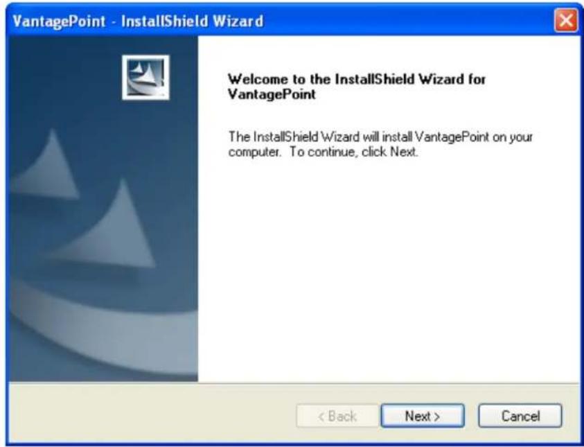
- To continue installation, click Next.
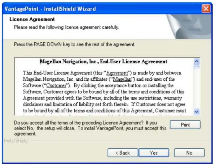
- Read the license agreement. If you accept the terms of the agreement, click Yes.
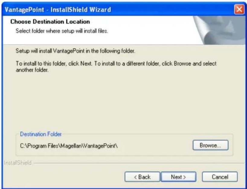
- Choose destination for files, click Next:
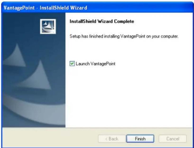
-
If the installation is successful, an InstallShield Wizard Complete window is displayed. Click Finish.
-
When the installation of VantagePoint is complete it should create icon on the desktop. The VantagePoint application is installed in the folder c:\All Programs\Magellan\VantagePoint
Launch VantagePoint™
The following instructions will help you launch VantagePoint™ Software. You can launch
VantagePoint by double clicking the

icon on your desktop OR from Start\All
Programs\Magellan\VantagePoint. When you open VantagePoint the following screen will appear:
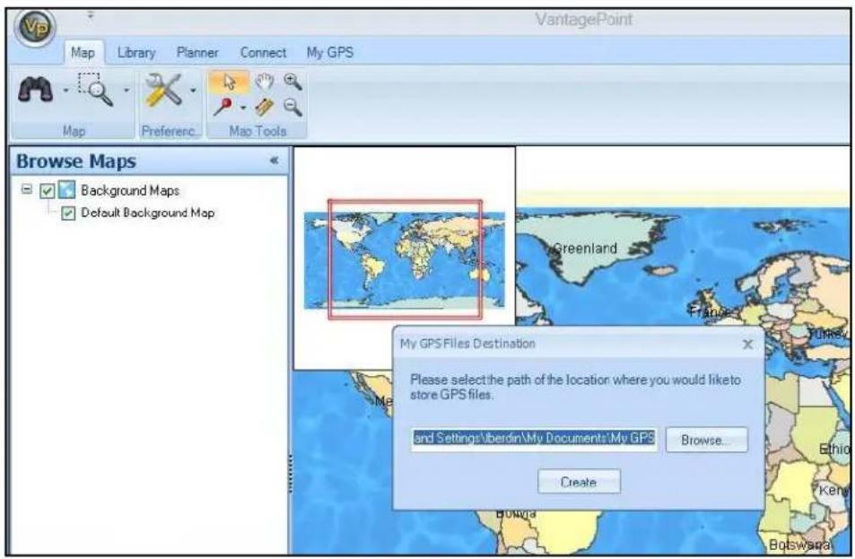
Next, you will see the screen below for creating a folder for all your GPS-related files. Click Create and VantagePoint will create a folder called "My GPS" in My Documents.
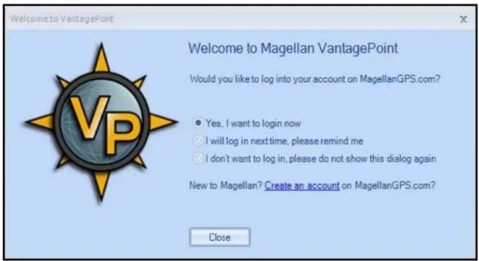
When My Gps folder is created, it will prompt you for login to register. If you do not wish to register at this time, click on "I will log in next time, ...".
Using VantagePoint
Main Window
After launching VantagePoint, the Main Window opens and displays the user interface with a Background Map*. The user interface is intuitive and easy to use. Toolbars have been replaced by a “Ribbon” where commands are organized into “Tabs” with Subtasks and Command buttons appearing after a Tab is selected:
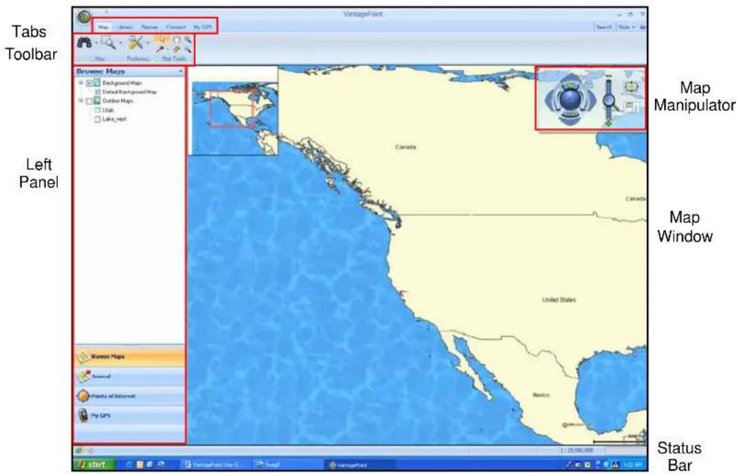
The major elements of the screen and their function are as follows:
Tabs – Tabs are task-menus
Toolbar – Tools for each Tab
Left Panel – Selecting Map or Planner opens the Left Panel options
Map Manipulator – View the Map Manipulator by scrolling over it
Map Window – The Background map will display automatically
Status Bar – Current selected functions are indicated on the Status Bar
Vertical Profile – Optional feature when working with a Magellan Topo Map and user clicks on street or Track. The Vertical Profile is located on lower-right corner and is partially hidden until mouse pointer hovers over it.
File Menu
The File Menu allows you to open maps and other files or Print the map window's current display.
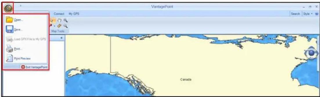
To open the File Menu, click on the VP Icon and select one of the following:
| Open | Add maps or user data files to VantagePoint from your GPS Unit, SD Programmer or your PC hard drive. |
| Save | Save data files |
| Load GPX File to My GPS | Load GPX file to GPS if Magellan Triton is connected to PC |
| Send the image displayed in the Map Viewer to printer. | |
| Print Preview | Preview the page that will be printed |
Search
Click on Search, upper-right side of the screen, a dialog box opens up allowing you to input or refine search criteria and to view Search Results. In the default Search window, All finds addresses, POIs, coordinates, geocaches and other searchable map objects with a single search input:
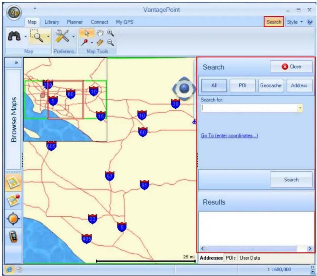
In the Search for field, enter the name of the object you are searching for and press the Search button. Results window displays the list of objects found according to your query. The Results are listed in the Addresses tab for addresses, in the POIs tab if POIs, and in the User Data tab if Journal items like waypoints, routes, track, or geocaches. These tabs are located at the bottom of Search dialog. Click on the object to view it in the Map window. The selected object is marked by a balloon on the map and the map view will re-center to this object. You can switch to advanced POI, Geocache, or Address searches at the top of Search window.
Style
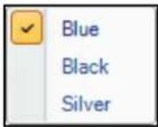
The Style button, next to Search tab, allows you to change the frame color:
About VantagePoint
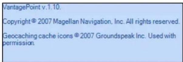
The button will reveal the VantagePoint software version and copyright information:
Map Tab
The Map Tab is used to view maps, manipulate the viewing parameters, and adjust geographic coordinates. The row below the Map Menu contains the Tools for editing a map:

Tools
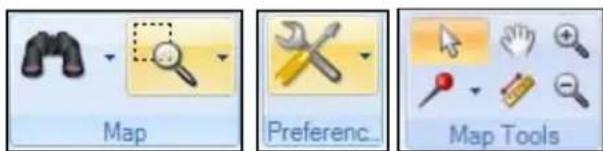
- Map
- View Tool turns ON/OFF functions
– Region Zoom for maps or other items
- Preference
— Set measure units (Meters, Feet, etc.)
- Set coordinate systems
— Set North references (true north or magnetic) for a map
- Map Tools
- Use the mouse pointer to select each map function
- Create waypoints or geocaches
— Pan, Measure Distance, Zoom in or Zoom out
Browse Maps
The Left Panel Browser allows the user to quickly view maps and turn ON or OFF. Available maps are organized into standard map groups with unique icons to differentiate, see below:
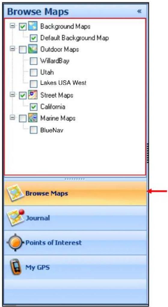
Map Types
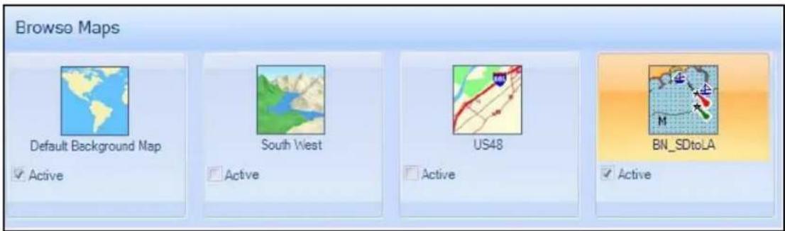
The map icons below show the types of map that can be loaded into VantagePoint. The first is a "Background" map which is a default map intended to be used for areas where you haven't loaded a detailed map with data. The other maps types are Outdoor Maps, Street Maps, and Marine maps, all of which show lots of detailed information:
Map Manipulator
The Map Manipulator is for orienting and navigating a map. On the right side of the screen is partially hidden until you scroll over it with the mouse pointer, allowing full view of the Manipulator and operation of functions.

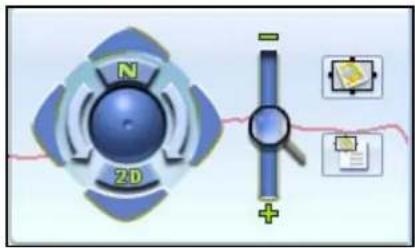
- Manipulator
- Scroll (Linear, 4-way): Click on the outer arrows to move the map view.
— Spin (Rotate): Click on the inner arrows to rotate the map display. - Tilt: Click and hold the mouse on center moveball; move up to tilt the map to 3D perspective view; move down to return to 2D view.
- Zoom: Click on magnifier to zoom in (+) or zoom out (-) of the map view.
— Snapshot: Save current viewing parameters and available regions
— View Snapshot: Return to a Saved Region at a later time.
- The buttons N and 2D tools return the map back to North up and/or 2D view.
Library Tab
The Library Tab is used to organize all of your content, including Maps, Journal (user generated content), Media, and Exchange. The icons below are used to select the individual functions:

Tools

- Library/Browse
- Browse Maps or POIs
- Library/Journal
- Waypoints
- Geocaches
- Tracks/Trails
-
Routes
-
Library/Media
— View, add, delete Media
- Library/Exchange
- Import Files
— Export Files
Planner Tab
The route Planning Tab helps map an upcoming hike or adventure. Use the tools below to create a route with waypoints and points of interest:

Tools
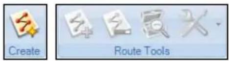
- The Planner feature allows the user to create routes, starting by clicking Create tool icon.
-
Add points by clicking on the map
— Drag and Drop search results from Search window -
If a Street Map is active, the user can calculate a route based on preferred routing method and receive maneuvers and turn-by-turn directions
- The Caches Along a Route Feature will find all local geocaches that exist in your VantagePoint Library.
• The Preferences item allows the user to define preferred routing method
Connect Tab
The Connect Tab allows the user to connect to MagellanGPS.com.

Tools
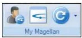
• My Magellan
— Create or Login My Magellan Account, View Support
- Visit MagellanGPS.com
- Update VantagePoint and/or Triton software
My GPS Tab
The My GPS Tab allows the user to view their connected GPS and transfer map and user data to/from Triton GPS.

Tools
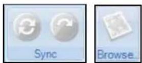
- Sync
— Synchronize user generated data
– Transfer user generated data
- Browse
- Transfer maps
Connecting Your Triton GPS Receiver to Your PC
Before connecting to your PC, perform the following steps on your Triton GPS:
In Triton GPS
- Press the MENU button on the GPS
- Select VIEW on the Menu
- Select SETTINGS in the "View" window
- In the "Settings" window on the GPS, select CONNECTIVITY
- Select VantagePoint from the drop-down screen
- Connect USB Cable from Triton to PC
Note: You should have an appropriate PC driver installed for Triton connection on PC when installing VantagePoint. Triton CD-ROM includes the PC driver for you to update if necessary.
On PC
- Run VantagePoint on your PC
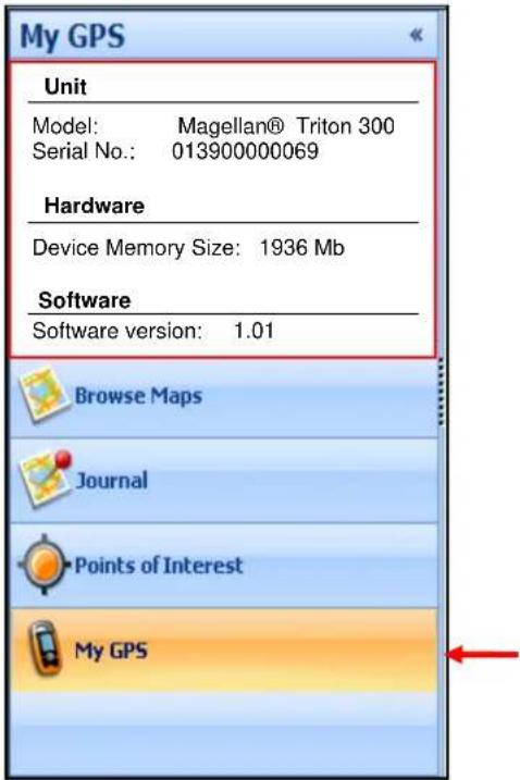
- In VantagePoint, click on My GPS on the Left Panel
My GPS Left Panel
Set your Triton GPS to VantagePoint connectivity mode (in Triton, press View > Settings > Connectivity, and select VantagePoint in drop-down menu) for VantagePoint to communicate with your Triton device. Click My GPS section at the bottom of Left Panel. When the connection is setup, your Triton device information will display on left panel.
Detailed Maps
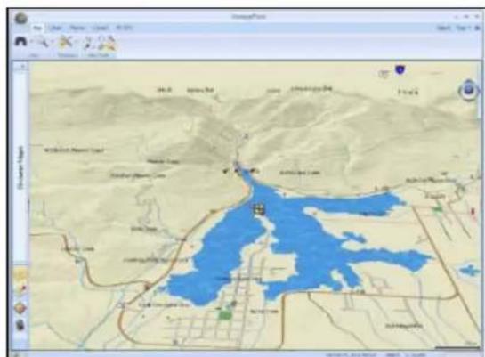
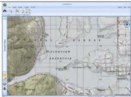
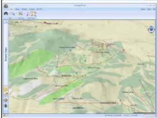
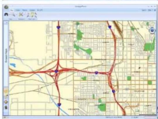
GPS maps that can be loaded into a GPS receiver
GPS maps that can be used on a desktop PC to program waypoints, routes and tracks, can be downloaded to a GPS receiver. You can use a Background map or purchased Magellan maps for planning a trip, during the trip and after the trip.
Magellan Maps and more information at:
http://www.magellangps.com/products/software.asp
- VantagePoint™ PC Application Software for Magellan® Triton™ GPS
- Overview
- Installation
- Launch VantagePoint™
- Using VantagePoint
- Main Window
- File Menu
- Search
- Style
- About VantagePoint
- Map Tab
- Tools
- - Map
- - Preference
- - Map Tools
- Browse Maps
- Map Types
- Map Manipulator
- - Manipulator
- Library Tab
- Planner Tab
- Connect Tab
- • My Magellan
- My GPS Tab
- - Sync
- - Browse
- Connecting Your Triton GPS Receiver to Your PC
- In Triton GPS
- On PC
- My GPS Left Panel
- Detailed Maps
- GPS maps that can be loaded into a GPS receiver
Brand : MAGELLAN
Model : VantagePoint
Category : Browser