
BT-Q1000eX eXtreme - GPS device Qstarz - Free user manual and instructions
Find the device manual for free BT-Q1000eX eXtreme Qstarz in PDF.


| Product type | GPS Data Logger |
| Dimensions | 72 x 42 x 20 mm |
| Weight | 60 g |
| Power source | Rechargeable Li-ion battery (1000 mAh) |
| Battery life | Up to 25 hours continuous logging |
| GPS chipset | SiRF Star III |
| Channels | 66 |
| Accuracy | < 5 meters |
| Internal memory | 2 GB (up to 100,000 track points) |
| Connectivity | USB 2.0, Bluetooth v2.0 |
| Data format | NMEA 0183, SiRF binary, Google Earth KML |
| Logging interval | 1 second to 60 minutes (configurable) |
| Water resistance | IPX6 water resistant |
| Operating temperature | -10°C to 60°C |
| Storage temperature | -20°C to 70°C |
| Software support | Q-Travel, Google Earth, Windows/Mac |
| LED indicator | Power, GPS lock, recording status |
| Spare parts | Battery, USB cable, car charger |
| Cleaning | Wipe with a soft, dry cloth |
| Safety | Avoid strong magnetic fields; charge only with supplied adapter |
Frequently Asked Questions - BT-Q1000eX eXtreme Qstarz
User questions about BT-Q1000eX eXtreme Qstarz
0 question about this device. Answer the ones you know or ask your own.
Ask a new question about this device
Download the instructions for your GPS device in PDF format for free! Find your manual BT-Q1000eX eXtreme - Qstarz and take your electronic device back in hand. On this page are published all the documents necessary for the use of your device. BT-Q1000eX eXtreme by Qstarz.
USER MANUAL BT-Q1000eX eXtreme Qstarz
eXtreme 5Hz Log - log up to 5 times per second
Lap Timing Analysis for Racing Performance Improvement
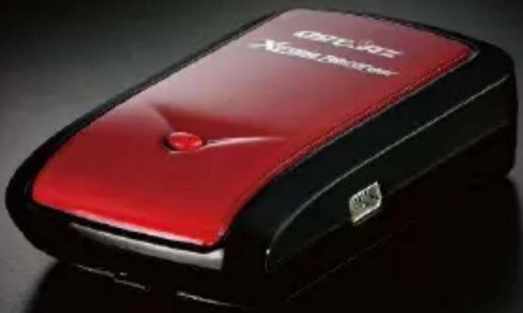
Table of Contents
-
OV+RVI+W .... 1
-
<RODUCT NOTIC+ 1
-
F+ATUR+S....2
-
<RODUCT S<+CIFICATION 3
-
HARDWAR+ INTRODUCTION 4
5-1.A PPEARA>CE 4
5-2.HARDWARE FU>CTIO> 5
5-3.B ATTERY I>STA++ATIO> 6
5-4.+EDI>DICATORS &B_EEPER 7
5-5.F U>CTIO> OF V IBRATIO> SE>SOR....8
- S+TU< BT-Q1000+X 9
6-1. | >STA++ THE DRIVER A>D SOFTWARE UTI+ITY FORBT-Q1000EX ...... 9
6-2.1 >STA++ GOOG+E EARTH.... 13
- START TO US+....13
7-1.F U++Y CHARGE THE BATTERY WHE>USI>G AT THE FIRST TIME.... 13
7-2.CO>>ECT BT-Q1000 EX WITH YOURPC 13
7-3.S TART THE SOFTWARE UTI+ITY 13
7-4.M OU>T BT-Q1000 X O> YOUR EXTREME SPORTS EQUIPME>T 18
- US+FUL R+F+R+NC+ A<<LICATIONS ON TH+ INT+RN+T ......22
8-1. +OCR GPS PHOTO 22
8-2.GPSB ABE+ 23
8-3.COACHR 24
8-4.<ETPHOTO STUDIO....25
8-5. VEO G IO ...... 26
8-6.R ACE CHRO>0 27
-
TROUBL+ SHOOTING ......28
-
A<<+NDIX....33
10-1. ACTIVATE THE BLUETOOTH FU>CTIO>I> YOUR PDA/SMART PHO>E OR PC .... 33
10-2. CREATE BLUETOOTH S ETTI>G (W I>DOWS MOBI+E5/6 FOR POC%ETPC) ..... 34
10-3. CO>FIGURE THE GPS I>TERMEDIATE DRIVER 37
10-4. START YOUR >AVIGATIO> SOFTWARE 39
10-6. SAFETY > OTICES 40
1. Overview
Thank you for purchasing Qstarz 66-CH series BT-Q1000eX - Bluetooth® A-GPS eXtreme Recorder™, built-in second generation GPS chipset MT% with 66 channels tracking for your navigation, common travel log, and extreme sports log. Especially for the extreme sports log part, BT-Q1000eX supports 5Hz log able to provide very precise log data when you are doing extreme sports activities, such as racing, aviating, gliding, skiing, etc... since it can log each point by per 200 millisecond. Besides, the software also provides an exclusive function of lap timing analysis. Via comparing the difference by the time of every lap, you are able to figure out the pros and cons of your performance and exceed your limit.
Register your Qstarz
Register your Qstarz product to get the latest news, software update, event, and product information.
http://www.qstarz.com/register/Product_reg/page.asp
2.
\- 3. Features
- Adopt MTK II chipset with high sensitivity -165dBm and 66-Channel General GPS Chip MTK IIGPS Module Frequency L1, 1575.42MHz C/A Ccde 1.023MHz chip rate Channels 66-CH Performance Antenna (Internal) Built-in patch antenna with L>A Sensitivity Tracking - 165 dBm Datum WGS84 Position Without aid: 3.0m 2D-RMS Accuracy <3m CEP(50%) without SA (horizontal)DGPS (WAAS, E>GOS, MSAS): 2.5m Velocity Without aid: 0.1m/s, DGPS (WAAS, E>GOS, MSAS): 0.05m/s Time 50 ns RMS Cold/Warm/Hot Start 35/33/1 sec, average Dynamic Condition Altitude <18,000m Velocity <515m/sec Acceleration <4g GPS Output Data >MEA 0183 (V3.01) -GGA, GSA, GSV, RMC (Default)VTG, GLL(Optional) Baud Rate 115,200 bps Built-in rechargeable Li-ion battery, Up to 42 hrs after fully charged Bluetooth Standard Fully compliant with Bluetooth V1.2 Bluetooth Profile Serial Port Profiles (SPP), Up to 10 meters Vibration.Sensor. Default On (can turn off from software) Beepe Default On (can turn off from software) Others Size / Weight 72.2 (L) X 46.5 (W) X 20 (H) mm/64.7 g (battery included) Operating Temperature - 10 °C to + 60 °C Storage Temperature - 20 °C to + 60 °C Charging 0 °C to + 45 °C 5. Hardware Introduction
5-1. Appearance
1. Power jack (mini USB type)
2. Mode switch (OFF/1Hz/5Hz)
3. Battery status LED (Red/Green)
4. Bluetooth status LED (Blue)
5. GPS status LED (Orange)
Log Status LED (Red)
6. Internal antenna
7. POI button


5-2. Hardware Function
Hardware Function Description Bluetooth Status Log status Mode Switch 7OFF8 Power off BT-Q1000eX Off Off Mode Switch 71Hz8 When switch to 1Hz mode, BT-Q1000eX can be used to navigate with handheld devices, and the data log function is enabled at 1Hz speed. Other log conditions setting (Time/Distance/Speed) can apply. On On Mode Switch 75Hz8 When switch to 5Hz mode, BT-Q1000eX can be used to navigate with handheld devices, and the data log function is enabled at 5Hz dedicated mode. Other log conditions setting can not apply. On On <ower>ack Take the power cable and connect it to the power jack (mini USB type) for charging only Push to log the favorite Point of Interest
Note: 5Hz mode will consume more power than 1Hz mode (42hrs). The approximate usage time of 5Hz mode is 32 hours.
Mode Switch 7OFF8

Mode Switch 71Hz8

Mode Switch 75Hz8

5-3. Battery installation
1. Press the
text_image
Diagram showing battery packaging process with green arrows indicating assembly steps
- Charging your battery
For the first time using the BT-Q1000eX, please charge battery until it is fully charged. Take the power cable and connect it to the power jack (mini USB type) and recharge through USB cable, travel

charger, or car cigarette adaptor. This will begin to charge the battery. Charging time is about 3 hours typically.
- When the Power +ED flashes, battery power is low status. Please recharge.
- When the Power +ED is Green, the battery is under charging mode.
- When the Power +ED is off, the battery is fully charged.
5-4. L+D Indicators & Beeper
L+D Indicators
L+D Status Flash ON OFF 
+ow Power (Red) Recharging(Green) Fully charged Bluetooth(Blue8) 
Flash per 2 sec.:Bluetooth connected and transmitting ModeFlash per 5 sec.:Power saving mode >otconnected/ Pairing(1Hz mode) GPS not powered / +og Mode is on (5Hz mode) G<TWC8>avi gationGPS position is fixed,Log (Red) 

GPS position is fixed, >avigationFlash per 2 sec: Low memory (20%) Flash 3 times: POI(Point of Interest) is recorded DetectingSatellite,GPSpositionnot fixMemory is full GPS not poweredLog Mode is off
Beeper Code
Status Beep code Description Startup 1 short beep One short beep on off->1Hz, Off->5Hz, 1Hz->5Hz, or 5Hz->1Hz GPS fix 2 short beeps 2 short beeps when GPS fix on 1Hz or 5Hz mode POI button 3 short beeps 3 short beeps when POI button being pressed Memory exhausted 3 long beeps 3 long beeps when the device is out of memory Sleep mode 1 long and 1 short beeps 1 long and then 1 short beep when the device enters sleep mode
*Beeper can be turned off from software -> Config GPS.
5-5. Function of Vibration Sensor
Vibration Sensor: Vibration Sensor is functioned for power saving and waypoint saving. It will detect the physical movement of the device. When it detects the device not moving more than 10 minutes, Q1000eX will enter sleep mode so that the Blue LED will turn to flash every 5 seconds. Under sleep mode the log will be disabled.
When the device is on sleep mode, SHAKE the device to wake it up and the blue LED will turn to flash every 2 seconds (at 5Hz mode this blue LED will not flash) and GPS Orange LED will be also on.
*Vibration Sensor function is turned on as default and can be turned off by provided software -> config GPS.
Note: Once the device enter sleep mode and it may auto wake-up when detecting “significant” movement. We strongly suggest you to use SHAKE method as first priority to wake-up device in case some tracks might not be recorded.
6. Setup BT-Q1000eX
6-1. Install the driver and software utility for BT-Q1000eX
System Requirement (Only compatible with Microsoft Windows XP / Vista)
Minimum System Requirement Recommended System Requirement - Windows XP/Vista/7- Pentium 3, 500Mhz- 512M RAM- 128MB disk space->etwork speed: 128Kbits/sec- 3D-capable video card with 16Mbytes of VRAM- 800x600, "16-bit High Color" screen - Windows XP- Pentium 4 2.4GHz+ or AMD2450xp+- 2G RAM- 2 GB of free disk space->etwork speed: 768 Kbits/sec or better (DSL/Cable)- 3D-capable video card with 32 MB of VRAM or greater- 1280x1024, "32-bit True Color" screen
1. Please insert the Software CD to your computer. The autorun window will appear and please select Q1000eX. Please press "Install PC Suite" to install the main program. If the autorun windows did not appear, please browse the CD and find the folder
"Utility\PC Suite\". Double click "Qstarz_PC_Suite_installer_M.exe" to install the software utility package. This software package contains USB driver, QTravel™, and QSports™ software inside.

2. System would pop up the utility installation dialog. Please click for the next step.

3. Please select “QSports™,” “QTravel™,” and “GPS Data Log Device Driver”, and then click to the next step. If you already installed USB driver, please unselect “GPS Data Log Device Driver.”

4. Click if you want to install the program in default target folder or you can click to change the install folder.

5. Give a folder's name for quick links in start menu and click to install the program.

6. When the utility installation is completed, please click to reboot. Or you can also reboot later by selecting "No, I want to reboot later by myself."

6-2. Install Google +arth
BT-Q1000eX supports showing your travel path directly on Google Earth. Please go to http://earth.google.com for the free download of Google Earth, and then install it to your computer. For the operation procedure of Google Earth, please refer to http://earth.google.com/support/
7. Start to use
7-1. Fully charge the battery when using at the first time
A fully charged battery can last up to 42 hours continuously operation (under 1Hz mode).
7-2. Connect BT-Q1000eX with your
1. 7-3. Start the software utility
2.
\- 3. Features
- Adopt MTK II chipset with high sensitivity -165dBm and 66-Channel 5. Hardware Introduction
5-1. Appearance
1. Power jack (mini USB type) 2. Mode switch (OFF/1Hz/5Hz) 3. Battery status LED (Red/Green) 4. Bluetooth status LED (Blue) 5. GPS status LED (Orange) Log Status LED (Red) 6. Internal antenna 7. POI button   5-2. Hardware Function| Hardware Function | Description | Bluetooth Status | Log status |
| Mode Switch 7OFF8 | Power off BT-Q1000eX Off Off | ||
| Mode Switch 71Hz8 | When switch to 1Hz mode, BT-Q1000eX can be used to navigate with handheld devices, and the data log function is enabled at 1Hz speed. Other log conditions setting (Time/Distance/Speed) can apply. | On On | |
| Mode Switch 75Hz8 | When switch to 5Hz mode, BT-Q1000eX can be used to navigate with handheld devices, and the data log function is enabled at 5Hz dedicated mode. Other log conditions setting can not apply. | On On | |
| <ower>ack | Take the power cable and connect it to the power jack (mini USB type) for charging only | ||
| Push to log the favorite Point of Interest | |||
Mode Switch 7OFF8
Mode Switch 71Hz8
Mode Switch 75Hz8
5-3. Battery installation
1. Press the- Charging your battery
For the first time using the BT-Q1000eX, please charge battery until it is fully charged. Take the power cable and connect it to the power jack (mini USB type) and recharge through USB cable, travel  charger, or car cigarette adaptor. This will begin to charge the battery. Charging time is about 3 hours typically. - When the Power +ED flashes, battery power is low status. Please recharge. - When the Power +ED is Green, the battery is under charging mode. - When the Power +ED is off, the battery is fully charged.5-4. L+D Indicators & Beeper
L+D Indicators
| L+D Status | Flash | ON OFF | ||
| +ow Power (Red) | Recharging(Green) | Fully charged | |
| Bluetooth(Blue8) | | Flash per 2 sec.:Bluetooth connected and transmitting ModeFlash per 5 sec.:Power saving mode | >otconnected/ Pairing(1Hz mode) | GPS not powered / +og Mode is on (5Hz mode) |
| G<TWC8>avi gationGPS position is fixed,Log (Red) | | GPS position is fixed, >avigationFlash per 2 sec: Low memory (20%) Flash 3 times: POI(Point of Interest) is recorded | DetectingSatellite,GPSpositionnot fixMemory is full | GPS not poweredLog Mode is off |
| Status Beep code Description | ||
| Startup 1 short beep | One short beep on off->1Hz, Off->5Hz, 1Hz->5Hz, or 5Hz->1Hz | |
| GPS fix 2 short beeps | 2 short beeps when GPS fix on 1Hz or 5Hz mode | |
| POI button 3 short beeps | 3 short beeps when POI button being pressed | |
| Memory exhausted | 3 long beeps | 3 long beeps when the device is out of memory |
| Sleep mode | 1 long and 1 short beeps | 1 long and then 1 short beep when the device enters sleep mode |
5-5. Function of Vibration Sensor
Vibration Sensor: Vibration Sensor is functioned for power saving and waypoint saving. It will detect the physical movement of the device. When it detects the device not moving more than 10 minutes, Q1000eX will enter sleep mode so that the Blue LED will turn to flash every 5 seconds. Under sleep mode the log will be disabled. When the device is on sleep mode, SHAKE the device to wake it up and the blue LED will turn to flash every 2 seconds (at 5Hz mode this blue LED will not flash) and GPS Orange LED will be also on. *Vibration Sensor function is turned on as default and can be turned off by provided software -> config GPS. Note: Once the device enter sleep mode and it may auto wake-up when detecting “significant” movement. We strongly suggest you to use SHAKE method as first priority to wake-up device in case some tracks might not be recorded.6. Setup BT-Q1000eX
6-1. Install the driver and software utility for BT-Q1000eX
System Requirement (Only compatible with Microsoft Windows XP / Vista)| Minimum System Requirement | Recommended System Requirement |
| - Windows XP/Vista/7- Pentium 3, 500Mhz- 512M RAM- 128MB disk space->etwork speed: 128Kbits/sec- 3D-capable video card with 16Mbytes of VRAM- 800x600, "16-bit High Color" screen | - Windows XP- Pentium 4 2.4GHz+ or AMD2450xp+- 2G RAM- 2 GB of free disk space->etwork speed: 768 Kbits/sec or better (DSL/Cable)- 3D-capable video card with 32 MB of VRAM or greater- 1280x1024, "32-bit True Color" screen |
6-2. Install Google +arth
BT-Q1000eX supports showing your travel path directly on Google Earth. Please go to http://earth.google.com for the free download of Google Earth, and then install it to your computer. For the operation procedure of Google Earth, please refer to http://earth.google.com/support/7. Start to use
7-1. Fully charge the battery when using at the first time
A fully charged battery can last up to 42 hours continuously operation (under 1Hz mode).7-2. Connect BT-Q1000eX with your
1. NOTE 1: Before starting the software utility, please make sure that the USB driver and the software utility has been installed properly.
NOTE 2: QTravel™ only supports BT-Q1000eX. Any intention to use QTravel™ connecting GPS units other than BT-Q1000eX would result in software disconnection automatically.
QSports™ - Your Virtual Sports Coach QSports™ is software with database structure
QSports™ can record, manage, and analyze all your daily/weekly/monthly activities with various sports gear such as Cycling, Running, <ogging, Climbing, Skiing, etc. Train yourself by means of QSports™ statistics to have good health control. Different
sport gear will generate corresponding category for better management and analysis.
- Click from
/ / / QSports Users have to input product key at the first time of use. The product key is located on the envelop of the software CD.
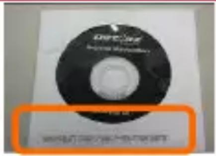

Important Notice: &o not lose your Product Key. Keep the packaging" or write the number down and keep it in a safe place.
2. Add New User
QSports™ supports multiple users. User information includes “User Name”, Gender, Birth Date, and Weight. In order to get correct calories calculation, please fill in the correct personal data.
3.
Import Wizard can guide you to load the tracks from GPS device easily.
3.1 Select default "Sport Type". QSports will create tracks with the default sport type, and users can change the sport type after import.
3.2 QSports™ will automatically detect the COM port and baud rate and load in the GPS tracks.
3.3 Activate the Lap analysis function: once import the data from Q1000eX, the lap analysis function will be activated. The Lap Analysis View button will appear on toolbar.
NOTE: Make sure to Power on GPS unit first before connecting with computer for downloading tracks.
4.
Export Wizard can guide you to proceed export process easily.
4.1 HTML: Pack selected tracks and photos into editable html files or a single easy sharing mht file.
4.2 Google Earth: %M+ and %MZ are Google Earth files formats. %M+ file contains detail waypoints and tracks info. %MZ file contains both simple track and photos info.
4.3 Track File: Export tracks and placemarks as GPX, >MEA, and CSV file formats.
5.
+ap analysis allows you to compare the data of each lap by time, by distance, or by user defined start/finish point.
5.1 Add Start/Finish point: click the black white flag on the right side of Google Map, and then put the black white flag on the start/finish point of the lap/line.
For Circuit: please put one start/finish point or one start point and one finish point.
For Line: need to put one start point and one finish point.
5.2 Add split points: click the red flag on the right side of Google Map, and then put the red flag on the place of the lap/line that you want to know more detail about it.
5.3
Show the lap analysis info instantly by distance, time, or user defined start/finish point.
Data will be split and shown by each distance value. Only for one way not repeating the circuit or line.
Data will be split and shown by each time value. Only for one way not repeating the circuit or line
Data will be split and shown by user defined start/finish and split points. Only for repeating the circuit or line.
5.4
Select tracks to compare to the current track. The comparison is meaningful when the paths are similar.
NOTE: To easily compare data among many devices, please change the device unique ID from software -> Config GPS -> User Name.
Then the imported track will be given a specific file name based on that user name.
For detail QSports functionality, please refer to QSports User's Manual attaching with Software.
QTravel™:
QTravel™ is the best Geotagging software to integrating your travel track and photo together easily. Support track editing, playback, and import/export Wizard.
-
Click from
/ / / QTravel Users have to input product key at the first time of use. The product key is located on the envelop of the software CD. -
\
Import Wizard can guide you to proceed the Geotag process easily.
2.1 The Import Wizard will jump out every time during program startup. You can also launch it by clicking
2.2 Select the method to import the tracks from device.
Create a new trip to save the tracks
Save the tracks into an existed trip
Import a trip from a project file saved by Travel Recorder software
2.3 QTravel™ will automatically detect the com port and baud rate and load in the GPS tracks.
2.4 A track list window will be popped up. Select the tracks to import.
2.5 Please select the photo folder to import photos for geotag.
You can also skip this step by clicking
NOTE: Make sure to Power on GPS unit first before connecting with computer for downloading tracks.
\
Export Wizard can guide you to proceed export process easily.
3.1 HTML: Pack selected tracks and photos into editable html files or a single easy sharing mht file.
3.2 Google Earth: KML and KMZ are Google Earth files formats. KML file contains detail waypoints and tracks info. KMZ file contains both simple track and photos info.
3.3 Track File: Export tracks and placemarks as GPX, NMEA, and CSV file formats.
3.4 Project File: Export whole trip as a Travel Recorder software compatible project file.
\
Update the AGPS data from internet assistance server to boost warm start speed to 15sec.
A-GPS is a system where outside sources, such as an assistance server and reference network, help a GPS receiver boosts performance beyond that of the same receiver in a stand-alone mode by downloading the almanac data from an assistance server.
Note1: A-GPS can boost GPS warm start speed to always lower than 15sec fix after the first fix. The A-GPS efficiency will decrease when time goes by. If it expires, you would have to download almanac data again because the acceleration efficiency of fix will become totally ineffective.
Note2: Please don't update the almanac data via Bluetooth interface.
For detail QTravel functionality, please refer to QTravel User's Manual attaching with Software.
Register your Product Key:
You can register your product key in "software -> about -> Input
Product %ey" by an email account. This email with a registered product key will be saved in Qstarz database. You can check your product key by presenting the corresponding email to Qstarz at any time.
Update the Software:
Please always go to Qstarz download page to check if there is any latest software update.
http://www.qstarz.com/download.htm
Please uninstall the old version before installation.
Note: The license of Qstarz PC Suite is different from that of stand-alone installation package of QTravel™. Thus you are unable to update QTravel software only. Please make sure to download the PC Suite installation package for update.
7-4. Mount BT-Q1000eX on your eXtreme Sports +equipment
1. Clean Surface
Use isopropyl rubbing alcohol or white spirits, wipe lightly, let dry. Do not use household cleaner.


Caution: Do not use with delicate or any rough surface.
2. Remove male Velcro strip and adhesive liner
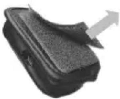

3.
Position Velcro strip and press entire Velcro strip firmly for 30 sec.

4. Wait 1 hour before use.

5. Slide Q1000eX into leather bag
Slide Q1000eX smoothly into leather bag. Attach the leather bag to male Velcro and press entire leather bag firmly.


/aution If the device will be exposed to outside environment" such as attached on motorcycle" any other safety protection equipment must be applied to prevent the device from sliding out of the bag.
To get best accuracy, please position the GPS antenna side up to sky.


Added safety protection equipment demonstrates:

Limitation of liability
Qstarz will not be liable for any loss or damage arising from this accessory, whether direct, indirect, special, incidental or consequential. It's owner's liability to protect Q1000eX during doing any extreme activity.
8. Useful reference Applications on the internet
8-1. locr G
BT-Q1000eX is the member of locr GPS Photo certified product. This utility can integrate travel log and digital photos by date/time to show your photos on the map directly. After the integration, the current GPS coordinates also can be imported to your digital photos for the further application. Please find the installation file for Windows XP/Vista or Symbian system in Qstarz GPS CD. Go to http://www.locr.com for the further information.
Compatibility: Windows X
text_image
GPS
Name
S###t
S###t
F####
GPS_011.JPG
22 22 22 22 22 22 22 22 22
GPS_011.JPG
22 22 22 22 22 22 22 22
GPS_011.JPG
22 01 01 01 01 01 01 01
GPS_011.JPG
23 01 01 01 01 01 01 01
GPS_011.JPG
23 01 01 01 01 01 01 01
GPS_011.JPG
23 01 01 01 01 01 01 01
GPS_011.JPG
23 01 01
GPS_011.JPG
23 01 01
GPS_011.JPG
23 01 01
GPS_011.JPG
23 01 01
GPS_011.JPG
23 01 01
GPS_011.JPG
23 01 01
GPS_011.JPG
23 01
GPS_011.JPG
23 01
GPS_011.JPG
23 01
GPS_011.JPG
23 01
GPS_011.JPG
23 01
GPS_011.JPG
23 01
GPS_011.JPG
23 01
GPS_011.JPG
23 01
GPS_01
GPS_01
GPS_01
GPS_01
GPS_01
GPS_01
GPS_01
GPS_01
GPS_01
GPS_01
GPS_01
GPS_01
GPS_01
GPS_01
GPS_01
GPS_01
GPS_01
GPS_01
GPS_01
GPS_01
GPS 01
GPS_01
GPS_01
GPS_01
GPS_01
GPS_01
GPS_01
GPS_01
GPS_01
GPS_01
GPS_01
GPS_01
GPS_01
GPS_01
GPS_01
GPS_01
GPS_01
GPS_01
GPS_01
GPS_01
GP#s#ch##d#
Google#
Address:
Lot: kds: S# J#e.
Long: kds: T# D#e#.kds: #e#.kds: #e#.kds: #e#.kds: #e#.kds: #e#.kds: #e#.kds: #e#.kds: #e#.kds: #e#.kds: #e#.kds: #e#.kds: #e#.kds: #e#.kds: #e#.kds: #e#.kds: #e#.kds: #e#.kdc#
Address:
Designator: http://www.gp.com/
Admin: Software...
Home: HomeSecurity...
View Off: View-View...
Import Phone:
Auto: www.gp.com/
Add: Add: Add: Add: Add: Add: Add: Add: Add: Add: Add: Add: Add: Add: Add: Add: Add: Add: Add: Add: Add: Add: Add: Add: Add: Add: Add: Add: Add: Add: Add: Add: Add: Add: Add: Add: Add: Add: Add: Add: Add: Add: Add: Add: Add: Add: Add: Add: Add: Add: Add: + -
Add:
Remove:
8-2. G
This utility can transfer your >MEA file to GPX file or other format. Please go to http://www.gpsbabel.org for free download.
Compatibility: Windows X
text_image
1. Select "NMEA.08.13.sentences"
2. Open your NMEA file
3. Select "GPX XML"
4. Enter your GPX file name
5. Click "let's go" to transfer
8-3. CoachR
This web site can share your travel log with your friends. Before sharing your trip, please apply a new account first. Please go to http://www.coachr.com for the further information.

8-4. >et
This utility can integrate travel log and digital photos by date/time to show your photos on the map directly. After the integration, the current GPS coordinates also can be imported to your digital photos for the further application. Please go to
http://www.jetphotosoft.com for free download.
Compatibility: Windows X

8-5. VeoGeo
This website allows you to combine travel log and video by date/time to show your video on the map directly. Please go to www.veogeo.com for further information and register for a free new account.

8-6. RaceChrono
RaceChrono is a GPS based lap timing software for >okia S60 smart phones. It can be used to measure lap times on almost any vehicle and track. It can be used to measure laptimes for example for motorbikes, bicycles, cars, water jets and quadbikes. Most important of all, it supports 5Hz update rate.
Please find the installation file in Qstarz GPS CD or go to http://www.racechrono.com for the further information.
Compatibility: Symbian

Hose Chromoversion 2.08 released
1. He very heavy to concentrate that the universe 1.0% of non-inrossed it then amplified light directly improved optimal up-browsing, some Q50-3 impact and w/cur seets into a GPC form. Also it transes many low interfacial interconnects.
IMG: Which Probes does
HiscoChrome work.com?
A. Carchionan was used on phosus with Nokia 100 2nd eding: fracture park 1 and a bowl, or Nokia 100 3rd eding.
FAQ: How does Year (even)
Tonic lines of a GFR position (e.g. to deformize laparoscopic performance
read more
9. Trouble Shooting
Question Answer Can BT-Q1000eX be used to navigate when travel log is on? Yes, BT-Q1000eX is able to navigate and log simultaneously whether on 1Hz mode or on 5Hz mode. I lost my travel charger and battery. Where can I find replacements for both? DC Input range of BT-Q1000eX is 4.5~5.5V. You can use a travel charger which support DC output range from 4.5~5.5V. You can also use a common mini USB cable to charge your unit via the laptop. Besides, The battery for BT-Q1000eX is compatible with >okia phone series. The battery model is B+-5C. Can the logged data be downloaded through Bluetooth? Yes, Q1000eX is able to transmit log data through Bluetooth. Why does BT-Q1000eX only can log 300,000~320,000 waypoints? We active more options previously to provide detailed GPS information for user's reference and download. So it would use more memory. If you reduce the options (under +og Format) for your log, it would save the memory and increase more waypoints. My BT-Q1000eX could not use for 42 hours (1Hz mode)? BT-Q1000eX can use 42 hours under the optimum environment. GPS would need more power consumption when keep trying a position fix, seeking Bluetooth connection, or under an unstable environment (bad weather, forest, buildings). Those would take GPS more calculation and power consumption. So it would spend more power consumption. After the red +ED light is blanking, it still can be used for your navigation without any problem.
Trouble Shooting of Software:
+rrorMessage <ossibleReason Solution No Data in Device. Log memory error Perform a reset in QTravel SW -> Config GPS. Not log valid GPS fix data The program will rule out the GPS not fix data, so make sure to log valid GPS data under open sky environment. Failed to read data from GPS module! Invalid operation 1. Unplug and plug in the USB cable.2. Switch off and on the device Com port detection errorDriver not installed properly 1. Manually select connection com port at Config GPS and check connection com port at Windows Device Manager -> Com&LPT -> GPS USB......or CP210X......2. Change another USB port for connectionReinstall the driver.For Q1000P, Q1200, Q1200Ultra,Q2000: Please remove the USB driver from Control Panel -> Remove Program -> Silicon Laboratories CP210x USB to UART Bridge...... And reinstall the driver.For Q1000eX, Q1300, Q1300S:Please remove the USB driver when the device is connected to PC and find “GPS USB Serial Interface Driver” at Device Manager and right click on it and press Uninstall. Then the confirmation dialog will appear and please select “Also delete device driver software.” And reinstall the driver. Switch is not turned on or incompatible GPS device! not turn on the device 1. Turn on the device.2. Unplug and plug in the USB cable. Incompatible GPS device Check the compatibility of your Qstarz GPS moduleQTravel is compatible with following Qstarz GPS:Q1000P, Q1000eX, Q1200, Q1200Ultra, Q1300, Q1300S, Q2000 Failed to connect GPS Module! GPS not correctly connected Follow the standard operation procedure in user’s manual for making the connection Com port detection error 1. Manually select connection com port at Config GPS and check connection com port at Windows Device Manager -> Com&LPT -> GPS USB......or CP210X......2. Change another USB port for connection Driver not installed properly Reinstall the driver.For Q1000P, Q1200, Q1200Ultra,Q2000: Please remove the USB driver from Control Panel -> Remove Program -> Silicon Laboratories CP210x USB to UART Bridge...... And reinstall the driver.For Q1000eX, Q1300, Q1300S:Please remove the USB driver when the device is connected to PC and find “GPS USB Serial Interface Driver” at Device Manager and right click on it and press Uninstall. Then the confirmation dialog will appear and please select “Also delete device driver software.” And reinstall the driver. GPS USB connection chip is faulty 1. “CP210x...” or “GPS USB...” does not appear at Windows Device Manager -> Com&LPT when the device connected with PC.2. Request a RMA to the store you bought from. Failed to write data into GPS Module! Invalid operation 1. Unplug and plug in the USB cable.2. Switch off and on the device3. Try to read log again and don’t unplug during read log process
Invalid product key Please double check the combination of the key or execute windows program “Regedit.exe” and find “H%EY_CURRE>T_USER\Software\QstarzApplications\TravelRecorder\OptionsSetting\ RegProd%ey_QStarz” or “H%EY_CURRE>T_USER\Software\QstarzApplications\QSports\OptionsSetting\ RegProd%ey_QStarz” and directly paste your product key. The product key should be in the format of XXXX-XXXX-XXXX-XXXX...... Product key lost The software key application is easy.<ust email your product serial number (not FCC ID) to us to get a new key. But please notice that this key application is just allowed once. So it’s important to keep the key in safe.
*Every time when you feel the device works abnormally, please perform both hard and soft reset to let device back to normal status. **If above method can not solve your problem, the device may be defective. Please request a RMA to the store you bought from.
10. Appendix
Navigate as a Bluetooth GPS Receiver with Handheld devices
10-1. Activate the Bluetooth function in your
Before activating the Bluetooth function in your PDA/PC, please switch BT-Q1000eX to <1HZ> or <5HZ> position for paring and check if your device is equipped with Bluetooth function. If not, you may need to acquire an optional CF/SD Bluetooth card or Bluetooth dongle.
NOTE 1:
BT-Q1000eX would be identified as "Qstarz 1000EX" under Bluetooth Manager. In further use, you just need to click it to connect to this GPS Travel Recorder.
NOTE 2:
The pairing procedure is required to execute in the first time only. And the pass code is "0000" if required.
NOTE 3:
Select correct com port and baud rate: 115,200 under your navigation software (Most of navigation software can auto-detect Bluetooth Com port, so you do not need to setup manually).
10-2. Create Bluetooth Setting 7Windows Mobile 5/6 for
1. Switch BT-Q1000eX on.
2. From the Start menu, click Settings. On the Connections tab, click the Bluetooth icon
3. On the Devices tab, click Add New Device... The settings application will search for your device. When it is found, click Next.
4. Enter the passcode "0000" and click Next.


5. On the
text_image
Settings
Partnership Settings
Deploy Name: GPS
Select services to use from this device.
✓ Serial Port
Refresh
Back Finish
6. Select the Mode tab and check the Turn on Bluetooth checkbox if it is not already checked.

7. Select the COM
text_image
Set Bings
Bluetooth
After pairing with a device, to set up a COM port tap New Outgoing Port. For other options, tap and hold an existing port.
New Outgoing Port
Devices Node COM ports
8. Select "Qstarz GPS" from the Add a Device list and click Next

9. Uncheck Secure Connection. From the
text_image
Settings
Bluetooth
Port:
LOMS
Secure Connection
Back 10 Finish
10-3. Configure the G
The GPS Intermediate Driver is a software layer between a Windows Mobile application and the GPS hardware drivers. This allows applications to work with a variety of GPS hardware. The GPS Intermediate Driver uses the registry to determine what COM port should be used to communicate with the GPS hardware. The recommended way to configure the registry to work with your GPS device is the GPS Settings icon
1. From the Start menu, click Settings. On the System tab, click the +xternal G
text_image
Settings
GPS Settings
Choose the port that programs will use to
obtain GPS data. Any program that uses GPS
will need to communicate with this port.
GPS program port:
COMO
Programs Hardwara Access
3. On the Hardware tab, select the COM port BT-Q1000eX is configured to use from the G
text_image
Settings
GPS Settings
Specify the hardware port to which your GPS device is connected. For more information, see the GPS device manufacturer's documentation.
GPS hardware port:
COMS
Baud rate: 4800
Programs Hardware Access
4. On the Access tab, make sure that the Manage G
text_image
Settings
GPS Settings
Windows Mobile manages access to your GPS device and allows multiple programs to obtain GPS data simultaneously. If you clear this check box, some programs may not be able to obtain GPS data.
✓ Manage GPS automatically (recommended)
Programs Hardware Access
10-4. Start your navigation software
Activate your navigation software and make sure to select the correct "COM Port".
NOTE 1:
In the map software such as TomTom, you might need to change preference and set “Other Bluetooth GPS Device” according to PDA/phone model. In some case please consult map software company to vary the setting if you have issue on positioning.
NOTE 2:
There might be specific setting requirement per navigation software. Such as Tomtom, please delete other GPS settings under Tomtom software, and keep one only.
10-6. Safety Notices
R&TTE / CE Notice
This device is confirmed to comply with the requirements set out in the Council Directive on the Approximation of the +aws of the Member States relating to Electromagnetic Compatibility (89/336/EEC), +ow-voltage Directive (73/23/EEC) and the Amendment Directive(93/68/EEC), the procedures given in European Council Directive 99/5/EC and 89/336/EEC.
The equipment was passed. The test was performed according to the following European standards:
E>300 328-2 V.1.2.1 (2001-08)
E>301 489-1 V.1.4.1 (2002-04) / E>301 489-17 V.1.2.1 (2002-04)
E> 50451: 2002
E>60950:2000
FCC Notice
This device complies with part 15 of the FCC rules. Operation is subject to the following two conditions:
1. This device may not cause harmful interference.
2. This device must accept any interference received, including interference that may cause undesired operation.
Spec. is subject to change without prior notice. All rights reserved. All registered trademark is belona to their respected companies.
4. Wait 1 hour before use.
5. Slide Q1000eX into leather bag
Slide Q1000eX smoothly into leather bag. Attach the leather bag to male Velcro and press entire leather bag firmly.   /aution If the device will be exposed to outside environment" such as attached on motorcycle" any other safety protection equipment must be applied to prevent the device from sliding out of the bag. To get best accuracy, please position the GPS antenna side up to sky.    Added safety protection equipment demonstrates: Limitation of liability
Qstarz will not be liable for any loss or damage arising from this accessory, whether direct, indirect, special, incidental or consequential. It's owner's liability to protect Q1000eX during doing any extreme activity.8. Useful reference Applications on the internet
8-1. locr G
BT-Q1000eX is the member of locr GPS Photo certified product. This utility can integrate travel log and digital photos by date/time to show your photos on the map directly. After the integration, the current GPS coordinates also can be imported to your digital photos for the further application. Please find the installation file for Windows XP/Vista or Symbian system in Qstarz GPS CD. Go to http://www.locr.com for the further information.
Compatibility: Windows X
text_image
GPS
Name
S###t
S###t
F####
GPS_011.JPG
22 22 22 22 22 22 22 22 22
GPS_011.JPG
22 22 22 22 22 22 22 22
GPS_011.JPG
22 01 01 01 01 01 01 01
GPS_011.JPG
23 01 01 01 01 01 01 01
GPS_011.JPG
23 01 01 01 01 01 01 01
GPS_011.JPG
23 01 01 01 01 01 01 01
GPS_011.JPG
23 01 01
GPS_011.JPG
23 01 01
GPS_011.JPG
23 01 01
GPS_011.JPG
23 01 01
GPS_011.JPG
23 01 01
GPS_011.JPG
23 01 01
GPS_011.JPG
23 01
GPS_011.JPG
23 01
GPS_011.JPG
23 01
GPS_011.JPG
23 01
GPS_011.JPG
23 01
GPS_011.JPG
23 01
GPS_011.JPG
23 01
GPS_011.JPG
23 01
GPS_01
GPS_01
GPS_01
GPS_01
GPS_01
GPS_01
GPS_01
GPS_01
GPS_01
GPS_01
GPS_01
GPS_01
GPS_01
GPS_01
GPS_01
GPS_01
GPS_01
GPS_01
GPS_01
GPS_01
GPS 01
GPS_01
GPS_01
GPS_01
GPS_01
GPS_01
GPS_01
GPS_01
GPS_01
GPS_01
GPS_01
GPS_01
GPS_01
GPS_01
GPS_01
GPS_01
GPS_01
GPS_01
GPS_01
GPS_01
GP#s#ch##d#
Google#
Address:
Lot: kds: S# J#e.
Long: kds: T# D#e#.kds: #e#.kds: #e#.kds: #e#.kds: #e#.kds: #e#.kds: #e#.kds: #e#.kds: #e#.kds: #e#.kds: #e#.kds: #e#.kds: #e#.kds: #e#.kds: #e#.kds: #e#.kds: #e#.kds: #e#.kdc#
Address:
Designator: http://www.gp.com/
Admin: Software...
Home: HomeSecurity...
View Off: View-View...
Import Phone:
Auto: www.gp.com/
Add: Add: Add: Add: Add: Add: Add: Add: Add: Add: Add: Add: Add: Add: Add: Add: Add: Add: Add: Add: Add: Add: Add: Add: Add: Add: Add: Add: Add: Add: Add: Add: Add: Add: Add: Add: Add: Add: Add: Add: Add: Add: Add: Add: Add: Add: Add: Add: Add: Add: Add: + -
Add:
Remove:
8-2. G
This utility can transfer your >MEA file to GPX file or other format. Please go to http://www.gpsbabel.org for free download.
Compatibility: Windows X
text_image
1. Select "NMEA.08.13.sentences"
2. Open your NMEA file
3. Select "GPX XML"
4. Enter your GPX file name
5. Click "let's go" to transfer
8-3. CoachR
This web site can share your travel log with your friends. Before sharing your trip, please apply a new account first. Please go to http://www.coachr.com for the further information.

8-4. >et
This utility can integrate travel log and digital photos by date/time to show your photos on the map directly. After the integration, the current GPS coordinates also can be imported to your digital photos for the further application. Please go to
http://www.jetphotosoft.com for free download.
Compatibility: Windows X

8-5. VeoGeo
This website allows you to combine travel log and video by date/time to show your video on the map directly. Please go to www.veogeo.com for further information and register for a free new account.

8-6. RaceChrono
RaceChrono is a GPS based lap timing software for >okia S60 smart phones. It can be used to measure lap times on almost any vehicle and track. It can be used to measure laptimes for example for motorbikes, bicycles, cars, water jets and quadbikes. Most important of all, it supports 5Hz update rate.
Please find the installation file in Qstarz GPS CD or go to http://www.racechrono.com for the further information.
Compatibility: Symbian

Hose Chromoversion 2.08 released
1. He very heavy to concentrate that the universe 1.0% of non-inrossed it then amplified light directly improved optimal up-browsing, some Q50-3 impact and w/cur seets into a GPC form. Also it transes many low interfacial interconnects.
IMG: Which Probes does
HiscoChrome work.com?
A. Carchionan was used on phosus with Nokia 100 2nd eding: fracture park 1 and a bowl, or Nokia 100 3rd eding.
FAQ: How does Year (even)
Tonic lines of a GFR position (e.g. to deformize laparoscopic performance
read more
9. Trouble Shooting
Question Answer Can BT-Q1000eX be used to navigate when travel log is on? Yes, BT-Q1000eX is able to navigate and log simultaneously whether on 1Hz mode or on 5Hz mode. I lost my travel charger and battery. Where can I find replacements for both? DC Input range of BT-Q1000eX is 4.5~5.5V. You can use a travel charger which support DC output range from 4.5~5.5V. You can also use a common mini USB cable to charge your unit via the laptop. Besides, The battery for BT-Q1000eX is compatible with >okia phone series. The battery model is B+-5C. Can the logged data be downloaded through Bluetooth? Yes, Q1000eX is able to transmit log data through Bluetooth. Why does BT-Q1000eX only can log 300,000~320,000 waypoints? We active more options previously to provide detailed GPS information for user's reference and download. So it would use more memory. If you reduce the options (under +og Format) for your log, it would save the memory and increase more waypoints. My BT-Q1000eX could not use for 42 hours (1Hz mode)? BT-Q1000eX can use 42 hours under the optimum environment. GPS would need more power consumption when keep trying a position fix, seeking Bluetooth connection, or under an unstable environment (bad weather, forest, buildings). Those would take GPS more calculation and power consumption. So it would spend more power consumption. After the red +ED light is blanking, it still can be used for your navigation without any problem.
Trouble Shooting of Software:
+rrorMessage <ossibleReason Solution No Data in Device. Log memory error Perform a reset in QTravel SW -> Config GPS. Not log valid GPS fix data The program will rule out the GPS not fix data, so make sure to log valid GPS data under open sky environment. Failed to read data from GPS module! Invalid operation 1. Unplug and plug in the USB cable.2. Switch off and on the device Com port detection errorDriver not installed properly 1. Manually select connection com port at Config GPS and check connection com port at Windows Device Manager -> Com&LPT -> GPS USB......or CP210X......2. Change another USB port for connectionReinstall the driver.For Q1000P, Q1200, Q1200Ultra,Q2000: Please remove the USB driver from Control Panel -> Remove Program -> Silicon Laboratories CP210x USB to UART Bridge...... And reinstall the driver.For Q1000eX, Q1300, Q1300S:Please remove the USB driver when the device is connected to PC and find “GPS USB Serial Interface Driver” at Device Manager and right click on it and press Uninstall. Then the confirmation dialog will appear and please select “Also delete device driver software.” And reinstall the driver. Switch is not turned on or incompatible GPS device! not turn on the device 1. Turn on the device.2. Unplug and plug in the USB cable. Incompatible GPS device Check the compatibility of your Qstarz GPS moduleQTravel is compatible with following Qstarz GPS:Q1000P, Q1000eX, Q1200, Q1200Ultra, Q1300, Q1300S, Q2000 Failed to connect GPS Module! GPS not correctly connected Follow the standard operation procedure in user’s manual for making the connection Com port detection error 1. Manually select connection com port at Config GPS and check connection com port at Windows Device Manager -> Com&LPT -> GPS USB......or CP210X......2. Change another USB port for connection Driver not installed properly Reinstall the driver.For Q1000P, Q1200, Q1200Ultra,Q2000: Please remove the USB driver from Control Panel -> Remove Program -> Silicon Laboratories CP210x USB to UART Bridge...... And reinstall the driver.For Q1000eX, Q1300, Q1300S:Please remove the USB driver when the device is connected to PC and find “GPS USB Serial Interface Driver” at Device Manager and right click on it and press Uninstall. Then the confirmation dialog will appear and please select “Also delete device driver software.” And reinstall the driver. GPS USB connection chip is faulty 1. “CP210x...” or “GPS USB...” does not appear at Windows Device Manager -> Com&LPT when the device connected with PC.2. Request a RMA to the store you bought from. Failed to write data into GPS Module! Invalid operation 1. Unplug and plug in the USB cable.2. Switch off and on the device3. Try to read log again and don’t unplug during read log process
Invalid product key Please double check the combination of the key or execute windows program “Regedit.exe” and find “H%EY_CURRE>T_USER\Software\QstarzApplications\TravelRecorder\OptionsSetting\ RegProd%ey_QStarz” or “H%EY_CURRE>T_USER\Software\QstarzApplications\QSports\OptionsSetting\ RegProd%ey_QStarz” and directly paste your product key. The product key should be in the format of XXXX-XXXX-XXXX-XXXX...... Product key lost The software key application is easy.<ust email your product serial number (not FCC ID) to us to get a new key. But please notice that this key application is just allowed once. So it’s important to keep the key in safe.
*Every time when you feel the device works abnormally, please perform both hard and soft reset to let device back to normal status. **If above method can not solve your problem, the device may be defective. Please request a RMA to the store you bought from.
10. Appendix
Navigate as a Bluetooth GPS Receiver with Handheld devices
10-1. Activate the Bluetooth function in your
Before activating the Bluetooth function in your PDA/PC, please switch BT-Q1000eX to <1HZ> or <5HZ> position for paring and check if your device is equipped with Bluetooth function. If not, you may need to acquire an optional CF/SD Bluetooth card or Bluetooth dongle.
NOTE 1:
BT-Q1000eX would be identified as "Qstarz 1000EX" under Bluetooth Manager. In further use, you just need to click it to connect to this GPS Travel Recorder.
NOTE 2:
The pairing procedure is required to execute in the first time only. And the pass code is "0000" if required.
NOTE 3:
Select correct com port and baud rate: 115,200 under your navigation software (Most of navigation software can auto-detect Bluetooth Com port, so you do not need to setup manually).
10-2. Create Bluetooth Setting 7Windows Mobile 5/6 for
1. Switch BT-Q1000eX on.
2. From the Start menu, click Settings. On the Connections tab, click the Bluetooth icon
3. On the Devices tab, click Add New Device... The settings application will search for your device. When it is found, click Next.
4. Enter the passcode "0000" and click Next.


5. On the
text_image
Settings
Partnership Settings
Deploy Name: GPS
Select services to use from this device.
✓ Serial Port
Refresh
Back Finish
6. Select the Mode tab and check the Turn on Bluetooth checkbox if it is not already checked.

7. Select the COM
text_image
Set Bings
Bluetooth
After pairing with a device, to set up a COM port tap New Outgoing Port. For other options, tap and hold an existing port.
New Outgoing Port
Devices Node COM ports
8. Select "Qstarz GPS" from the Add a Device list and click Next

9. Uncheck Secure Connection. From the
text_image
Settings
Bluetooth
Port:
LOMS
Secure Connection
Back 10 Finish
10-3. Configure the G
The GPS Intermediate Driver is a software layer between a Windows Mobile application and the GPS hardware drivers. This allows applications to work with a variety of GPS hardware. The GPS Intermediate Driver uses the registry to determine what COM port should be used to communicate with the GPS hardware. The recommended way to configure the registry to work with your GPS device is the GPS Settings icon
1. From the Start menu, click Settings. On the System tab, click the +xternal G
text_image
Settings
GPS Settings
Choose the port that programs will use to
obtain GPS data. Any program that uses GPS
will need to communicate with this port.
GPS program port:
COMO
Programs Hardwara Access
3. On the Hardware tab, select the COM port BT-Q1000eX is configured to use from the G
text_image
Settings
GPS Settings
Specify the hardware port to which your GPS device is connected. For more information, see the GPS device manufacturer's documentation.
GPS hardware port:
COMS
Baud rate: 4800
Programs Hardware Access
4. On the Access tab, make sure that the Manage G
text_image
Settings
GPS Settings
Windows Mobile manages access to your GPS device and allows multiple programs to obtain GPS data simultaneously. If you clear this check box, some programs may not be able to obtain GPS data.
✓ Manage GPS automatically (recommended)
Programs Hardware Access
10-4. Start your navigation software
Activate your navigation software and make sure to select the correct "COM Port".
NOTE 1:
In the map software such as TomTom, you might need to change preference and set “Other Bluetooth GPS Device” according to PDA/phone model. In some case please consult map software company to vary the setting if you have issue on positioning.
NOTE 2:
There might be specific setting requirement per navigation software. Such as Tomtom, please delete other GPS settings under Tomtom software, and keep one only.
10-6. Safety Notices
R&TTE / CE Notice
This device is confirmed to comply with the requirements set out in the Council Directive on the Approximation of the +aws of the Member States relating to Electromagnetic Compatibility (89/336/EEC), +ow-voltage Directive (73/23/EEC) and the Amendment Directive(93/68/EEC), the procedures given in European Council Directive 99/5/EC and 89/336/EEC.
The equipment was passed. The test was performed according to the following European standards:
E>300 328-2 V.1.2.1 (2001-08)
E>301 489-1 V.1.4.1 (2002-04) / E>301 489-17 V.1.2.1 (2002-04)
E> 50451: 2002
E>60950:2000
FCC Notice
This device complies with part 15 of the FCC rules. Operation is subject to the following two conditions:
1. This device may not cause harmful interference.
2. This device must accept any interference received, including interference that may cause undesired operation.
Spec. is subject to change without prior notice. All rights reserved. All registered trademark is belona to their respected companies.
8-2. G
This utility can transfer your >MEA file to GPX file or other format. Please go to http://www.gpsbabel.org for free download.
Compatibility: Windows X
text_image
1. Select "NMEA.08.13.sentences"
2. Open your NMEA file
3. Select "GPX XML"
4. Enter your GPX file name
5. Click "let's go" to transfer
8-3. CoachR
This web site can share your travel log with your friends. Before sharing your trip, please apply a new account first. Please go to http://www.coachr.com for the further information.

8-4. >et
This utility can integrate travel log and digital photos by date/time to show your photos on the map directly. After the integration, the current GPS coordinates also can be imported to your digital photos for the further application. Please go to
http://www.jetphotosoft.com for free download.
Compatibility: Windows X

8-5. VeoGeo
This website allows you to combine travel log and video by date/time to show your video on the map directly. Please go to www.veogeo.com for further information and register for a free new account.

8-6. RaceChrono
RaceChrono is a GPS based lap timing software for >okia S60 smart phones. It can be used to measure lap times on almost any vehicle and track. It can be used to measure laptimes for example for motorbikes, bicycles, cars, water jets and quadbikes. Most important of all, it supports 5Hz update rate.
Please find the installation file in Qstarz GPS CD or go to http://www.racechrono.com for the further information.
Compatibility: Symbian

Hose Chromoversion 2.08 released
1. He very heavy to concentrate that the universe 1.0% of non-inrossed it then amplified light directly improved optimal up-browsing, some Q50-3 impact and w/cur seets into a GPC form. Also it transes many low interfacial interconnects.
IMG: Which Probes does
HiscoChrome work.com?
A. Carchionan was used on phosus with Nokia 100 2nd eding: fracture park 1 and a bowl, or Nokia 100 3rd eding.
FAQ: How does Year (even)
Tonic lines of a GFR position (e.g. to deformize laparoscopic performance
read more
9. Trouble Shooting
Question Answer Can BT-Q1000eX be used to navigate when travel log is on? Yes, BT-Q1000eX is able to navigate and log simultaneously whether on 1Hz mode or on 5Hz mode. I lost my travel charger and battery. Where can I find replacements for both? DC Input range of BT-Q1000eX is 4.5~5.5V. You can use a travel charger which support DC output range from 4.5~5.5V. You can also use a common mini USB cable to charge your unit via the laptop. Besides, The battery for BT-Q1000eX is compatible with >okia phone series. The battery model is B+-5C. Can the logged data be downloaded through Bluetooth? Yes, Q1000eX is able to transmit log data through Bluetooth. Why does BT-Q1000eX only can log 300,000~320,000 waypoints? We active more options previously to provide detailed GPS information for user's reference and download. So it would use more memory. If you reduce the options (under +og Format) for your log, it would save the memory and increase more waypoints. My BT-Q1000eX could not use for 42 hours (1Hz mode)? BT-Q1000eX can use 42 hours under the optimum environment. GPS would need more power consumption when keep trying a position fix, seeking Bluetooth connection, or under an unstable environment (bad weather, forest, buildings). Those would take GPS more calculation and power consumption. So it would spend more power consumption. After the red +ED light is blanking, it still can be used for your navigation without any problem.
Trouble Shooting of Software:
+rrorMessage <ossibleReason Solution No Data in Device. Log memory error Perform a reset in QTravel SW -> Config GPS. Not log valid GPS fix data The program will rule out the GPS not fix data, so make sure to log valid GPS data under open sky environment. Failed to read data from GPS module! Invalid operation 1. Unplug and plug in the USB cable.2. Switch off and on the device Com port detection errorDriver not installed properly 1. Manually select connection com port at Config GPS and check connection com port at Windows Device Manager -> Com&LPT -> GPS USB......or CP210X......2. Change another USB port for connectionReinstall the driver.For Q1000P, Q1200, Q1200Ultra,Q2000: Please remove the USB driver from Control Panel -> Remove Program -> Silicon Laboratories CP210x USB to UART Bridge...... And reinstall the driver.For Q1000eX, Q1300, Q1300S:Please remove the USB driver when the device is connected to PC and find “GPS USB Serial Interface Driver” at Device Manager and right click on it and press Uninstall. Then the confirmation dialog will appear and please select “Also delete device driver software.” And reinstall the driver. Switch is not turned on or incompatible GPS device! not turn on the device 1. Turn on the device.2. Unplug and plug in the USB cable. Incompatible GPS device Check the compatibility of your Qstarz GPS moduleQTravel is compatible with following Qstarz GPS:Q1000P, Q1000eX, Q1200, Q1200Ultra, Q1300, Q1300S, Q2000 Failed to connect GPS Module! GPS not correctly connected Follow the standard operation procedure in user’s manual for making the connection Com port detection error 1. Manually select connection com port at Config GPS and check connection com port at Windows Device Manager -> Com&LPT -> GPS USB......or CP210X......2. Change another USB port for connection Driver not installed properly Reinstall the driver.For Q1000P, Q1200, Q1200Ultra,Q2000: Please remove the USB driver from Control Panel -> Remove Program -> Silicon Laboratories CP210x USB to UART Bridge...... And reinstall the driver.For Q1000eX, Q1300, Q1300S:Please remove the USB driver when the device is connected to PC and find “GPS USB Serial Interface Driver” at Device Manager and right click on it and press Uninstall. Then the confirmation dialog will appear and please select “Also delete device driver software.” And reinstall the driver. GPS USB connection chip is faulty 1. “CP210x...” or “GPS USB...” does not appear at Windows Device Manager -> Com&LPT when the device connected with PC.2. Request a RMA to the store you bought from. Failed to write data into GPS Module! Invalid operation 1. Unplug and plug in the USB cable.2. Switch off and on the device3. Try to read log again and don’t unplug during read log process
Invalid product key Please double check the combination of the key or execute windows program “Regedit.exe” and find “H%EY_CURRE>T_USER\Software\QstarzApplications\TravelRecorder\OptionsSetting\ RegProd%ey_QStarz” or “H%EY_CURRE>T_USER\Software\QstarzApplications\QSports\OptionsSetting\ RegProd%ey_QStarz” and directly paste your product key. The product key should be in the format of XXXX-XXXX-XXXX-XXXX...... Product key lost The software key application is easy.<ust email your product serial number (not FCC ID) to us to get a new key. But please notice that this key application is just allowed once. So it’s important to keep the key in safe.
*Every time when you feel the device works abnormally, please perform both hard and soft reset to let device back to normal status. **If above method can not solve your problem, the device may be defective. Please request a RMA to the store you bought from.
10. Appendix
Navigate as a Bluetooth GPS Receiver with Handheld devices
10-1. Activate the Bluetooth function in your
Before activating the Bluetooth function in your PDA/PC, please switch BT-Q1000eX to <1HZ> or <5HZ> position for paring and check if your device is equipped with Bluetooth function. If not, you may need to acquire an optional CF/SD Bluetooth card or Bluetooth dongle.
NOTE 1:
BT-Q1000eX would be identified as "Qstarz 1000EX" under Bluetooth Manager. In further use, you just need to click it to connect to this GPS Travel Recorder.
NOTE 2:
The pairing procedure is required to execute in the first time only. And the pass code is "0000" if required.
NOTE 3:
Select correct com port and baud rate: 115,200 under your navigation software (Most of navigation software can auto-detect Bluetooth Com port, so you do not need to setup manually).
10-2. Create Bluetooth Setting 7Windows Mobile 5/6 for
1. Switch BT-Q1000eX on.
2. From the Start menu, click Settings. On the Connections tab, click the Bluetooth icon
3. On the Devices tab, click Add New Device... The settings application will search for your device. When it is found, click Next.
4. Enter the passcode "0000" and click Next.


5. On the
text_image
Settings
Partnership Settings
Deploy Name: GPS
Select services to use from this device.
✓ Serial Port
Refresh
Back Finish
6. Select the Mode tab and check the Turn on Bluetooth checkbox if it is not already checked.

7. Select the COM
text_image
Set Bings
Bluetooth
After pairing with a device, to set up a COM port tap New Outgoing Port. For other options, tap and hold an existing port.
New Outgoing Port
Devices Node COM ports
8. Select "Qstarz GPS" from the Add a Device list and click Next

9. Uncheck Secure Connection. From the
text_image
Settings
Bluetooth
Port:
LOMS
Secure Connection
Back 10 Finish
10-3. Configure the G
The GPS Intermediate Driver is a software layer between a Windows Mobile application and the GPS hardware drivers. This allows applications to work with a variety of GPS hardware. The GPS Intermediate Driver uses the registry to determine what COM port should be used to communicate with the GPS hardware. The recommended way to configure the registry to work with your GPS device is the GPS Settings icon
1. From the Start menu, click Settings. On the System tab, click the +xternal G
text_image
Settings
GPS Settings
Choose the port that programs will use to
obtain GPS data. Any program that uses GPS
will need to communicate with this port.
GPS program port:
COMO
Programs Hardwara Access
3. On the Hardware tab, select the COM port BT-Q1000eX is configured to use from the G
text_image
Settings
GPS Settings
Specify the hardware port to which your GPS device is connected. For more information, see the GPS device manufacturer's documentation.
GPS hardware port:
COMS
Baud rate: 4800
Programs Hardware Access
4. On the Access tab, make sure that the Manage G
text_image
Settings
GPS Settings
Windows Mobile manages access to your GPS device and allows multiple programs to obtain GPS data simultaneously. If you clear this check box, some programs may not be able to obtain GPS data.
✓ Manage GPS automatically (recommended)
Programs Hardware Access
10-4. Start your navigation software
Activate your navigation software and make sure to select the correct "COM Port".
NOTE 1:
In the map software such as TomTom, you might need to change preference and set “Other Bluetooth GPS Device” according to PDA/phone model. In some case please consult map software company to vary the setting if you have issue on positioning.
NOTE 2:
There might be specific setting requirement per navigation software. Such as Tomtom, please delete other GPS settings under Tomtom software, and keep one only.
10-6. Safety Notices
R&TTE / CE Notice
This device is confirmed to comply with the requirements set out in the Council Directive on the Approximation of the +aws of the Member States relating to Electromagnetic Compatibility (89/336/EEC), +ow-voltage Directive (73/23/EEC) and the Amendment Directive(93/68/EEC), the procedures given in European Council Directive 99/5/EC and 89/336/EEC.
The equipment was passed. The test was performed according to the following European standards:
E>300 328-2 V.1.2.1 (2001-08)
E>301 489-1 V.1.4.1 (2002-04) / E>301 489-17 V.1.2.1 (2002-04)
E> 50451: 2002
E>60950:2000
FCC Notice
This device complies with part 15 of the FCC rules. Operation is subject to the following two conditions:
1. This device may not cause harmful interference.
2. This device must accept any interference received, including interference that may cause undesired operation.
Spec. is subject to change without prior notice. All rights reserved. All registered trademark is belona to their respected companies.
8-3. CoachR
This web site can share your travel log with your friends. Before sharing your trip, please apply a new account first. Please go to http://www.coachr.com for the further information. 8-4. >et
This utility can integrate travel log and digital photos by date/time to show your photos on the map directly. After the integration, the current GPS coordinates also can be imported to your digital photos for the further application. Please go to
http://www.jetphotosoft.com for free download.
Compatibility: Windows X

8-5. VeoGeo
This website allows you to combine travel log and video by date/time to show your video on the map directly. Please go to www.veogeo.com for further information and register for a free new account.

8-6. RaceChrono
RaceChrono is a GPS based lap timing software for >okia S60 smart phones. It can be used to measure lap times on almost any vehicle and track. It can be used to measure laptimes for example for motorbikes, bicycles, cars, water jets and quadbikes. Most important of all, it supports 5Hz update rate.
Please find the installation file in Qstarz GPS CD or go to http://www.racechrono.com for the further information.
Compatibility: Symbian

Hose Chromoversion 2.08 released
1. He very heavy to concentrate that the universe 1.0% of non-inrossed it then amplified light directly improved optimal up-browsing, some Q50-3 impact and w/cur seets into a GPC form. Also it transes many low interfacial interconnects.
IMG: Which Probes does
HiscoChrome work.com?
A. Carchionan was used on phosus with Nokia 100 2nd eding: fracture park 1 and a bowl, or Nokia 100 3rd eding.
FAQ: How does Year (even)
Tonic lines of a GFR position (e.g. to deformize laparoscopic performance
read more
9. Trouble Shooting
Question Answer Can BT-Q1000eX be used to navigate when travel log is on? Yes, BT-Q1000eX is able to navigate and log simultaneously whether on 1Hz mode or on 5Hz mode. I lost my travel charger and battery. Where can I find replacements for both? DC Input range of BT-Q1000eX is 4.5~5.5V. You can use a travel charger which support DC output range from 4.5~5.5V. You can also use a common mini USB cable to charge your unit via the laptop. Besides, The battery for BT-Q1000eX is compatible with >okia phone series. The battery model is B+-5C. Can the logged data be downloaded through Bluetooth? Yes, Q1000eX is able to transmit log data through Bluetooth. Why does BT-Q1000eX only can log 300,000~320,000 waypoints? We active more options previously to provide detailed GPS information for user's reference and download. So it would use more memory. If you reduce the options (under +og Format) for your log, it would save the memory and increase more waypoints. My BT-Q1000eX could not use for 42 hours (1Hz mode)? BT-Q1000eX can use 42 hours under the optimum environment. GPS would need more power consumption when keep trying a position fix, seeking Bluetooth connection, or under an unstable environment (bad weather, forest, buildings). Those would take GPS more calculation and power consumption. So it would spend more power consumption. After the red +ED light is blanking, it still can be used for your navigation without any problem.
Trouble Shooting of Software:
+rrorMessage <ossibleReason Solution No Data in Device. Log memory error Perform a reset in QTravel SW -> Config GPS. Not log valid GPS fix data The program will rule out the GPS not fix data, so make sure to log valid GPS data under open sky environment. Failed to read data from GPS module! Invalid operation 1. Unplug and plug in the USB cable.2. Switch off and on the device Com port detection errorDriver not installed properly 1. Manually select connection com port at Config GPS and check connection com port at Windows Device Manager -> Com&LPT -> GPS USB......or CP210X......2. Change another USB port for connectionReinstall the driver.For Q1000P, Q1200, Q1200Ultra,Q2000: Please remove the USB driver from Control Panel -> Remove Program -> Silicon Laboratories CP210x USB to UART Bridge...... And reinstall the driver.For Q1000eX, Q1300, Q1300S:Please remove the USB driver when the device is connected to PC and find “GPS USB Serial Interface Driver” at Device Manager and right click on it and press Uninstall. Then the confirmation dialog will appear and please select “Also delete device driver software.” And reinstall the driver. Switch is not turned on or incompatible GPS device! not turn on the device 1. Turn on the device.2. Unplug and plug in the USB cable. Incompatible GPS device Check the compatibility of your Qstarz GPS moduleQTravel is compatible with following Qstarz GPS:Q1000P, Q1000eX, Q1200, Q1200Ultra, Q1300, Q1300S, Q2000 Failed to connect GPS Module! GPS not correctly connected Follow the standard operation procedure in user’s manual for making the connection Com port detection error 1. Manually select connection com port at Config GPS and check connection com port at Windows Device Manager -> Com&LPT -> GPS USB......or CP210X......2. Change another USB port for connection Driver not installed properly Reinstall the driver.For Q1000P, Q1200, Q1200Ultra,Q2000: Please remove the USB driver from Control Panel -> Remove Program -> Silicon Laboratories CP210x USB to UART Bridge...... And reinstall the driver.For Q1000eX, Q1300, Q1300S:Please remove the USB driver when the device is connected to PC and find “GPS USB Serial Interface Driver” at Device Manager and right click on it and press Uninstall. Then the confirmation dialog will appear and please select “Also delete device driver software.” And reinstall the driver. GPS USB connection chip is faulty 1. “CP210x...” or “GPS USB...” does not appear at Windows Device Manager -> Com&LPT when the device connected with PC.2. Request a RMA to the store you bought from. Failed to write data into GPS Module! Invalid operation 1. Unplug and plug in the USB cable.2. Switch off and on the device3. Try to read log again and don’t unplug during read log process
Invalid product key Please double check the combination of the key or execute windows program “Regedit.exe” and find “H%EY_CURRE>T_USER\Software\QstarzApplications\TravelRecorder\OptionsSetting\ RegProd%ey_QStarz” or “H%EY_CURRE>T_USER\Software\QstarzApplications\QSports\OptionsSetting\ RegProd%ey_QStarz” and directly paste your product key. The product key should be in the format of XXXX-XXXX-XXXX-XXXX...... Product key lost The software key application is easy.<ust email your product serial number (not FCC ID) to us to get a new key. But please notice that this key application is just allowed once. So it’s important to keep the key in safe.
*Every time when you feel the device works abnormally, please perform both hard and soft reset to let device back to normal status. **If above method can not solve your problem, the device may be defective. Please request a RMA to the store you bought from.
10. Appendix
Navigate as a Bluetooth GPS Receiver with Handheld devices
10-1. Activate the Bluetooth function in your
Before activating the Bluetooth function in your PDA/PC, please switch BT-Q1000eX to <1HZ> or <5HZ> position for paring and check if your device is equipped with Bluetooth function. If not, you may need to acquire an optional CF/SD Bluetooth card or Bluetooth dongle.
NOTE 1:
BT-Q1000eX would be identified as "Qstarz 1000EX" under Bluetooth Manager. In further use, you just need to click it to connect to this GPS Travel Recorder.
NOTE 2:
The pairing procedure is required to execute in the first time only. And the pass code is "0000" if required.
NOTE 3:
Select correct com port and baud rate: 115,200 under your navigation software (Most of navigation software can auto-detect Bluetooth Com port, so you do not need to setup manually).
10-2. Create Bluetooth Setting 7Windows Mobile 5/6 for
1. Switch BT-Q1000eX on.
2. From the Start menu, click Settings. On the Connections tab, click the Bluetooth icon
3. On the Devices tab, click Add New Device... The settings application will search for your device. When it is found, click Next.
4. Enter the passcode "0000" and click Next.


5. On the
text_image
Settings
Partnership Settings
Deploy Name: GPS
Select services to use from this device.
✓ Serial Port
Refresh
Back Finish
6. Select the Mode tab and check the Turn on Bluetooth checkbox if it is not already checked.

7. Select the COM
text_image
Set Bings
Bluetooth
After pairing with a device, to set up a COM port tap New Outgoing Port. For other options, tap and hold an existing port.
New Outgoing Port
Devices Node COM ports
8. Select "Qstarz GPS" from the Add a Device list and click Next

9. Uncheck Secure Connection. From the
text_image
Settings
Bluetooth
Port:
LOMS
Secure Connection
Back 10 Finish
10-3. Configure the G
The GPS Intermediate Driver is a software layer between a Windows Mobile application and the GPS hardware drivers. This allows applications to work with a variety of GPS hardware. The GPS Intermediate Driver uses the registry to determine what COM port should be used to communicate with the GPS hardware. The recommended way to configure the registry to work with your GPS device is the GPS Settings icon
1. From the Start menu, click Settings. On the System tab, click the +xternal G
text_image
Settings
GPS Settings
Choose the port that programs will use to
obtain GPS data. Any program that uses GPS
will need to communicate with this port.
GPS program port:
COMO
Programs Hardwara Access
3. On the Hardware tab, select the COM port BT-Q1000eX is configured to use from the G
text_image
Settings
GPS Settings
Specify the hardware port to which your GPS device is connected. For more information, see the GPS device manufacturer's documentation.
GPS hardware port:
COMS
Baud rate: 4800
Programs Hardware Access
4. On the Access tab, make sure that the Manage G
text_image
Settings
GPS Settings
Windows Mobile manages access to your GPS device and allows multiple programs to obtain GPS data simultaneously. If you clear this check box, some programs may not be able to obtain GPS data.
✓ Manage GPS automatically (recommended)
Programs Hardware Access
10-4. Start your navigation software
Activate your navigation software and make sure to select the correct "COM Port".
NOTE 1:
In the map software such as TomTom, you might need to change preference and set “Other Bluetooth GPS Device” according to PDA/phone model. In some case please consult map software company to vary the setting if you have issue on positioning.
NOTE 2:
There might be specific setting requirement per navigation software. Such as Tomtom, please delete other GPS settings under Tomtom software, and keep one only.
10-6. Safety Notices
R&TTE / CE Notice
This device is confirmed to comply with the requirements set out in the Council Directive on the Approximation of the +aws of the Member States relating to Electromagnetic Compatibility (89/336/EEC), +ow-voltage Directive (73/23/EEC) and the Amendment Directive(93/68/EEC), the procedures given in European Council Directive 99/5/EC and 89/336/EEC.
The equipment was passed. The test was performed according to the following European standards:
E>300 328-2 V.1.2.1 (2001-08)
E>301 489-1 V.1.4.1 (2002-04) / E>301 489-17 V.1.2.1 (2002-04)
E> 50451: 2002
E>60950:2000
FCC Notice
This device complies with part 15 of the FCC rules. Operation is subject to the following two conditions:
1. This device may not cause harmful interference.
2. This device must accept any interference received, including interference that may cause undesired operation.
Spec. is subject to change without prior notice. All rights reserved. All registered trademark is belona to their respected companies.
Compatibility: Windows X

8-5. VeoGeo
This website allows you to combine travel log and video by date/time to show your video on the map directly. Please go to www.veogeo.com for further information and register for a free new account.

8-6. RaceChrono
RaceChrono is a GPS based lap timing software for >okia S60 smart phones. It can be used to measure lap times on almost any vehicle and track. It can be used to measure laptimes for example for motorbikes, bicycles, cars, water jets and quadbikes. Most important of all, it supports 5Hz update rate.
Please find the installation file in Qstarz GPS CD or go to http://www.racechrono.com for the further information.
Compatibility: Symbian

Hose Chromoversion 2.08 released
1. He very heavy to concentrate that the universe 1.0% of non-inrossed it then amplified light directly improved optimal up-browsing, some Q50-3 impact and w/cur seets into a GPC form. Also it transes many low interfacial interconnects.
IMG: Which Probes does
HiscoChrome work.com?
A. Carchionan was used on phosus with Nokia 100 2nd eding: fracture park 1 and a bowl, or Nokia 100 3rd eding.
FAQ: How does Year (even)
Tonic lines of a GFR position (e.g. to deformize laparoscopic performance
read more
9. Trouble Shooting
| Question | Answer |
| Can BT-Q1000eX be used to navigate when travel log is on? | Yes, BT-Q1000eX is able to navigate and log simultaneously whether on 1Hz mode or on 5Hz mode. |
| I lost my travel charger and battery. Where can I find replacements for both? | DC Input range of BT-Q1000eX is 4.5~5.5V. You can use a travel charger which support DC output range from 4.5~5.5V. You can also use a common mini USB cable to charge your unit via the laptop. Besides, The battery for BT-Q1000eX is compatible with >okia phone series. The battery model is B+-5C. |
| Can the logged data be downloaded through Bluetooth? | Yes, Q1000eX is able to transmit log data through Bluetooth. |
| Why does BT-Q1000eX only can log 300,000~320,000 waypoints? | We active more options previously to provide detailed GPS information for user's reference and download. So it would use more memory. If you reduce the options (under +og Format) for your log, it would save the memory and increase more waypoints. |
| My BT-Q1000eX could not use for 42 hours (1Hz mode)? | BT-Q1000eX can use 42 hours under the optimum environment. GPS would need more power consumption when keep trying a position fix, seeking Bluetooth connection, or under an unstable environment (bad weather, forest, buildings). Those would take GPS more calculation and power consumption. So it would spend more power consumption. After the red +ED light is blanking, it still can be used for your navigation without any problem. |
| +rrorMessage | <ossibleReason | Solution |
| No Data in Device. | Log memory error | Perform a reset in QTravel SW -> Config GPS. |
| Not log valid GPS fix data | The program will rule out the GPS not fix data, so make sure to log valid GPS data under open sky environment. | |
| Failed to read data from GPS module! | Invalid operation | 1. Unplug and plug in the USB cable.2. Switch off and on the device |
| Com port detection errorDriver not installed properly | 1. Manually select connection com port at Config GPS and check connection com port at Windows Device Manager -> Com&LPT -> GPS USB......or CP210X......2. Change another USB port for connectionReinstall the driver.For Q1000P, Q1200, Q1200Ultra,Q2000: Please remove the USB driver from Control Panel -> Remove Program -> Silicon Laboratories CP210x USB to UART Bridge...... And reinstall the driver.For Q1000eX, Q1300, Q1300S:Please remove the USB driver when the device is connected to PC and find “GPS USB Serial Interface Driver” at Device Manager and right click on it and press Uninstall. Then the confirmation dialog will appear and please select “Also delete device driver software.” And reinstall the driver. | |
| Switch is not turned on or incompatible GPS device! | not turn on the device | 1. Turn on the device.2. Unplug and plug in the USB cable. |
| Incompatible GPS device | Check the compatibility of your Qstarz GPS moduleQTravel is compatible with following Qstarz GPS:Q1000P, Q1000eX, Q1200, Q1200Ultra, Q1300, Q1300S, Q2000 | |
| Failed to connect GPS Module! | GPS not correctly connected | Follow the standard operation procedure in user’s manual for making the connection |
| Com port detection error | 1. Manually select connection com port at Config GPS and check connection com port at Windows Device Manager -> Com&LPT -> GPS USB......or CP210X......2. Change another USB port for | |
| connection | ||
| Driver not installed properly | Reinstall the driver.For Q1000P, Q1200, Q1200Ultra,Q2000: Please remove the USB driver from Control Panel -> Remove Program -> Silicon Laboratories CP210x USB to UART Bridge...... And reinstall the driver.For Q1000eX, Q1300, Q1300S:Please remove the USB driver when the device is connected to PC and find “GPS USB Serial Interface Driver” at Device Manager and right click on it and press Uninstall. Then the confirmation dialog will appear and please select “Also delete device driver software.” And reinstall the driver. | |
| GPS USB connection chip is faulty | 1. “CP210x...” or “GPS USB...” does not appear at Windows Device Manager -> Com&LPT when the device connected with PC.2. Request a RMA to the store you bought from. | |
| Failed to write data into GPS Module! | Invalid operation | 1. Unplug and plug in the USB cable.2. Switch off and on the device3. Try to read log again and don’t unplug during read log process |
| Invalid product key | Please double check the combination of the key or execute windows program “Regedit.exe” and find “H%EY_CURRE>T_USER\Software\QstarzApplications\TravelRecorder\OptionsSetting\ RegProd%ey_QStarz” or “H%EY_CURRE>T_USER\Software\QstarzApplications\QSports\OptionsSetting\ RegProd%ey_QStarz” and directly paste your product key. The product key should be in the format of XXXX-XXXX-XXXX-XXXX...... |
| Product key lost | The software key application is easy.<ust email your product serial number (not FCC ID) to us to get a new key. But please notice that this key application is just allowed once. So it’s important to keep the key in safe. |
10. Appendix
Navigate as a Bluetooth GPS Receiver with Handheld devices10-1. Activate the Bluetooth function in your
Before activating the Bluetooth function in your PDA/PC, please switch BT-Q1000eX to <1HZ> or <5HZ> position for paring and check if your device is equipped with Bluetooth function. If not, you may need to acquire an optional CF/SD Bluetooth card or Bluetooth dongle.
NOTE 1:
BT-Q1000eX would be identified as "Qstarz 1000EX" under Bluetooth Manager. In further use, you just need to click it to connect to this GPS Travel Recorder.NOTE 2:
The pairing procedure is required to execute in the first time only. And the pass code is "0000" if required.NOTE 3:
Select correct com port and baud rate: 115,200 under your navigation software (Most of navigation software can auto-detect Bluetooth Com port, so you do not need to setup manually).10-2. Create Bluetooth Setting 7Windows Mobile 5/6 for
1. Switch BT-Q1000eX on.
2. From the Start menu, click Settings. On the Connections tab, click the Bluetooth icon
3. On the Devices tab, click Add New Device... The settings application will search for your device. When it is found, click Next.
4. Enter the passcode "0000" and click Next.


5. On the
text_image
Settings
Partnership Settings
Deploy Name: GPS
Select services to use from this device.
✓ Serial Port
Refresh
Back Finish
6. Select the Mode tab and check the Turn on Bluetooth checkbox if it is not already checked.

7. Select the COM
text_image
Set Bings
Bluetooth
After pairing with a device, to set up a COM port tap New Outgoing Port. For other options, tap and hold an existing port.
New Outgoing Port
Devices Node COM ports
8. Select "Qstarz GPS" from the Add a Device list and click Next

9. Uncheck Secure Connection. From the
text_image
Settings
Bluetooth
Port:
LOMS
Secure Connection
Back 10 Finish
10-3. Configure the G
The GPS Intermediate Driver is a software layer between a Windows Mobile application and the GPS hardware drivers. This allows applications to work with a variety of GPS hardware. The GPS Intermediate Driver uses the registry to determine what COM port should be used to communicate with the GPS hardware. The recommended way to configure the registry to work with your GPS device is the GPS Settings icon
1. From the Start menu, click Settings. On the System tab, click the +xternal G
text_image
Settings
GPS Settings
Choose the port that programs will use to
obtain GPS data. Any program that uses GPS
will need to communicate with this port.
GPS program port:
COMO
Programs Hardwara Access
3. On the Hardware tab, select the COM port BT-Q1000eX is configured to use from the G
text_image
Settings
GPS Settings
Specify the hardware port to which your GPS device is connected. For more information, see the GPS device manufacturer's documentation.
GPS hardware port:
COMS
Baud rate: 4800
Programs Hardware Access
4. On the Access tab, make sure that the Manage G
text_image
Settings
GPS Settings
Windows Mobile manages access to your GPS device and allows multiple programs to obtain GPS data simultaneously. If you clear this check box, some programs may not be able to obtain GPS data.
✓ Manage GPS automatically (recommended)
Programs Hardware Access
10-4. Start your navigation software
Activate your navigation software and make sure to select the correct "COM Port".
NOTE 1:
In the map software such as TomTom, you might need to change preference and set “Other Bluetooth GPS Device” according to PDA/phone model. In some case please consult map software company to vary the setting if you have issue on positioning.
NOTE 2:
There might be specific setting requirement per navigation software. Such as Tomtom, please delete other GPS settings under Tomtom software, and keep one only.
10-6. Safety Notices
R&TTE / CE Notice
This device is confirmed to comply with the requirements set out in the Council Directive on the Approximation of the +aws of the Member States relating to Electromagnetic Compatibility (89/336/EEC), +ow-voltage Directive (73/23/EEC) and the Amendment Directive(93/68/EEC), the procedures given in European Council Directive 99/5/EC and 89/336/EEC.
The equipment was passed. The test was performed according to the following European standards:
E>300 328-2 V.1.2.1 (2001-08)
E>301 489-1 V.1.4.1 (2002-04) / E>301 489-17 V.1.2.1 (2002-04)
E> 50451: 2002
E>60950:2000
FCC Notice
This device complies with part 15 of the FCC rules. Operation is subject to the following two conditions:
1. This device may not cause harmful interference.
2. This device must accept any interference received, including interference that may cause undesired operation.
Spec. is subject to change without prior notice. All rights reserved. All registered trademark is belona to their respected companies.
10-3. Configure the G
The GPS Intermediate Driver is a software layer between a Windows Mobile application and the GPS hardware drivers. This allows applications to work with a variety of GPS hardware. The GPS Intermediate Driver uses the registry to determine what COM port should be used to communicate with the GPS hardware. The recommended way to configure the registry to work with your GPS device is the GPS Settings icon
1. From the Start menu, click Settings. On the System tab, click the +xternal G
text_image
Settings
GPS Settings
Choose the port that programs will use to
obtain GPS data. Any program that uses GPS
will need to communicate with this port.
GPS program port:
COMO
Programs Hardwara Access
3. On the Hardware tab, select the COM port BT-Q1000eX is configured to use from the G
text_image
Settings
GPS Settings
Specify the hardware port to which your GPS device is connected. For more information, see the GPS device manufacturer's documentation.
GPS hardware port:
COMS
Baud rate: 4800
Programs Hardware Access
4. On the Access tab, make sure that the Manage G
text_image
Settings
GPS Settings
Windows Mobile manages access to your GPS device and allows multiple programs to obtain GPS data simultaneously. If you clear this check box, some programs may not be able to obtain GPS data.
✓ Manage GPS automatically (recommended)
Programs Hardware Access
10-4. Start your navigation software
Activate your navigation software and make sure to select the correct "COM Port".
NOTE 1:
In the map software such as TomTom, you might need to change preference and set “Other Bluetooth GPS Device” according to PDA/phone model. In some case please consult map software company to vary the setting if you have issue on positioning.
NOTE 2:
There might be specific setting requirement per navigation software. Such as Tomtom, please delete other GPS settings under Tomtom software, and keep one only.
10-6. Safety Notices
R&TTE / CE Notice
This device is confirmed to comply with the requirements set out in the Council Directive on the Approximation of the +aws of the Member States relating to Electromagnetic Compatibility (89/336/EEC), +ow-voltage Directive (73/23/EEC) and the Amendment Directive(93/68/EEC), the procedures given in European Council Directive 99/5/EC and 89/336/EEC.
The equipment was passed. The test was performed according to the following European standards:
E>300 328-2 V.1.2.1 (2001-08)
E>301 489-1 V.1.4.1 (2002-04) / E>301 489-17 V.1.2.1 (2002-04)
E> 50451: 2002
E>60950:2000
FCC Notice
This device complies with part 15 of the FCC rules. Operation is subject to the following two conditions:
1. This device may not cause harmful interference.
2. This device must accept any interference received, including interference that may cause undesired operation.
Spec. is subject to change without prior notice. All rights reserved. All registered trademark is belona to their respected companies.
10-4. Start your navigation software
Activate your navigation software and make sure to select the correct "COM Port".NOTE 1:
In the map software such as TomTom, you might need to change preference and set “Other Bluetooth GPS Device” according to PDA/phone model. In some case please consult map software company to vary the setting if you have issue on positioning.NOTE 2:
There might be specific setting requirement per navigation software. Such as Tomtom, please delete other GPS settings under Tomtom software, and keep one only.10-6. Safety Notices
R&TTE / CE Notice
This device is confirmed to comply with the requirements set out in the Council Directive on the Approximation of the +aws of the Member States relating to Electromagnetic Compatibility (89/336/EEC), +ow-voltage Directive (73/23/EEC) and the Amendment Directive(93/68/EEC), the procedures given in European Council Directive 99/5/EC and 89/336/EEC. The equipment was passed. The test was performed according to the following European standards: E>300 328-2 V.1.2.1 (2001-08) E>301 489-1 V.1.4.1 (2002-04) / E>301 489-17 V.1.2.1 (2002-04) E> 50451: 2002 E>60950:2000FCC Notice
This device complies with part 15 of the FCC rules. Operation is subject to the following two conditions: 1. This device may not cause harmful interference. 2. This device must accept any interference received, including interference that may cause undesired operation. Spec. is subject to change without prior notice. All rights reserved. All registered trademark is belona to their respected companies.



- TABLE OF CONTENTS
- OVERVIEW
- REGISTER YOUR QSTARZ REGISTER YOUR QSTARZ PRODUCT TO GET THE LATEST NEWS, SOFTWARE UPDATE, EVENT, AND PRODUCT INFORMATION. HTTP://WWW.QSTARZ.COM/REGISTER/PRODUCT_REG/PAGE.ASP 2
- HARDWARE INTRODUCTION
- 5-1. APPEARANCE
- MODE SWITCH 7OFF8
- MODE SWITCH 71HZ8
- MODE SWITCH 75HZ8
- 5-3. BATTERY INSTALLATION
- CHARGING YOUR BATTERY
- 5-4. L+D INDICATORS & BEEPER
- L+D INDICATORS
- 5-5. FUNCTION OF VIBRATION SENSOR
- SETUP BT-Q1000EX
- 6-1. INSTALL THE DRIVER AND SOFTWARE UTILITY FOR BT-Q1000EX
- 6-2. INSTALL GOOGLE +ARTH
- START TO USE
- 7-1. FULLY CHARGE THE BATTERY WHEN USING AT THE FIRST TIME
- 7-2. CONNECT BT-Q1000EX WITH YOUR
- 7-3. START THE SOFTWARE UTILITY
- QSPORTS™ - YOUR VIRTUAL SPORTS COACH QSPORTS™ IS SOFTWARE WITH DATABASE STRUCTURE
- ADD NEW USER
- 3
- 4
- 5
- 5.3
- 5.4
- QTRAVEL™
- UPDATE THE SOFTWARE
- 7-4. MOUNT BT-Q1000EX ON YOUR EXTREME SPORTS +EQUIPMENT
- CLEAN SURFACE
- REMOVE MALE VELCRO STRIP AND ADHESIVE LINER
- SLIDE Q1000EX INTO LEATHER BAG
- LIMITATION OF LIABILITY
- USEFUL REFERENCE APPLICATIONS ON THE INTERNET
- 8-1. LOCR G
- 8-4. >ET
- 8-6. RACECHRONO
- COMPATIBILITY: SYMBIAN
- HOSE CHROMOVERSION 2.08 RELEASED
- IMG: WHICH PROBES DOES
- FAQ: HOW DOES YEAR (EVEN)
- APPENDIX
- 10-1. ACTIVATE THE BLUETOOTH FUNCTION IN YOUR
- NOTE 1
- NOTE 2
- NOTE 3
- 10-2. CREATE BLUETOOTH SETTING 7WINDOWS MOBILE 5/6 FOR
- 10-6. SAFETY NOTICES
- R&TTE / CE NOTICE
- FCC NOTICE
Brand : Qstarz
Model : BT-Q1000eX eXtreme
Category : GPS device