Bridge 14500 - Browser TOMTOM - Free user manual and instructions
Find the device manual for free Bridge 14500 TOMTOM in PDF.

| Product Type | GPS Navigator for Trucks |
| Model | Bridge 14500 |
| Brand | TomTom |
| Display | 5-inch touchscreen |
| Dimensions | 7.0 x 4.2 x 0.8 inches |
| Weight | 9.6 oz |
| Power Supply | Vehicle DC 12/24V via included adapter |
| Battery Type | Lithium-ion rechargeable, 2400 mAh |
| Battery Life | Up to 2 hours (typical usage) |
| Maps | Preloaded with truck-specific maps (North America or Europe) |
| Traffic Information | Real-time traffic via TomTom services (subscription required) |
| Voice Control | Yes, with hands-free calling via Bluetooth |
| Mounting | Suction cup windshield mount with adjustable arm |
| Maintenance | Clean with soft dry cloth; avoid liquids |
| Safety | Always mount securely; do not place where it obstructs view |
| Spare Parts | Available from TomTom (mount, charger, replacement batteries) |
| Repairability | Repairs should be performed by authorized service centers |
| Operating Temperature | 14°F to 140°F (-10°C to 60°C) |
| Connectivity | Bluetooth, USB 2.0, microSD slot |
| Warranty | 1 year limited |
Frequently Asked Questions - Bridge 14500 TOMTOM
User questions about Bridge 14500 TOMTOM
0 question about this device. Answer the ones you know or ask your own.
Ask a new question about this device
Download the instructions for your Browser in PDF format for free! Find your manual Bridge 14500 - TOMTOM and take your electronic device back in hand. On this page are published all the documents necessary for the use of your device. Bridge 14500 by TOMTOM.
USER MANUAL Bridge 14500 TOMTOM
TomTom BRIDGE Reference Guide
14500
Contents
Welcome to TomTom BRIDGE 6
Starting TomTom BRIDGE 8
Using gestures 9
Apps on TomTom BRIDGE 10
Connecting TomTom BRIDGE 11
About connecting TomTom BRIDGE.... 11
Connect using Bluetooth.... 11
Connect using Portable Wi-Fi Hotspot 12
Reconnecting your smartphone 12
Unable to get a connection 13
TomTom BRIDGE features 14
Memory card slot 14
Transferring files to your device 14
System bar 15
Updating the software 15
Sending information to TomTom 15
Clearing personal data 16
Language 17
Installing in your vehicle 18
Charging TomTom BRIDGE 19
TomTom BRIDGE not starting 20
Take care of your navigation device 21
Getting help 22
Welcome to navigation with TomTom 24
About TomTom services 25
GPS reception 26
What's on the navigation app screen 27
The map view.... 27
The guidance view.... 28
The route bar 30
Distances and the route bar 31
The quick menu 31
Advanced Lane Guidance 31
Time-dependent speed limits 32
Running in the background.... 32
Changing the text and button size.... 32
Main Menu 33
Navigation buttons.... 33
Other buttons.... 34
Volume control 35
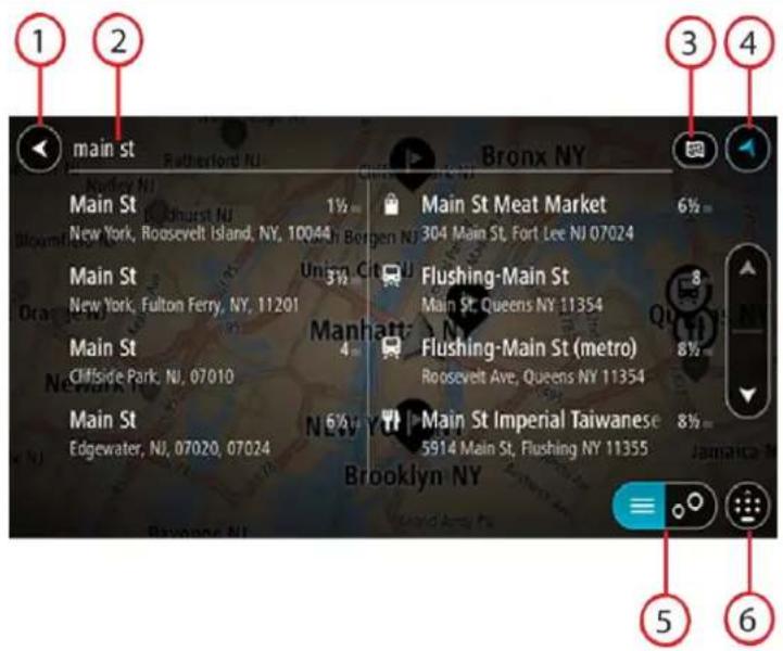
Using Quick Search 36
About search.... 36
Planning a route to a POI using search.... 36
Entering search terms.... 38
Working with search results 39
About ZIP codes 41
About mapcodes 41
List of POI type icons.... 41
Planning a route 46
Planning a route to an address using search 46
Planning a route to a city center 48
Planning a route to a POI using search.... 49
Planning a route using the map 51
Planning a route using My Places 52
Planning a route using coordinates 54
Planning a route using a mapcode 55
Finding an alternative route 56
Planning a route in advance 56
Finding a parking lot 58
Finding a gas station 60
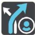
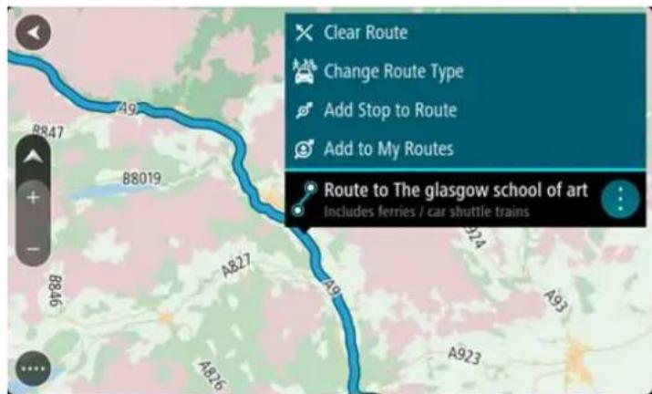
Changing your route 63
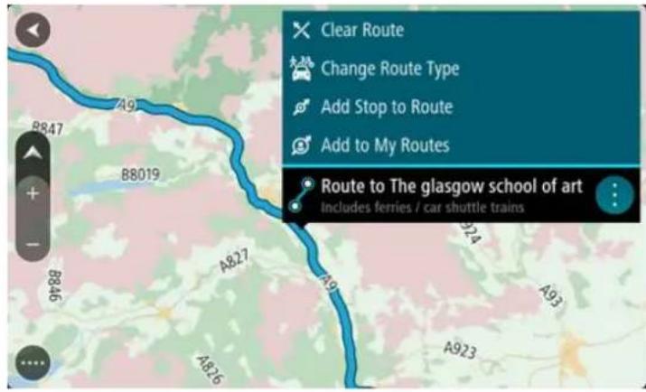
The Current Route Menu 63
Avoiding a blocked road 64
Types of route 64
Route features 65
Adding a stop to your route from your current route 65
Adding a stop to your route using the map 65
Deleting a stop from your route.... 66
Reordering stops on a route 66
My Routes 67
About My Routes 67
Saving a route 67
Navigating using a saved route 67
Adding a stop to a saved route using the map.... 68
Deleting a route from My Routes....69
Traffic 70
About TomTom Traffic 70
The route bar 70
Looking at traffic on the map 71
Looking at traffic on your route....72
Traffic incidents 73
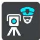
Safety Cameras 74
About safety cameras 74
Safety camera warnings 74
Changing the way you are warned 76
Reporting a new safety camera 76
Confirm or remove a speed trap 77
Updating locations for cameras and hazards 77
My Places 78
About My Places....78
Setting your home location 78
Changing your home location 79
Adding a location from My Places....80
Add a location to My Places from the map 80
Adding a location to My Places using search 80
Deleting a recent destination from My Places 81
Deleting a location from My Places 81
Settings 82
Appearance 82
Theme Color 82
Size of text and buttons 82
Brightness 83
Arrival information panel.... 83
Route Information 84
Voices 85
Maps 85
Route Planning 86
Sounds and Warnings 86
Warning type 86
Safety camera warnings 87
Safety warnings 87
Units 87
Language 88
Getting Help 89
Help 89
Using the External Camera app 91
Using the TomTom Music app 93
Addendum 94
Copyright notices 100
Welcome to TomTom BRIDGE
This Reference Guide explains how to use TomTom BRIDGE and the installed TomTom apps. The Reference Guide has the following sections:
TomTom BRIDGE
■ The TomTom Navigation app
■ The TomTom Camera app
■ The TomTom Music app
Important: For other TomTom BRIDGE settings and operation instructions, and for instructions about other apps installed on TomTom BRIDGE, please refer to the applicable User Documentation.
Version 14.500
TomTom BRIDGE
Starting TomTom BRIDGE
TomTom BRIDGE starts when it is in its dock, and the dock has power. When TomTom BRIDGE is not in its dock, you can also press the On/Off button until the device starts.
The TomTom BRIDGE home screen is shown.
Note: The TomTom BRIDGE home screen shown below is an example. The home screen on TomTom BRIDGE might look different and have different apps installed.
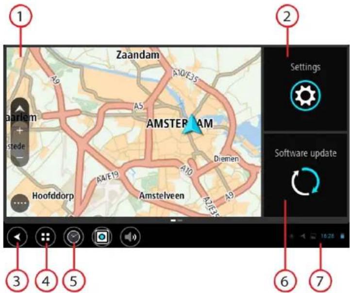
- An app running in a widget.
For example the TomTom Navigation app and the External camera app can run in a widget on the home screen. Select the widget to open the app.
Note: A widget is an app that runs in its own panel. You can select a widget to open the full app.
- Settings button.
Select Settings to change features on TomTom BRIDGE.
- Back button.
Select this button to return to the previous screen that was open.
- Home button.
Select this button to return to the device home screen.
- System bar.
You can add shortcuts for your favorite apps to this bar.
- Software update button.
Shortcut button to open the Software update app. This app lets you update TomTom BRIDGE to the latest software version.
- Status bar.
Touch this area to show app notifications and the device status.
Using gestures
You use gestures to control your device.
This Reference Guide explains which gestures to use throughout the guide but here is a complete list of all the gestures you can use.
Double tap
Touch one finger on the screen twice in rapid succession.
Example of when to use this: Zooming in.
Drag
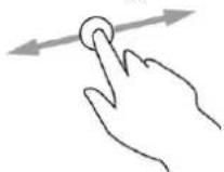
Put one finger on the screen and move it across the screen.
Example of when to use this: Scrolling a screen.
Flick
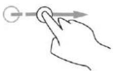
Flick the tip of a single finger across the screen.
Example of when to use this: Scrolling a big distance on the screen.
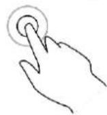
Press and hold
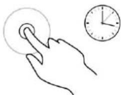
natural_image
Line drawing of a hand pressing a circular button next to an analog clock (no text or symbols)Put one finger on the screen for more than one half second.
Example of when to use this: Selecting an item, or opening a pop-up menu for an item.
Pinch to zoom
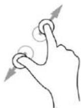
Touch the screen with your thumb and a finger. Move them apart to zoom in or move them together to zoom out.
Example of when to use this: Zooming in and out on the screen.
Tap or select
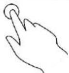
Tap a single finger on the screen.
Example of when to use this: Selecting an item in a menu, or opening an item.
Apps on TomTom BRIDGE
TomTom BRIDGE is an Android device that has different apps installed on it. Some of the apps will be standard Android apps, for example a browser, a clock, and a photo gallery. Specialized apps could be added by the device owner, and TomTom has also added apps.
Note: TomTom BRIDGE might be locked to prevent you adding your own apps.
You can find other apps on the device by scrolling to the right. To see all the apps on the device, select All apps.
You can also add up to two app quick-launch buttons to the device's System bar for apps you want to use often.
Connecting TomTom BRIDGE
About connecting TomTom BRIDGE
TomTom BRIDGE connects to the internet using your smartphone so you can use the installed apps and access TomTom services. Using your smartphone to connect means that data is sent and received by your smartphone using your cellular service provider.
Your smartphone needs to be compatible with TomTom BRIDGE, and you must have a data plan from a cellular service provider. Go to tomtom.com/connect for more information.
Important: You might have additional costs when you use your smartphone to connect TomTom BRIDGE, especially if you are outside the area covered by your data plan. Check with your cellular service provider for more information.
TomTom BRIDGE can be connected in one of the following ways:
■ Connection using Bluetooth tethering or Bluetooth hotspot.
■ Connection using Portable Wi-Fi hotspot.
Note: To update the TomTom BRIDGE software, use a normal Wi-Fi connection.
Depending on your phone's Operating System, these connection methods may have one of the following names:
- Personal Hotspot
■ Tethering and portable hotspot
The hotspot functions are likely already in your phone's Operating System, or you can download an app to create one. Please check the user guide for your phone if you are having trouble finding the settings.
Note: Some cellular service providers do not allow users to use a hotspot or Personal Area Network (PAN). If your phone does not have the PAN function, you should contact your service provider for more information.
For more help, go to tomtom.com/connect.
Connect using Bluetooth
To connect TomTom BRIDGE to your smartphone using Bluetooth, do the following:
- Turn on Bluetooth tethering or Bluetooth hotspot on your phone, and make sure your phone is discoverable.
- Press the Home button on TomTom BRIDGE.
- Select the Settings app.
- Turn on Bluetooth.
- Select Bluetooth, then select SEARCH FOR DEVICES. The TomTom BRIDGE searches for your phone and shows it as an available device.
TipTomTom BRIDGE: If cannot find your phone, make sure your phone is still 'discoverable' or 'visible' for other Bluetooth devices.
-
Select your phone from the list of available devices.
-
After you have connected your TomTom BRIDGE to your smartphone, you need to check the box in the Bluetooth profile on the TomTom BRIDGE to enable internet access as shown below.
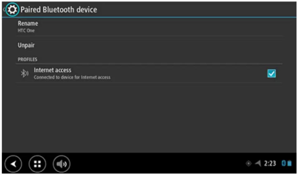
TomTom BRIDGE connects to TomTom services using your phone's internet connection. TomTom services are now active.
Connect using Portable Wi-Fi Hotspot
Important: You might have additional costs when you use your smartphone to connect TomTom BRIDGE, especially if you are outside the area covered by your data plan. Check with your cellular service provider for more information.
Note: To update the TomTom BRIDGE software, use a normal Wi-Fi connection.
To connect TomTom BRIDGE to your smartphone using a Portable Wi-Fi Hotspot, do the following:
- Turn on Portable Wi-Fi Hotspot on your phone. Make a note of the password for the Wi-Fi connection.
- Press the Home button on TomTom BRIDGE.
- Select All apps.
- Select the Settings app.
- Turn on Wi-Fi.
- Select Wi-Fi, then select your phone from the list of Wi-Fi sources.
- Enter the password for the Wi-Fi connection, then select Connect. TomTom BRIDGE connects to TomTom services using your phone's internet connection.
Note: Using a Portable Wi-Fi connection can drain your phone's battery quicker.
TomTom services are now active.
Reconnecting your smartphone
You do not need to do anything to reconnect TomTom BRIDGE to your phone.
TomTom BRIDGE will remember your phone and will find it automatically when you have Bluetooth tethering or Portable Wi-Fi hotspot turned on and you are in range of your device. If you have a valid TomTom services subscription, the service starts automatically.
On TomTom BRIDGE Status bar, check that TomTom BRIDGE is connected to the internet.
If you want to connect using another phone, you must connect using Bluetooth or connect using Portable Wi-Fi hotspot for that phone.
Tip: If reconnecting automatically to your smartphone using Bluetooth does not work, you can manually reconnect as described in Connect using Bluetooth.
Unable to get a connection
If TomTom BRIDGE cannot connect to your phone, or you have no internet connection, check the following:
- Your phone is shown on TomTom BRIDGE.
- Your phone's Bluetooth tethering or Portable Wi-Fi hotspot is turned on.
- Your data plan with your cellular service provider is active, and you can access the internet on your phone.
TomTom BRIDGE features
TomTom BRIDGE uses the Android operating system. TomTom and the device owner have changed the operating system in the following ways:
- Certain Android features have been disabled, either by TomTom or by the device owner. This makes the device safer and easier to use while driving.
- Some new features and apps have been added, both by TomTom and by the device owner. These additions customize the device, making it relevant for the functions it will be used for.
The features and apps added by TomTom are as follows:
Important: For other TomTom BRIDGE device settings and operation, and for instructions about other apps on the device, please refer to the applicable User Documentation.
Memory card slot
TomTom BRIDGE has a memory card slot that is located on the bottom of the device. You can use a memory card to access your personal files, for example photos or music files.
Transferring files to your device
You can transfer personal files, for example photos or music files, to the TomTom BRIDGE internal memory. This allows you to use apps on the device to view photos or play music.
Note: Not all file types can be opened by the device.
Note: You can transfer files from a computer running one of the following operating systems:
- Windows 7 or higher
- Apple OS X 10.5 or higher
- Some Linux distributions of version 14.04 or higher.
To transfer files to the device, do the following steps:
- Connect the TomTom BRIDGE to your computer using the USB cable supplied with your device, then switch your device on.
Note: Use ONLY the USB cable supplied with your device. Other USB cables may not work.
Note: You cannot use the mount to connect your device to your computer.
Note: You should plug the USB cable directly into a USB port on your computer and not into a USB hub or USB port on a keyboard or monitor.
- On your computer, open a file manager program.
Your device appears in your computer's files system as TomTom Bridge. - Open your device's Internal Storage folder.
- Copy files from your computer to a folder on your device.
Tip: To keep the device organized, copy the files to a folder with a relevant name. For example, copy your music files to the Music folder.
- Disconnect the device from your computer.
Tip: You can remove all the files you copied to the device by clearing your personal data.
System bar
The System bar is at the bottom of the screen and it contains quick-launch buttons, for example the Back and Home buttons. You can add up to two extra buttons to this bar to quickly start apps that you often use.
To add a quick-launch button for an app, do the following:
- Select the Home button.
- Select the Settings app.
- In Settings, select System bar.
- Under Quick Launch Buttons, select Assign app.
- Select an app from the list to assign to a quick-launch button.
- Select the Home button.
Your new quick-launch button is added to the System bar.
To remove a quick-launch button, do the following:
- Select the Home button.
- Select the Settings app.
- In Settings, select System bar.
- Under Quick Launch Buttons, select and hold the button you want to remove.
- In the pop-up box that appears, select OK to remove the quick-launch button.
- Select the Home button.
The quick-launch button is removed from the System bar.
Updating the software
The TomTom BRIDGE owner will periodically release new software updates.
Tip: When a software update is available, a notification appears in the Notification bar. Select the bottom right corner of the device screen to open the Notification area.
When you have access to a Wi-Fi connection, you can update the software using the Software update app.
Note: Software updates can only be downloaded using a Wi-Fi connection.
To update the software on the device, do the following:
- Select the Home button.
- Select the Settings app.
- In Wireless and networks, select Wi-Fi.
Select and connect to a Wi-Fi network. - Select the Home button.
- Select the Software update app.
Your device automatically downloads and installs the software update.
Note: You may have to restart the device to install the software update.
Sending information to TomTom
When you first start TomTom BRIDGE or you have reset TomTom BRIDGE, you are informed about how TomTom uses your information. This information includes your location, how you use the services, and information you enter. We learn how you use the device so we can continually improve.
Go to the Your information app in the All apps menu to read about how TomTom uses your information.
If you think that your information is not being used for the purpose for which you have provided it to TomTom, contact us at tomtom.com/support.
You can find current and more detailed information at tomtom.com/privacy.
Clearing personal data
The TomTom BRIDGE device stores your personal data as you use the apps installed on the device. All photos and music you have transferred to the device is also personal data.
If you have finished using the device it is a good idea to clear your personal data before you pass the device back to the owner.
To clear your personal data, do the following steps:
Note: Software updates can only be downloaded using a Wi-Fi connection.
- If you are using a personal memory card, remove the memory card from its slot.
- Select the Settings app.
- Select Backup & reset.
- Select Clear personal data.
- Select Clear, then select Clear again.
Your device automatically switches off and clears your personal data.
Language
The language used on TomTom BRIDGE is also used on the apps installed on the device.
To change the device language, do the following:
- Select the Home button.
- Select the Settings app.
- Select Language & input, then select Language.
- Select the language you want, then select OK.
Your device language changes.
Installing in your vehicle
Only use the supplied dock and vehicle mount to hold TomTom BRIDGE when you are using it in your vehicle.
Charging TomTom BRIDGE
The battery in TomTom BRIDGE charges when you install the device in its dock and the dock is powered. You can also use a USB Home Charger.
You are warned when the battery level is low or critical. You lose your connection to the internet when the battery level is low or critical. When the battery is empty, the device goes into sleep mode.
Note: Charging your TomTom BRIDGE using your computer is not recommended. The voltage output of computer USB ports varies by manufacturer.
TomTom BRIDGE not starting
In rare cases, TomTom BRIDGE may not start correctly or may stop responding.
First, check that the battery is charged. To charge the battery, connect your device to power or install it in the dock. It can take up to 3 hours to fully charge the battery.
If this does not solve the problem, you can reset the device. To do this, press and hold the On/Off button until your device begins to restart.
Take care of your navigation device
It is important to take care of your device:
- Do not open the casing of your device under any circumstances. Doing so may be dangerous and will void the warranty.
- Wipe or dry the screen of your device using a soft cloth. Do not use any liquid cleaners.
Getting help
You can get further help by going to tomtom.com/support.
For warranty and privacy information, go to tomtom.com/legal.
TomTom Navigation App
Welcome to navigation with TomTom
This Section explains how you use the TomTom Navigation app.
Important: For other TomTom BRIDGE settings and operation instructions, and for instructions about other apps installed on TomTom BRIDGE, please refer to the applicable User Documentation.
The navigation app is installed on the device, either as an app that you have to open, or as a software widget on the Home screen. The widget has some limited functionality, for example you can see your route and route instructions on the widget, but you can't plan a route.
Select the widget to open the full navigation app to use all the navigation features.
The Get going chapter is a great place to start. You'll learn all about starting up and setting up the device, and using the navigation app to plan your first route. You'll see a quick introduction to TomTom services, which includes Traffic & Safety Cameras. To help avoid traffic delays and get you to your destination quicker, you can even use TomTom services on the routes you drive every day.
For information about what you see in the navigation app, go to:
■ What's on the screen
- Using gestures
- Main menu
About TomTom services
TomTom services give you real-time information about traffic and safety cameras on your route. To help avoid traffic delays and get you to your destination quicker, you can even use TomTom services on the routes you drive every day.
To get TomTom Services on TomTom BRIDGE, connect TomTom BRIDGE to a network.
Note: TomTom services are not available in all countries or regions, and not all services are available in all countries or regions. For more information on available services in each region, go to tomtom.com/services.
GPS reception
When you first start the navigation app, it may need a few minutes to find your GPS position and show your current location on the map. Make sure you have GPS activated on your device.
Tip: The GPS settings are in the device's Settings app.
In areas where GPS reception is not possible, such as tunnels, your location may not be accurate.
Important: The navigation app cannot give you route instructions until it has received location data.
Some devices need a data connection to obtain a GPS location.
If your device has no GPS reception, the navigation app uses positioning information from WiFi networks or mobile phone towers. This information is used for route planning and to determine your approximate location.
What's on the navigation app screen
The map view
The map view is shown when you have no planned route. Your actual location is shown as soon as your device has found your GPS location.
You can use map view in the same way as you might look at a traditional paper map. You can move around the map using gestures, and zoom using the zoom buttons.
Important: Everything on the map is interactive, including the route and the map symbols - try selecting something and see what it does!
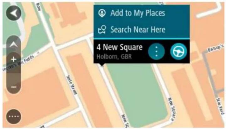
Tip: To open a pop-up menu for an item on the map, for example a route or a POI, select the item to open the menu. To select a location on the map, select and hold the location until the pop-up menu opens.
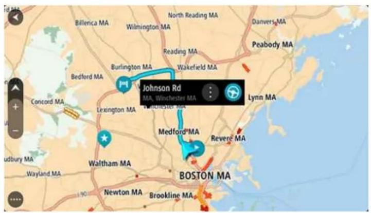
The map shows your current location and many other locations such as your My Places locations.
If you have not planned a route, the map is zoomed out to show the area around your location.
If you have planned a route, your complete route is shown on the map. You can add stops to your route directly from the map. When you start to drive, the guidance view is shown.
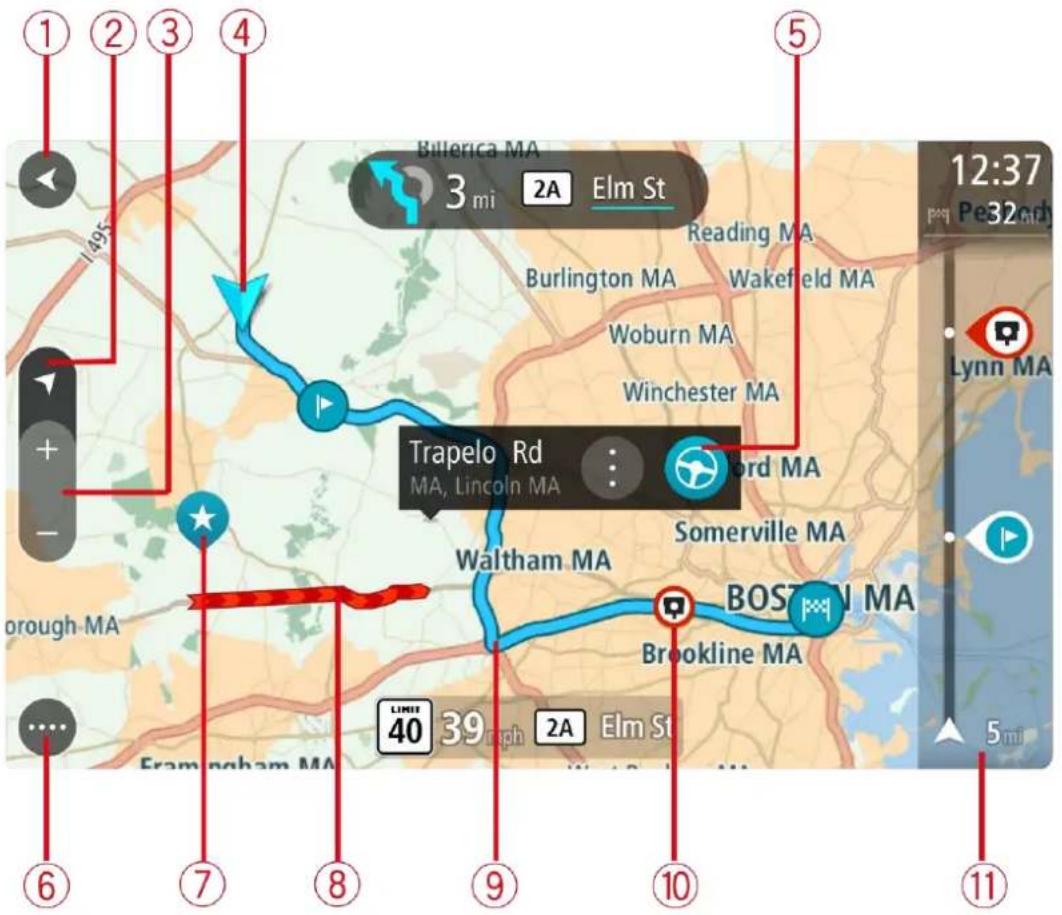
- Back button. This button returns the map to an overview of your whole route or, if no route is planned, moves the map to put your current location at the center.
- Switch view button. Select the switch view button to change between the map view and the guidance view.
When in map view, if you are driving, the small arrow rotates to show you your current driving direction, with north being up. - Zoom buttons. Select the zoom buttons to zoom in and out.
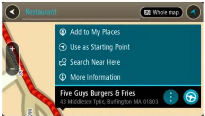
- Current location. This symbol shows your current location. Select it to add it to My Places or search near your current location.
Note: If your device cannot find your location using GPS or other methods, the symbol appears gray.
-
Selected location. Press and hold to select a location on the map. Select the pop-up menu button to show options for the location, or select the drive button to plan a route to the location.
-
Main Menu button. Select the button to open the Main Menu.
-
Map symbols. Symbols are used on the map to show your destination and your saved places:
- Your destination.
- Your home location. You can set your home location in My Places.

A stop on your route.

- A location saved in My Places.
Select a map symbol to open the pop-up menu, then select the menu button to see a list of actions you can take.
-
Traffic information. Select the traffic incident to display information about the traffic delay.
-
Your route, if you have planned a route. Select the route to clear it, change the route type, add a stop or save changes to your route.
-
Safety cameras on your route. Select a safety camera to display information about that camera.
-
Route bar. The route bar is shown when you have planned a route.
The guidance view
The guidance view is used to guide you along the route to your destination. The guidance view is shown when you start driving. You see your current location and details along your route, including 3D buildings in some cities.
The guidance view is normally in 3D. To show a 2D map with the map moving in your direction of travel, change the 2D and 3D default settings.
Tip: When you have planned a route and the 3D guidance view is shown, select the switch view button to change to the map view and use the interactive features.
When your navigation device starts after sleeping and you have a route planned, you are shown the guidance view with your current location.
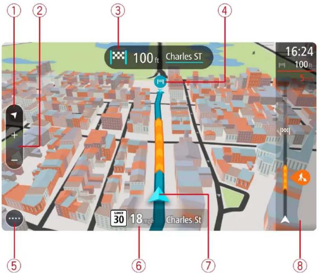
-
Switch view button. Select the switch view button to change between the map view and the guidance view.
-
Zoom buttons. Select the zoom buttons to zoom in and out.
Tip: On some devices you can also pinch to zoom in and out.
-
Instruction panel. This panel shows the following information:
-
The direction of your next turn.
- The distance to your next turn.
- The name of the next road on your route.
-
Lane guidance at some crossings.
-
Route symbols. Symbols are used on your route to show your starting location, your stops, and your destination.
-
Main Menu button. Select the button to show the Main Menu.
-
Speed panel. This panel shows the following information:
-
The speed limit at your location.
- Your current speed. If you drive more than 3 mph (5 km/h) over the speed limit the speed panel turns red. If you drive less than 3 mph (5 km/h) over the speed limit the speed panel turns orange.
-
The name of the street you are driving on.
-
Current location. This symbol shows your current location. Select the symbol or the speed panel to open the quick menu.
Note: If your device cannot find your location using GPS or other methods, the symbol appears gray.
- Route bar. The route bar is shown when you have planned a route.
Important: To see a wider route bar showing additional route information, change the setting for Route Information.
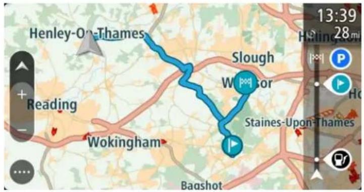
The route bar
The route bar is shown when you have planned a route. It has an arrival information panel at the top, and a bar with symbols underneath.
Important: To see a wider route bar showing additional route information, change the setting for Route Information.
Note: The distance ahead shown by the route bar depends on the overall length of your route.
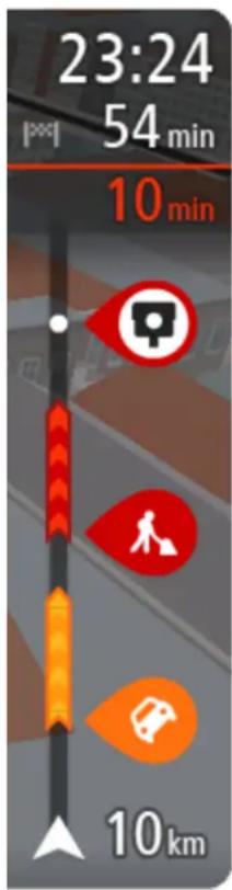
The arrival information panel shows the following information:
- The estimated time that you will arrive at your destination.
- The length of time to drive to the destination from your current location.
- A parking button is shown near the destination flag when parking is available near your destination.
Tip: If your destination is in a different time zone, you see a plus (+) or a minus (-) sign and the time difference in hours and half hours in the arrival information panel. The estimated time of arrival is the local time at your destination.
If you have stops on your route, select this panel to change between information about the next stop and your final destination.
You can choose the information you see on the arrival information panel.
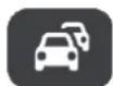
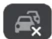
Traffic status - if your device isn't receiving any traffic information, a symbol showing traffic with a cross appears underneath the arrival information panel.
The bar uses symbols to show the following information:
- The next two stops on your route.
Gas stations that are directly on your route. - TomTom Traffic.
■ TomTom Safety Cameras and Danger Zones. - Rest stops directly on your route.
You can choose the information you see on your route.
The symbols are in the order that they occur on your route. For traffic incidents, the symbol for each incident alternates between showing the type of incident and the delay in minutes. Select a symbol to see more information about a stop, an incident or a safety camera. If a symbol is shown on top of another symbol, selecting the symbols zooms in on the route bar to show each symbol separately. You can then select a symbol.
The total time delay due to traffic jams and other incidents on your route, including information provided by IQ Routes, is shown above the symbols.
For a complete list of incident types, see Traffic incidents.
The bottom of the route bar represents your current location and shows the distance to the next incident on your route. In addition, you can
Note: To make the route bar more readable some incidents may not be shown. These incidents will always be of minor importance and only cause short delays.
The route bar also shows status messages, for example Finding fastest route or Playing route preview.
Distances and the route bar
The distance ahead shown on the route bar depends on the length of your route, or the distance remaining on your route.
- For remaining distances longer than 31 miles (50 km), only the next 31 miles (50 km) is shown. The destination icon is not shown.
Tip: You can scroll the route bar to see your whole route.
- For remaining distances between 6 miles (10 km) and 31 miles (50 km), the complete distance is shown. The destination icon is shown fixed at the top of the route bar.
- For remaining distances of less than 6 miles (10 km) the complete distance is shown. The destination icon moves down toward the chevron symbol as you get closer to your destination.
The top half of the route bar shows twice the distance of the bottom half, as shown in the following examples:
- A remaining distance of 31 miles (50 km) on the route bar is split into 21 miles (34 km) at the top and 9 miles (16 km) on the bottom.
- A remaining distance of 6 miles (10 km) on the route bar is split into 4 miles (6.6 km) at the top and 2 miles (3.3 km) on the bottom.
The route bar is constantly updated as you drive.
The quick menu
To open the quick menu, select the current location symbol or the speed panel in the guidance view.
You can then do any of the following:
- Mark a location
■ Report a new safety camera - Avoid a blocked road
- See your current location or your latitude/longitude if not on a named road.
Advanced Lane Guidance
Note: Lane guidance is not available for all crossings or in all countries.
Advanced Lane Guidance helps you prepare for highway exits and crossings by showing the correct driving lane for your planned route.
As you approach an exit or crossing, the lane you need is shown on the screen and in the instruction panel.
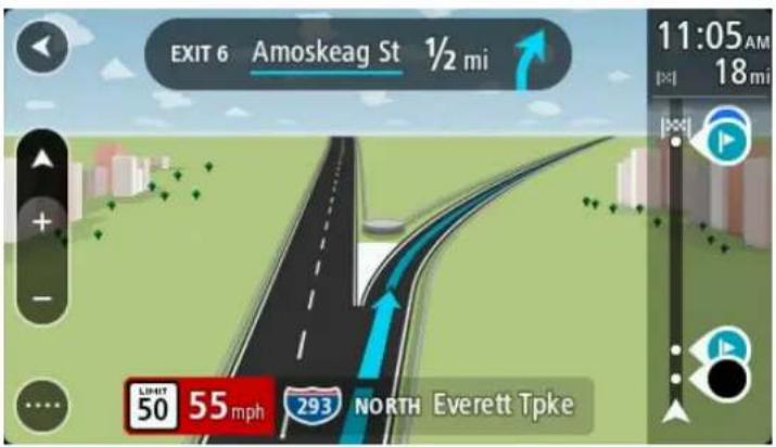
Tip: To close the lane image, select anywhere on the screen or press the back button.
To turn lane images off, select the Settings button in the Main Menu, then select Appearance. Turn off the Show previews of highway exits setting.
Time-dependent speed limits
Some speed limits change depending on the time of day. For example, you may see the speed limit near schools decrease to 40 km/h or 25 mph in the morning from 08:00 a.m. - 09:00 a.m. and in the afternoon from 3:00 p.m. - 4:00 p.m. Where possible, the speed limit shown in the speed panel changes to show these variable speed limits.
Some speed limits change depending on driving conditions. For example, the speed limit will decrease if there is heavy traffic, or the weather conditions are bad. These variable speed limits are not shown in the speed panel. The speed shown in the speed panel is the maximum speed limit allowed in good driving conditions.
Important: The speed limit shown in the speed panel is only an indication. You must always obey the actual speed limit for the road you are on and the conditions you are driving in.
Running in the background
The app continues to run when it is in the background, for example when you are using another app on TomTom BRIDGE.
If the app is running in the background and you are driving on a planned route, you will continue to hear driving instructions.
Changing the text and button size
You can change the size of the text and the buttons you see on the screen, for example to make the text easier to read and the buttons easier to use.
Note: This feature is only available on devices with a 6 inch / 15 cm or larger screen.
To change the size of the text and the buttons, select the Settings button in the Main Menu, then select Appearance, then select Size of text and buttons. Your device must restart to apply the change.
Main Menu
Navigation buttons
On the map view or guidance view, select the Main Menu button to open the Main Menu.
The following navigation buttons are available in the Main Menu:
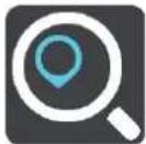
| Search | Select this button to search for an address, a place or a Point of Interest, then plan a route to that location. |
 | |
| Current route | Select this button toclear or changeyour planned route. |
 | |
| Report Safety Camera | Select this button toreport a safety camera. |
 | |
| My Places | Select this button to show yoursaved places. |
 | |
| My Routes | Select this button to show yoursaved routes. |
 |
Parking
Select this button to find parking lots/garages.
Gas Station
Select this button to find gas stations.
Other buttons
On the map or guidance view, select the Main Menu button to open the Main Menu.
The following buttons are available in the Main Menu screen, in addition to the navigation buttons:

Select this button to open the Settings Menu.

Select this button to open the Help Menu. The Help Menu contains a guided tour and information about the navigation app.

Select this button to return to the previous screen.

Select this button to return to the map view or guidance view.

This symbol shows the power level of the battery in your device.
This symbol shows that your device is connected to TomTom services.
This symbol shows that your device is not connected to TomTom services.

Select this button to turn off voice instructions. You will no longer hear spoken route instructions but you will still hear information such as traffic information and warning sounds.
Tip: You can select the types of instructions you want to hear. Select Voices in the Settings Menu and select the instructions you want to hear.


Select this button to turn on voice instructions.
Select this button to reduce the brightness of the screen and display the map in darker colors.
When driving at night or when driving through a dark tunnel, it is easier to view the screen and less distracting for the driver if the brightness of the screen is dimmed.
Tip: Your device automatically switches between day and night colors depending on the time of day. To turn off this feature, select Appearance in the Settings menu and turn off Switch to night colors when dark.

Select this button to increase the brightness of the screen and display the map in brighter colors.
Volume control
On the map or guidance view, select the Main Menu button to open the Main Menu.
Select and slide the volume control to change the volume of voice instructions and warnings. If the voice instructions are turned off, the volume control will still change the volume of the warnings.

natural_image
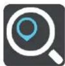
Simple graphic of a speaker icon and a horizontal bar with a circle, no text or symbols present.Using Quick Search
About search
You use search to find a wide range of places and then navigate to them. You can search for the following:
- A specific address, for example, 335 Madison Avenue, New York.
- A partial address, for example, Madison Ave NY.
- A type of place, for example, gas station or restaurant.
- A place by name, for example, Starbucks.
- A ZIP code, for example, 36925 York for York, Alabama.
- A city to navigate to a city center, for example, Kingston, NY.
- A POI (Point of Interest) near your current location, for example, restaurant near me.
- Latitude and longitude coordinates, for example,
N 40°45'28" W 73°59'09".
Planning a route to a POI using search
Important: In the interest of safety and to avoid distractions while you are driving, you should always plan a route before you start driving.
To plan a route to a POI type or a specific POI using search, do the following:
- Select the Main Menu button to open the Main Menu.
- Select Search.
The search screen opens with the keyboard showing.
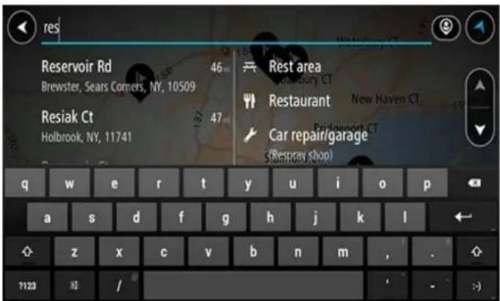
- Use the keyboard to enter the name of the place you want to plan a route to.
Tip: If you press and hold a letter key on the keyboard, you get access to extra characters if they are available. For example, press and hold the letter "e" to access characters 3 e è é ê ë and more.
You can search for a POI (Point of Interest) type, such as a restaurant or tourist attraction. Alternatively, you can search for a specific POI, for example "Rosie's Pizzeria."
Note: When searching, the whole map is searched. If you want to change how the search is done, select the button to the right of the search box. You can then change where the search is done, for example along the route or in a city.
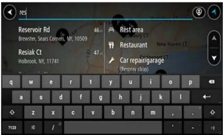
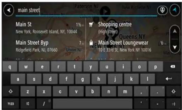
- As you type, suggestions based on what you have entered are shown in columns. You can continue typing or select a suggestion.
Tip: To see more results, hide the keyboard or swipe the results list to scroll it.
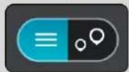
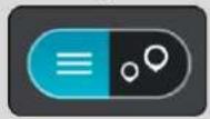
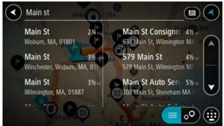
Tip: You can switch between seeing the results on the map or in a list by selecting the list/map button:
-
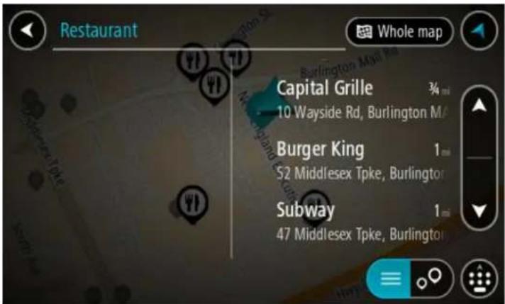
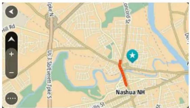
Select a POI type or an individual POI. If you selected a POI type, select a POI. The location is shown on the map.
-
To plan a route to this destination, select the drive button:

A route is planned and then guidance to your destination begins. As soon as you start driving, the guidance view is shown automatically.
Tip: If your destination is in a different time zone, you see a plus (+) or a minus (-) sign and the time difference in hours and half hours in the arrival information panel. The estimated time of arrival is the local time at your destination.
Tip: You can add a stop to a route that you have already planned.
Tip: You can save a route using My Routes.
Entering search terms
Select Search in the Main menu to start searching for addresses and POIs. The search screen opens showing the device keyboard and the following buttons:
Tip: Hide the device keyboard to show the whole search screen.
1. Back button.
Select this button to go back to the previous screen.
2. Search input box.
Enter your search term here. As you type, matching addresses and POIs are shown.
Tip: If you press and hold a letter key on the keyboard, you get access to extra characters if they are available. For example, press and hold the letter "e" to access characters 3 e è é ê ë and more.
Tip: To edit, select a word you have already typed to place the cursor. You can then insert or delete characters.
3. Type of search.
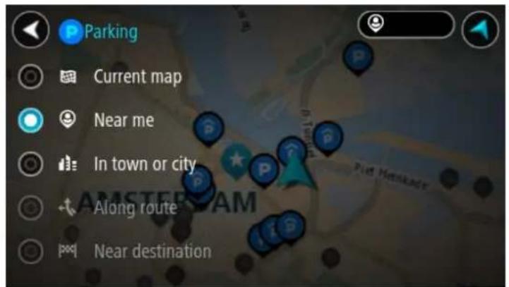
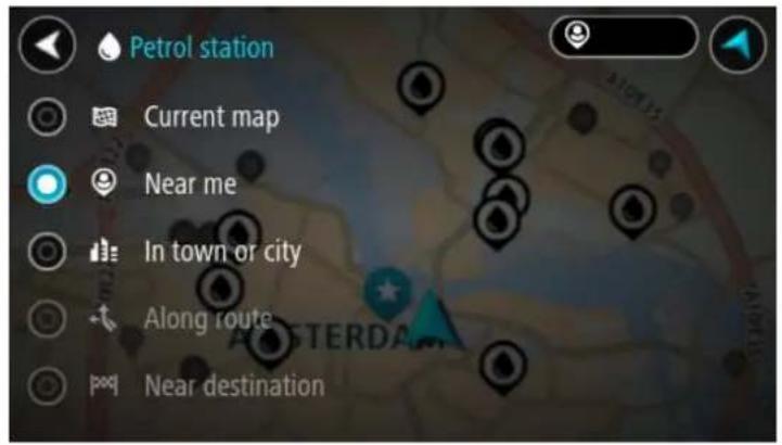
By default, the whole of the current map is searched. Once you have used search, the last search type you selected is used. Select this button to change the type of search to any of the following:

Whole map
Select this option to search the whole of your current map with no limit to the search radius. Your current location is the center of the search. The results are ranked by exact match.

Near me
Select this option to search with your current GPS location as the search center. The results are ranked by distance.

In town or city
Select this option to use a town or city as the center for your search. You need to enter the town or city name using the keyboard. When you have selected the town or city from the results list, you can search for an address or POI in that city.

Along route
When a route has been planned, you can select this option to search along your route for a specific type of location, for example, gas stations. When prompted, enter the type of location and then select it in the right-hand column to carry out the search.

Near destination
When a route has been planned, you can select this option to use your destination as the center for your search.

Latitude Longitude
Select this option to enter a pair of latitude longitude coordinates.
4. View button.
Select this button to return to the map view or guidance view.
5. List/map button.
Select this button to switch between showing the results in a list or showing the results on the map.
6. Show/hide keyboard.
Select this button to show the keyboard. Hide the keyboard using the device's back function.
Tip: To cancel a search, select the map/guidance view button in the top right-hand corner of the screen.
Working with search results
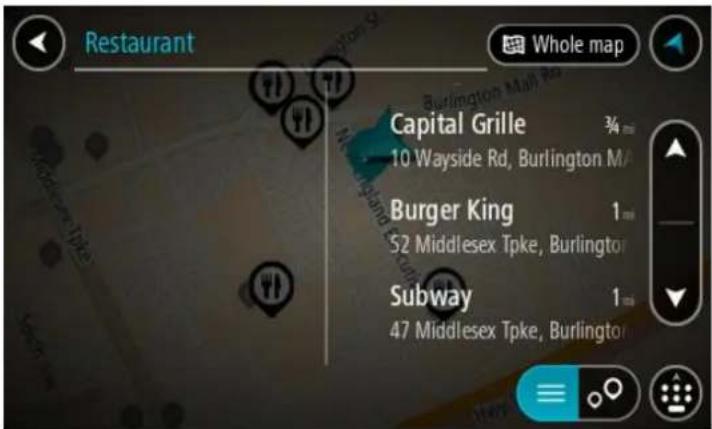
Your search results are shown in two columns.
Address and city matches are shown in the left-hand column, and POIs, types of POIs and Places are shown in the right-hand column.
Tip: To see more results, hide the keyboard or swipe the results list to scroll it.
Tip: You can switch between seeing the results on the map or in a list by selecting the list/map button:
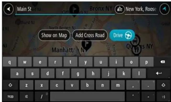
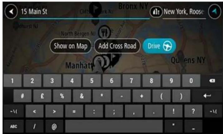
When you select an address from the list of search results, you can choose to show it on the map, add a crossroad or plan a route to that chosen location. To get an exact address you can add the house number.
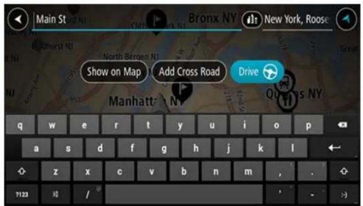
If you show the result on the map, you can use the pop-up menu to add a location from My Places or search near this location. If a route is already planned, you can add the location to your current route.
Note: The best search results are shown on the map. When you zoom in, the lower ranked search results are gradually shown.
About ZIP codes
You can search using a ZIP code to get closer to the area in which you want to find an address or POI.
When you search using a ZIP code, your results include all the streets in a city district, the whole town, or the towns and villages within that ZIP code area.
Note: If you search using a ZIP code you will not get a specific address in your results.
You do not have to use the state or province postal abbreviation or first change the state or province because this is included in the ZIP code.
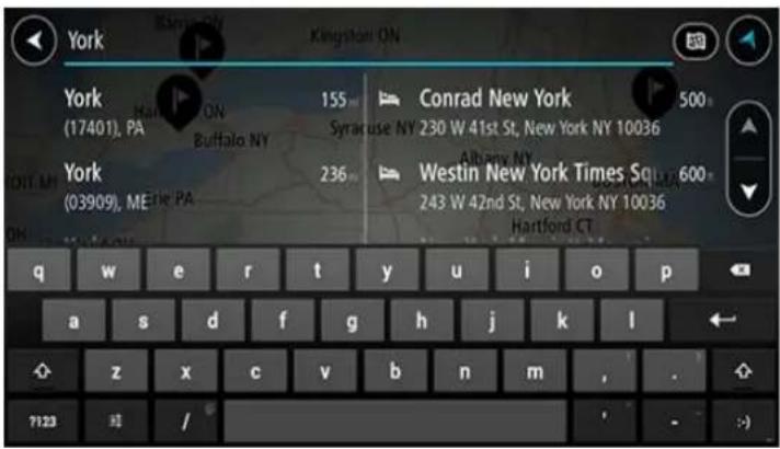
For example, a search for York in the whole map returns a long list of possible results. Adding a space followed by the ZIP code narrows the results down to the York that you are looking for.
About mapcodes
In countries where roads and houses have no names or addresses, you can use a mapcode instead. A mapcode represents a location.
Every location on Earth, including those in the sea, like islands and oil rigs, can be represented by a mapcode. Mapcodes are short, and easy to recognize, remember and communicate. They are precise to a few meters, which is good enough for every-day use.
Go to mapcode.com for instructions on how to find the mapcode for a location.
Mapcodes are more precise and more flexible than the address on a business card. You can choose a location that you want to associate with your address, for example, the main entrance or the entrance to a parking lot.
List of POI type icons
Legal and financial services

Court house

ATM

Legal - Attorneys

Bank

Legal - other services
Food services

Convenience store

Fast food restaurant

Restaurant

Chinese restaurant
Accommodation

Hotel or motel

Luxury hotel

Campground

Economy chain hotel
Emergency services

Hospital or clinic

Dentist

Police station

Veterinarian

Doctor

Fire station
Car-related services

Outside parking

Gas station

Parking garage

Car wash

Car dealer

Vehicle inspection center

Rental car facility

Electric/hybrid car charging point(s)

Rental car parking

Car repair facility
Other services

Embassy

Pet services

Government office

Telecommunication

Company

Community service

Post office

Pharmacy

Shopping center

Beauty services

Tourist information office

Shop
Education

College or university

School

Library

Convention center
Leisure

Casino

Winery

Theater

Tourist attraction

Movie Theater

Zoo

Concert hall

Amusement park

Museum

Exhibition center

Opera

Cultural center

Nightlife

Leisure center
Sport

Sports Park

Swimming pool

Mountain peak

Water sports

Beach

Tennis court

Park or recreation area

Ice skating rink

Yacht basin or marina

Sports center

Stadium

Golf course
Religion

Church

Place of worship
Travel

Railroad station

Mountain pass

Airport

Scenic or panoramic view

Ferry terminal

ZIP code

Border crossing

Residential area

Bus station

Gas station

Toll plaza

Electric/hybrid car charging stations

Rest area

Truck stop
Planning a route
Planning a route to an address using search
Important: In the interest of safety and to avoid distractions while you are driving, you should always plan a route before you start driving.
To plan a route to an address using search, do the following:
- Select the Main Menu button to open the Main Menu.
- Select Search.
The search screen opens with the keyboard showing.
- Use the keyboard to enter the name of the place you want to plan a route to.
Tip: If you press and hold a letter key on the keyboard, you get access to extra characters if they are available. For example, press and hold the letter "e" to access characters 3 e è é è and more.
You can search for an address, town, city, ZIP code or mapcode.
Tip: To search for a specific city you can use the city's state code or ZIP code. For example, searching for York will return many results. If you search for York AL or York 36925 then that city will be at the top of the results. You can then search in the city.
Tip: When searching, the whole map is searched. If you want to change how the search is done, select the button to the right of the search box. You can then change where the search is done, for example, to being along the route or in a city.
- As you type the address, suggestions are shown based on what you have entered. You can continue typing or select a suggestion.
Towns and roads are shown on the left, POIs are shown on the right.
Tip: To see more results, hide the keyboard or swipe the results list to scroll it.
Tip: You can switch between seeing the results on the map or in a list by selecting the list/map button:

- Select an address suggestion.
- Enter the house number if you have one and haven't entered it already.
Tip: If you enter a house number that is not found, the number appears red. The nearest house number that is found is shown in the Drive button. You can enter a new house number, or you can select Drive to drive to the nearest house number.
- Select Drive.
Your navigation device plans a route then starts to guide you to your destination. As soon as you start driving, the guidance view is shown automatically.
Tip: If your destination is in a different time zone, you see a plus (+) or a minus (-) sign and the time difference in hours and half hours in the arrival information panel. The estimated time of arrival is the local time at your destination.
Tip: You can add a stop to a route that you have already planned.
Tip: You can save a route using My Routes.
Important: In the interest of safety and to avoid distractions while you are driving, you should always plan a route before you start driving.
To plan a route to a city center using search, do the following:
- Select the Main Menu button to open the Main Menu.
- Select Search.
The search screen opens with the keyboard showing.
- Use the keyboard to enter the name of the city or town you want to plan a route to.
Tip: If you press and hold a letter key on the keyboard, you get access to extra characters if they are available. For example, press and hold the letter "e" to access characters 3 e è é ê ë and more.
You can search for a town, city, or ZIP code.
Tip: To search for a specific city you can use the city's state code or ZIP code. For example, searching for York will return many results. If you search for York AL or York 36925 then that city will be at the top of the results. You can then search in the city.
Tip: When searching, the whole map is searched. If you want to change how the search is done, select the button to the right of the search box. You can then change where the search is done, for example, to being along the route or in a city.
- As you type the address, suggestions are shown based on what you have entered. You can continue typing or select a suggestion.
Towns and roads are shown on the left; POIs are shown on the right.
Tip: To see more results, hide the keyboard or swipe the results list to scroll it.
Tip: You can switch between seeing the results on the map or in a list by selecting the list/map button:

- Select the city in the left-hand column.
The city name is shown in the right side of the search input box, and the city center POI is shown below in the right-hand column.
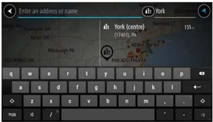
- Select the city center POI.
The city center location is shown on the map.
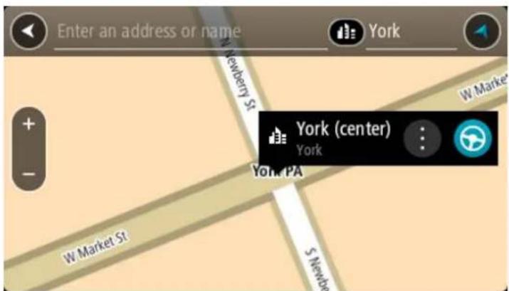
- Select Drive.
Your navigation device plans a route then starts to guide you to your destination. As soon as you start driving, the guidance view is shown automatically.
Tip: If your destination is in a different time zone, you see a plus (+) or a minus (-) sign and the time difference in hours and half hours in the arrival information panel. The estimated time of arrival is the local time at your destination.
Tip: You can add a stop to a route that you have already planned.
Tip: You can save a route using My Routes.
Planning a route to a POI using search
Important: In the interest of safety and to avoid distractions while you are driving, you should always plan a route before you start driving.
To plan a route to a POI type or a specific POI using search, do the following:
- Select the Main Menu button to open the Main Menu.
2. Select Search.
The search screen opens with the keyboard showing.
- Use the keyboard to enter the name of the place you want to plan a route to.
Tip: If you press and hold a letter key on the keyboard, you get access to extra characters if they are available. For example, press and hold the letter "e" to access characters 3 e è é ê ë and more.
You can search for a POI (Point of Interest) type, such as a restaurant or tourist attraction. Alternatively, you can search for a specific POI, for example "Rosie's Pizzeria."
Note: When searching, the whole map is searched. If you want to change how the search is done, select the button to the right of the search box. You can then change where the search is done, for example along the route or in a city.
- As you type, suggestions based on what you have entered are shown in columns. You can continue typing or select a suggestion.
Tip: To see more results, hide the keyboard or swipe the results list to scroll it.
Tip: You can switch between seeing the results on the map or in a list by selecting the list/map button:

-
Select a POI type or an individual POI. If you selected a POI type, select a POI. The location is shown on the map.
-
To plan a route to this destination, select the drive button:

A route is planned and then guidance to your destination begins. As soon as you start driving, the guidance view is shown automatically.
Tip: If your destination is in a different time zone, you see a plus (+) or a minus (-) sign and the time difference in hours and half hours in the arrival information panel. The estimated time of arrival is the local time at your destination.
Tip: You can add a stop to a route that you have already planned.
Tip: You can save a route using My Routes.
Planning a route using the map
Important: In the interest of safety and to avoid distractions while you are driving, you should always plan a route before you start driving.
To plan a route using the map, do the following:
- Move the map and zoom in until you can see the destination that you want to navigate to.
Tip: You can also select a map symbol to open the pop-up menu, then select the drive button to plan a route to that location.
- When you have found your destination on the map, select it by pressing and holding the screen for about one second.
A pop-up menu shows the nearest address.
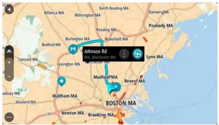
- To plan a route to this destination, select the drive button:

A route is planned and then guidance to your destination begins. As soon as you start driving, the guidance view is shown automatically.
Tip: You can use the location you selected in other ways, such as adding it to My Places, by selecting the pop-up menu button.
Tip: If your destination is in a different time zone, you see a plus (+) or a minus (-) sign and the time difference in hours and half hours in the arrival information panel. The estimated time of arrival is the local time at your destination.
Tip: You can add a stop to a route that you have already planned.
Tip: You can save a route using My Routes.
Planning a route using My Places
To navigate to one of My Places from your current location, do the following:
- Select the Main Menu button to open the Main Menu.
- Select My Places.
A list of all your Places opens.
![My Places Home [★] Recent destinations My restaurant My sport club Edit List Add a New Place](/content/2026/06/1195127/images/37a52166d3c58e7cdac420f4c59a4fd93dd4011b7ed71517ed69f25335f6e930.jpg)
- Select the Place you want to navigate to, for example Home.
Your chosen Place is shown on the map with a pop-up menu.
- To plan a route to this Place, select the drive button:

A route is planned and then guidance to your destination begins. As soon as you start driving, the guidance view is shown automatically.
Tip: If your destination is in a different time zone, you see a plus (+) or a minus (-) sign and the time difference in hours and half hours in the arrival information panel. The estimated time of arrival is the local time at your destination.
Tip: You can add a stop to a route that you have already planned.
Tip: You can save a route using My Routes.
Important: In the interest of safety and to avoid distractions while you are driving, you should always plan a route before you start driving.
To plan a route using a pair of coordinates, do the following:
- Select the Main Menu button to open the Main Menu.
- Select Search.
The search screen opens with the keyboard showing.
- Select the type of search button to the right of the search box.

-
Select Latitude Longitude.
-
Type in your pair of coordinates. You can enter any of these coordinate types:
- Decimal values, for example: N 40.75773, W 73.985708 40.75773, -73.985708
Tip: For decimal values you don't have to use a letter to indicate the latitude and longitude. For locations west of the 0 meridian and locations south of the equator, use a minus sign (-) before the coordinate.
- Degrees, minutes and seconds, for example: N 40°45'28" W 73°59'09" - GPS standard coordinates, for example: N 40 45.46 W 73 59.15
Note: The bar below the coordinates turns red if you enter coordinates that are not recognized by your TomTom navigation app.
- As you type in the coordinates, suggestions are shown based on what you have entered. You can continue typing or select a suggestion.
Towns and roads are shown on the left; POIs are shown on the right.
Tip: To see more results, hide the keyboard or swipe the results list to scroll it. Tip: You can switch between seeing the results on the map or in a list by selecting the list/map button:

- Select a suggestion for your destination.
The location is shown on the map.
- To plan a route to this destination, select the drive button:

A route is planned and then guidance to your destination begins. As soon as you start driving, the guidance view is shown automatically.
Tip: If your destination is in a different time zone, you see a plus (+) or a minus (-) sign and the time difference in hours and half hours in the arrival information panel. The estimated time of arrival is the local time at your destination.
Tip: You can add a stop to a route that you have already planned.
Tip: You can save a route using My Routes.
Planning a route using a mapcode
Important: In the interest of safety and to avoid distractions while you are driving, you should always plan a route before you start driving.
To plan a route using a mapcode, do the following:
- Select the Main Menu button to open the Main Menu.
- Select Search.
The search screen opens with the keyboard showing.
-
Type in your mapcode. You can enter any of these mapcode types:
-
International, for example, S8VXZ.PJZ2.
- Country-specific, for example, USA WW6G.S9GT.
- Alternative country-specific, for example, DC LQ.FR or DC JJ.1B2.
Tip: All the mapcodes in this example are for the same location - the US Capitol building in Washington DC, USA. See About mapcodes for information on how to get a mapcode for a location.
- As you type in the mapcode, suggestions are shown based on what you have entered. You can continue typing or select a suggestion.
Towns and roads are shown on the left, POIs are shown on the right.
Tip: To see more results, hide the keyboard or swipe the results list to scroll it.
Tip: You can switch between seeing the results on the map or in a list by selecting the list/map button:
- Select a suggestion for your destination.
- Select Drive.
A route is planned and then guidance to your destination begins. As soon as you start driving, the guidance view is shown automatically.
Tip: If your destination is in a different time zone, you see a plus (+) or a minus (-) sign and the time difference in hours and half hours in the arrival information panel. The estimated time of arrival is the local time at your destination.
Tip: You can add a stop to a route that you have already planned.
Tip: You can save a route using My Routes.
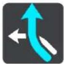
Finding an alternative route
Important: In the interest of safety and to avoid distractions while you are driving, you should always plan a route before you start driving.
To find an alternative route, do the following:
- Plan a route as usual.
- On the map view, select the route itself.
- Select the pop-up menu button to open the menu.
- Select Alternative Route and then select Find alternative.
Up to three alternative routes are shown on the map view. Each alternative route shows the difference in travel time in a balloon.
Tip: Information from the Lifetime Traffic service is used when calculating alternative routes. Any route that is 50% longer in time than the original route is not shown.
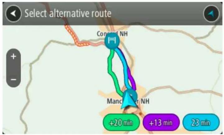
- Select your chosen route by tapping on the time balloon.
- Select Let's go.
- Guidance to your destination begins. As soon as you start driving, the guidance view is shown automatically.
Note: You can also find alternative routes by selecting Current Route in the main menu, followed by Find Alternative.
Planning a route in advance
You can plan a route in advance before you drive it. You can save the route as part of your My Routes list.
To plan a route in advance, do the following:
- Select the Main Menu button to open the Main Menu.

- Select Search.
The search screen opens with the keyboard showing.
- Use the keyboard to enter the name of the location you want to use as a starting point.
- Select an address or POI suggestion.
- Select Show on Map.
- Select the pop-up menu button.
A pop-up menu shows a list of options.
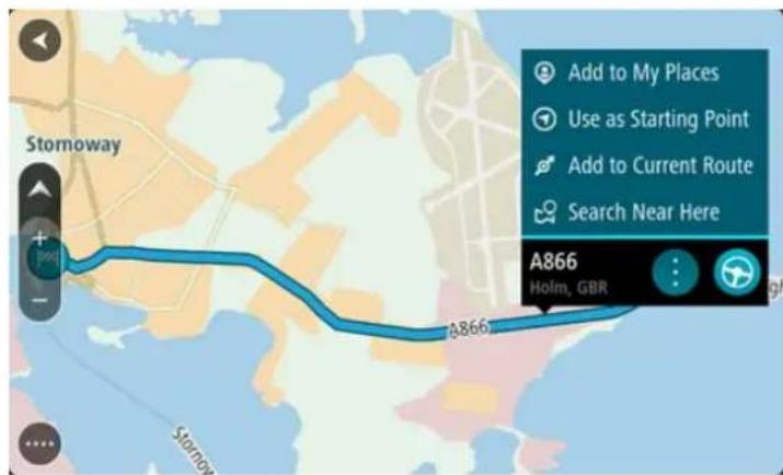
- Select Use as Starting Point.
- Repeat the search steps to choose your destination, and then select the drive button in the pop-up menu:

Your route is planned using your chosen starting point and destination. The estimated time of arrival is shown at the top of the route bar.
Tip: If you don't want to use search to choose your starting point and destination, go to the map view and press and hold to select a location.
Tip: Stops, POIs, Places and the destination can all be selected as starting points using their pop-up menus.
Changing the starting point to be your current location
- Select the starting point of the route in the map view.
- Select the pop-up menu button.
A pop-up menu shows a list of options.
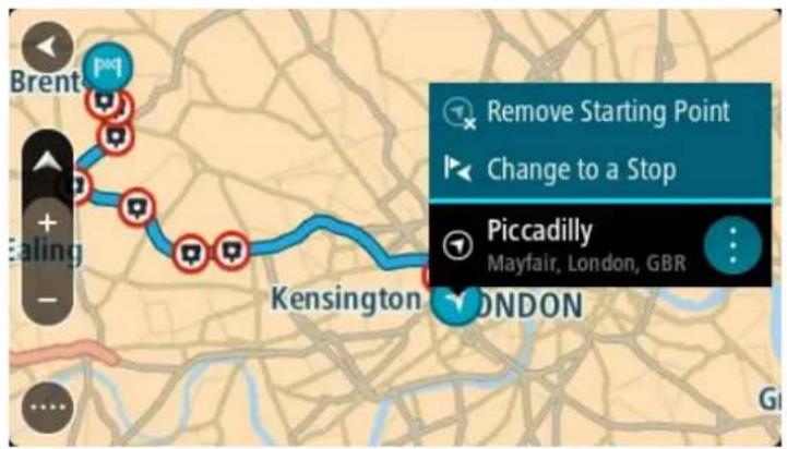
3. Select Remove Starting Point.
Your route is replanned with your current location as the starting point.
Changing the starting point into a stop
- Select the starting point on the route in the map view.
- Select the pop-up menu button.
A pop-up menu shows a list of options.
3. Select Change to a Stop.
Your route is replanned with the starting point changed into a stop.
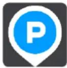
Finding a parking lot
To find a parking lot, do the following:
- Select the Main Menu button to open the Main Menu.

- Select Parking.
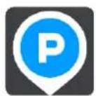
The map opens showing the locations of parking lots.
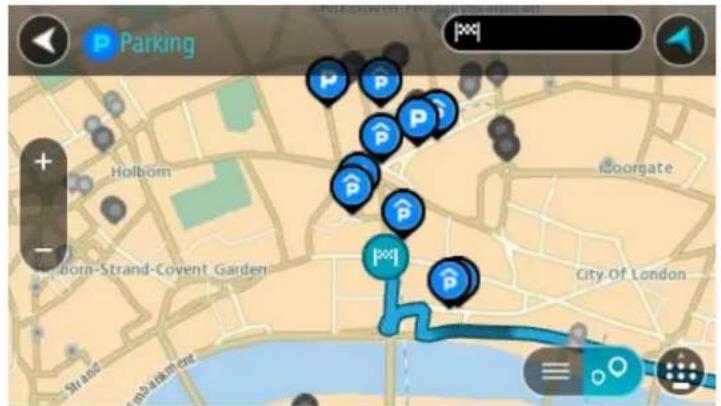
If a route is planned, the map shows parking lots near your destination. If a route isn't planned, the map shows parking lots near your current location.
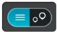
You can change the screen to show a list of parking lots by pressing this button:
You can select a parking lot from the list to locate it on the map.
Tip: You can scroll down the list of results using the scroll bar on the right side of the screen.
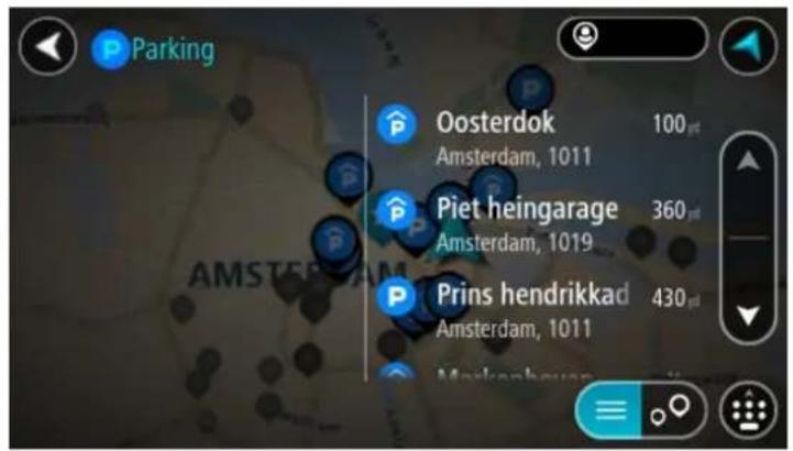
If you want to change how the search is done, select the button to the right of the search box. You can then change where the search is carried out, for example, to search near you or the whole map.
- Select a parking lot from the map or the list.
A pop-up menu opens on the map showing the name of the parking lot.
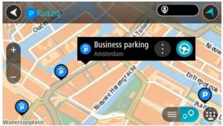
- To plan a route to your chosen parking lot, select the drive button:

A route is planned and then guidance to your destination begins. As soon as you start driving, the guidance view is shown automatically.
Tip: You can add a parking lot as a stop on your route by using the pop-up menu.
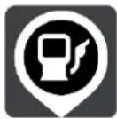
Finding a gas station
To find a gas station, do the following:
- Select the Main Menu button to open the Main Menu.

- Select Gas Station.
The map opens showing the locations of gas stations.
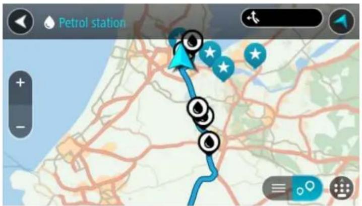
If a route is planned, the map shows gas stations along your route. If a route isn't planned, the map shows gas stations near your current location.
You can change the screen to show a list of gas stations by pressing this button:
You can select a gas station from the list to locate it on the map.
Tip: You can scroll down the list of results using the scroll bar on the right side of the screen.
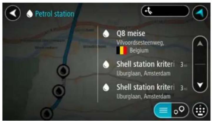
If you want to change how the search is done, select the button to the right of the search box. You can then change where the search is carried out, for example, to search near you or the whole map.
- Select a gas station from the map or the list.
A pop-up menu opens on the map showing the name of the gas station.
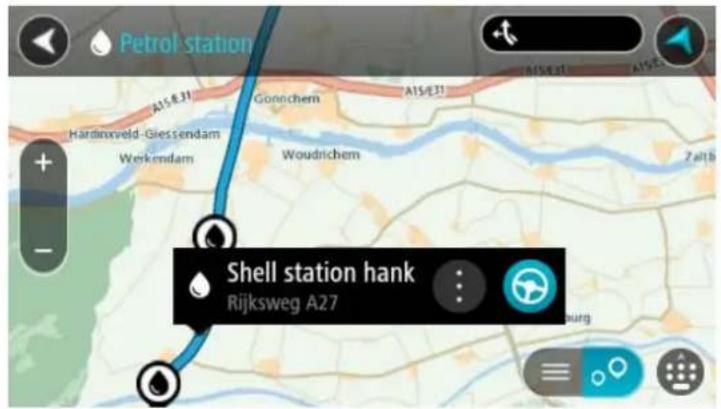
- To plan a route to your chosen gas station, select the drive button:

A route is planned and then guidance to your destination begins. As soon as you start driving, the guidance view is shown automatically.
Tip: You can add a gas station as a stop on your route by using the pop-up menu. A gas station that is a stop on your route has a blue icon.
Changing your route
The Current Route Menu
When you have planned a route, select the Current Route button in the Main Menu to open the Current Route Menu.
The following buttons are available in the Current Route Menu:
Clear Route | Select this button to clear the currently planned route.The Current Route Menu closes and you return to the map view. |
Find Alternative | You see this button when you have planned a route. Select this button to show up to three alternative routes on the map view. |
Avoid Blocked Road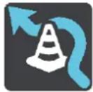 | Select this button to avoid an unexpected obstacle that is blocking the road on your route. |
Avoid Toll Roads and More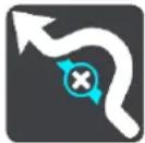 | Select this button to avoid some types of route features that are on your currently planned route. These include ferries, toll roads and unpaved roads. |
Add Stop to Route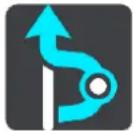 | Select this button to add a stop to your currently planned route. You can also add a stop to your route directly from the map. |
Add to My Routes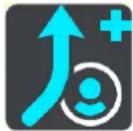 | If you plan a new route that has not already been saved, you see this button. Select this button to save this route as part of your My Routes list. |
Save Changes to Route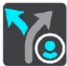 | If you make a change to a My Route, you see this button. Select this button to save the changes. |
Change Route Type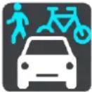 | Select this button to change the type of route used to plan your route. Your route will be recalculated using the new route type. |
Reorder Stops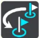 | Select this button to see the lists of stops for your current route. You can then change the order of the stops on your route.For a route without stops, you can also select this button to reverse your route. |
Drive to Route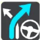 | Select this button to plan a route from your current location to the starting point of a My Route. The starting point is converted to a stop. |
Play Route Preview | Select this button to watch a preview of your planned route. |
Stop Route Preview | Select this button to stop the preview of your planned route. |
Avoiding a blocked road
If there is a blocked road on your route you can change your route to avoid it.
- In the guidance view, select the current location symbol or the speed panel.
Tip: The speed panel is only shown when you have started driving on your route.
- Select Avoid Blocked Road.
A new route is found that avoids the blocked road. You may be shown up to two alternatives depending on the road network between you and your destination.
The new route is shown on the map view with the difference in travel time in a balloon.
Note: It may not be possible to find an alternative route around the blocked road if none exists.
-
Select the new route by selecting the time balloon.
-
Select Let's go.
Guidance to your destination resumes avoiding the blocked road. As soon as you start driving, the guidance view is shown automatically.
Types of route
Select Change Route Type to change the type of route planned to your current destination. Your route is recalculated using the new route type.
You can select the following types of route:
- Fastest route - the fastest route to your destination. Your route is constantly checked taking into account the traffic conditions.
- Shortest route - the shortest route to your destination. This may take much longer than the fastest route.
- Most eco-friendly route - the most fuel-efficient route.
- Avoid interstate highways - this type of route avoids all highways.
- Walking Route - this type of route is optimized for walking.
- Bicycle Route - this type of route is optimized for bicycles.
You can set the default route type in the Settings Menu.
Route features
You can choose to avoid some features that are on your currently planned route. You can avoid the following route features:
- Toll Roads
■ Ferries and car shuttle trains - Carpool Lanes
- Unpaved Roads
Note: Carpool lanes are sometimes known as High Occupancy Vehicle Lanes (HOV lanes) and are not present in every country. To travel on these lanes, you may need to have more than one person in the car, for example, or the car may need to use environmentally-friendly fuel.
If you choose to avoid a route feature, a new route is planned.
In Route Planning in the Settings Menu, you can set how each route feature is handled when a new route is planned.
Adding a stop to your route from your current route
- In the Main Menu, select Current Route.
- Select Add Stop to Route.
The map view is shown.
- To select a stop, do one of the following steps:
- Zoom in on the map, then press and hold to select a location. In the pop-up menu, select Add to Current Route.

- Select Search and search for a location. When you have found a location, select the Add Stop to Route button.
Your route is recalculated to include your stop.
Adding a stop to your route using the map
- Press the switch view button to show the map.
Your complete route is shown on the map.
- Zoom in on the map, then press and hold to select a location.
- Select the pop-up menu button.
- Select Use in Route.
- Select Add to Current Route.

Your route is recalculated to include your stop.
Deleting a stop from your route
- Press the switch view button to show the map. Your complete route is shown on the map.
- In the route bar, press the stop you want to delete. The map zooms in to the stop and shows a pop-up menu.
Tip: If you select the wrong stop, press the back button to return to the map.
- Select Delete This Stop.
The stop is deleted and your route is recalculated.
Reordering stops on a route
Note: If you have a route with no stops, you can use this button to reverse the route.
- In the map view, select the route.
Tip: Zoom in on the route to make it easier to select.
- Select Manage Stops, then Reorder Stops.
The map view is shown with the route cleared. The destination and all the stops are shown on the map.
- Select the stops one by one in the order you wish to drive them.
The symbols change to a flag as you select each stop.
- Select your destination.
Your route is recalculated with the stops in the changed order.
About My Routes
My Routes provides an easy way to create saved routes with optional stops, sometimes known as an itinerary. You can use My Routes to save, retrieve and edit routes.
You may want to use My Routes in one or more of the following situations:
- While working - Your job involves driving several routes with multiple stops on a daily basis. Your routes can change and you need to be flexible and be able to change the order of your stops or change the planned route.
- While on vacation - You are going on vacation and want to plan and save a route. Your route includes scenic roads, stops at various hotels, and other places like tourist attractions.
- While commuting to work - You want to add one or two regular stops between home and work. Your route back home in the evening is the reverse of your route to work in the morning.
You can add the route that you have planned on the map to your My Routes list by selecting it.
Saving a route
- Plan a route using the steps described in Planning a route.
Tip: If you cannot see your planned route on the map view, select the back button to show your route.
- Select the route.
- Select the pop-up menu button to open the menu.
- Select Manage Route, then Add to My Routes.
The name of the route is shown in the edit screen.
- Edit the name of the route so that you can easily recognize it.
- Select Done to save your route in the My Routes list.
Tip: You can also save a route using the Add to My Routes button in the Current Route menu.
Navigating using a saved route
To navigate using a previously saved route, do the following:
- In the Main Menu, select My Routes.
- Select a route from your list.
The route is shown on the map view.
- To navigate to the start of the saved route, select Drive.
The starting point of the saved route is converted to your first stop and then the route is planned. Guidance to your destination begins from your current location. As soon as you start driving, the guidance view is shown automatically.
Tip: There are two other ways to navigate using a saved route:
Select the starting point of the route. When the pop-up menu opens, select Change to a Stop.
Alternatively, select Drive to Route in the Current Route menu.
Adding a stop to a saved route using the map
Note: You can also press and hold a location on the map and select Add to Current Route from the pop-up menu.
- Press the switch view button to show the map.
Your complete route is shown on the map.
-
Select the route.
-
Select the pop-menu button to open the menu.
- Select Add Stop to Route.
Tip: Add Stop to Route can also be found in the Manage Stops sub-menu.
- Select your new stop on the map.
Tip: If you know the name of your new stop, you can use Search to select your stop instead of using the map.
- Select the Add Stop button to add this location as a stop.
Your route is recalculated to include your stop.
Tip: To update the saved route in your My Routes list with the changes, select the route on the map, then select Save Changes to Route in the pop-up menu.
Deleting a route from My Routes
- In the Main Menu, select My Routes.
- Select Edit List.
- Select the routes you want to delete.
- Select Delete.
Traffic
About TomTom Traffic
TomTom Traffic is a unique TomTom service providing real-time traffic information. For more information about TomTom services, go to tomtom.com/services.
In combination with IQ Routes, TomTom Traffic helps you plan the optimum route to your destination taking into account the current local traffic conditions.
Your TomTom BRIDGE device regularly receives information about the changing traffic conditions. If traffic jams or other incidents are found on your current route, your device will offer to replan your route to try and avoid any delays.
TomTom BRIDGE uses either a permanent connection or a smartphone connection to connect to TomTom services.
Important: If use your smartphone to connect to TomTom Services and you are outside of the area covered by your cellular data plan, you may be liable for extra roaming charges while using TomTom Services.
Note: TomTom services are not available in all countries or regions, and not all services are available in all countries or regions. For more information on available services in each region, go to tomtom.com/services.
The route bar
The route bar is shown when you have planned a route. It has an arrival information panel at the top, and a bar with symbols underneath.
Important: To see a wider route bar showing additional route information, change the setting for Route Information.
Note: The distance ahead shown by the route bar depends on the overall length of your route.
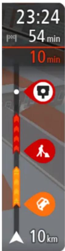
The arrival information panel shows the following information:
- The estimated time that you will arrive at your destination.
- The length of time to drive to the destination from your current location.
- A parking button is shown near the destination flag when parking is available near your destination.
Tip: If your destination is in a different time zone, you see a plus (+) or a minus (-) sign and the time difference in hours and half hours in the arrival information panel. The estimated time of arrival is the local time at your destination.
If you have stops on your route, select this panel to change between information about the next stop and your final destination.
You can choose the information you see on the arrival information panel.
Traffic status - if your device isn't receiving any traffic information, a symbol showing traffic with a cross appears underneath the arrival information panel.
The bar uses symbols to show the following information:
- The next two stops on your route.
Gas stations that are directly on your route. - TomTom Traffic.
■ TomTom Safety Cameras and Danger Zones.
■ Rest stops directly on your route.
You can choose the information you see on your route.
The symbols are in the order that they occur on your route. For traffic incidents, the symbol for each incident alternates between showing the type of incident and the delay in minutes. Select a symbol to see more information about a stop, an incident or a safety camera. If a symbol is shown on top of another symbol, selecting the symbols zooms in on the route bar to show each symbol separately. You can then select a symbol.
The total time delay due to traffic jams and other incidents on your route, including information provided by IQ Routes, is shown above the symbols.
For a complete list of incident types, see Traffic incidents.
The bottom of the route bar represents your current location and shows the distance to the next incident on your route. In addition, you can choose to see the current time if you turn the setting on.
Note: To make the route bar more readable some incidents may not be shown. These incidents will always be of minor importance and only cause short delays.
The route bar also shows status messages, for example Finding fastest route or Playing route preview.
Looking at traffic on the map
Traffic incidents are shown on the map. If several traffic incidents overlap, the highest priority incident is shown. For example, a road closure is higher priority than road work or a closed lane.
Tip: Select an incident on the map to see more detailed information.
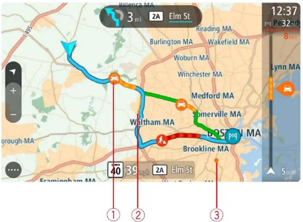
- Traffic incident that affects your route in your direction of travel.
A symbol or number at the start of the incident shows the type of incident or the delay in minutes, for example 5 minutes.
The color of the incident indicates the speed of traffic relative to the maximum allowed speed at that location, with red being the slowest. The stripes on the traffic jam are also animated to show the speed of the traffic, where appropriate.
For a complete list of incident types, see Traffic incidents.
- Traffic incident on your route but in the opposite direction of travel.
- Traffic incidents on roads that are not visible at your current zoom level.
Looking at traffic on your route
Information about traffic incidents on your route is shown in the route bar on the right-hand side of the map.
The route bar tells you about traffic delays while you are driving, using symbols to show you where each traffic incident is located on your route.
Note: If your device isn't receiving any traffic information, a symbol showing traffic with a cross appears underneath the arrival information panel.
Note: To make the route bar more readable some incidents may not be shown. These incidents will always be of minor importance and only cause short delays.
To get more information about an incident, select an incident in the route bar. The map opens zoomed in on the incident and a pop-up opens showing detailed information about the traffic incident.
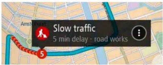
The information shown includes:
- The type of traffic incident - general, accident, road work or lane closure.
- The severity of the incident - slow traffic, traffic lining up or stationary traffic.
- The delay time.
■ The length of the incident.
For a complete list of incident types, see Traffic incidents.
Select the back button to go back to the guidance view.
Traffic incidents
Traffic incidents and warnings are shown in the map view and in the route bar. Symbols shown in a circle are traffic incidents. Checks are done to see if a faster route is available and your route is replanned to avoid traffic incidents.
Traffic incident symbols:
Stationary traffic
Traffic lining up
Slow traffic
Unknown accident
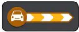
Unknown incident
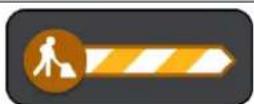
Road work
Lane closure
Road closure
Safety Cameras
About safety cameras
The Safety Cameras service warns you about the following camera locations:
- Fixed safety camera locations.
■ Speed trap locations.
■ Speed trap hotspots.
■ Average safety camera locations.
■ Speed enforcement zones.
■ Red light camera locations. - Traffic restriction cameras.
The Safety Cameras service also warns you about the following safety hazards:
■ Accident blackspot locations.
- Traffic jams.
TomTom BRIDGE uses either a permanent connection or a smartphone connection to connect to TomTom services.
Important: If you are outside of the area covered by your cellular data plan, you may be liable for extra roaming charges while using TomTom Services.
Note: TomTom services are not available in all countries or regions, and not all services are available in all countries or regions. For more information on available services in each region, go to tomtom.com/services.
Safety camera warnings
When you first start using your device, a warning sound is played for the most common types of safety camera. To change the way you are warned about safety cameras, select Sounds & Warnings in the Settings menu.
Warnings are given as you approach a safety camera. You are warned in several ways:
- A symbol is shown in the route bar and on your route on the map.
- Your distance to the safety camera is shown in the route bar.
- You hear a warning sound as you get near the camera.
■ While you are approaching a camera or driving in an average speed zone, your speed is monitored. If you drive more than 5 km/h or 3 mph over the speed limit the route bar turns red. If you drive less than 5 km/h or 3 mph over the speed limit the route bar turns orange.
Tip: In the map view or guidance view, you can select a safety camera symbol in the route bar to see the type of camera, the maximum speed and also the length of an average speed zone. In the map view, you can also select a safety camera that is shown on your route.
| Symbol shown on map | Symbol shown in route bar | Description |
 |  | Safety camera - this type of camera checks the speed of passing vehicles and is fixed in one place. |
 |  | Speed trap - this type of camera checks the speed of passing vehicles and can be moved to different locations. |
 |  | Speed trap hotspots - this type of warning shows places where speed traps are often used. |
 |  | Average speed safety cameras - these types of cameras measure your average speed between two points. You are warned at the start and end of the average speed zone.While you are driving in an average speed zone, your average speed is shown, instead of your current speed. The distance to the end of the area is shown in the route bar. |
 |  | Speed enforcement zones - these zones can contain multiple safety cameras.You are warned at the start and end of a speed enforcement zone. While you are driving in a speed enforcement zone, your current speed is shown, and the visual warning is shown in the route bar. |
 |  | Red light camera - this type of camera checks for vehicles breaking traffic rules at traffic lights. There are two types of red light safety cameras - those which check if you drive through a red light and those which check for driving through a red light together with speeding. |
 | ||
 |  | Traffic restriction - this type of warning warns you about restricted roads. |
 |  | Accident hotspot - this type of warning is given for a place where road traffic accidents have historically been concentrated.You are warned at the start and end of the accident hotspot. While you are driving in an accident hotspot, your current speed is shown.When you are in the hotspot, the visual warning continues to be shown in the route bar. |
 |  | Traffic jams - warnings are given in the route bar for traffic jams. |
Changing the way you are warned
To change the way the navigation app warns you about speed cameras, select the Sounds and Warnings button in the Settings Menu.
You can then set how you want to be warned for the different types of cameras and safety hazards. You can change settings for whether you want to be warned, never warned or warned only if you are speeding.
For example, to change how you are warned when you approach a safety camera, do the following:
- Select Sounds and Warnings in the Settings Menu.
- Select Safety camera warnings.
- Select Safety cameras.
-
Select one of the following warning options:
-
Always.
- Only when speeding.
-
Never.
-
Select the back button.
Tip: To turn off all audible warnings, select Settings, followed by Sounds and Warnings and then turn off Warning sounds.
Reporting a new safety camera
If you pass a new safety camera that you were not warned about, you can report it instantly.
Note: To report a safety camera, your device must have a cellular data connection.
You can report a safety camera in two ways:
Using the quick menu to report a safety camera
- Select the current location symbol or the speed panel in the guidance view.
- Select Report Safety Camera from the pop-up menu.
You see a message thanking you for adding the camera.
Tip: If you make a mistake when reporting a camera, select Cancel in the message.
The safety camera is saved on your device automatically, and is also sent to other users.
Using the Main Menu to report a safety camera
- Select the Main Menu button to open the Main Menu.

2. Select Report Safety Camera.
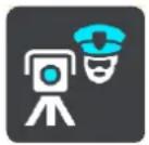
You see a message thanking you for adding the camera.
Tip: If you make a mistake when reporting a camera, select Cancel in the message.
The safety camera is saved on your device automatically, and is also sent to other users.
Confirm or remove a speed trap
You can confirm the presence of a speed trap or remove a speed trap if it is no longer present.
- Just after you pass a speed trap, in the route bar you are asked if the camera was still there.
- Select Yes if the speed trap is still there.
- Select No if the speed trap has been removed.
If you select No, the speed trap is removed from your device.
Updating locations for cameras and hazards
The locations of safety cameras can change frequently. New cameras can also appear without warning and the locations for other hazards, such as accident hotspots, may also change.
When connected to TomTom services, all camera updates for fixed safety camera and speed trap locations are received in real time. You do not need to do anything to receive updates - they are sent to your navigation app automatically.
About My Places
My Places provides an easy way to select a location without the need to search for the location each time. You can use My Places to create a collection of useful addresses.
The following items are always in My Places:
- Home - Your home location can be your home address or somewhere you often visit, such as your office. This feature provides an easy way to navigate there.
- Recent destinations - Select this button to select your destination from a list of locations you have recently used as destinations. These also include your stops.
You can add a location to My Places directly in My Places, by selecting a location from the map, by searching for a location or by marking a location.
Your home location, marked locations, and the locations that you have added appear in a list in My Places and are shown with a marker on the map.
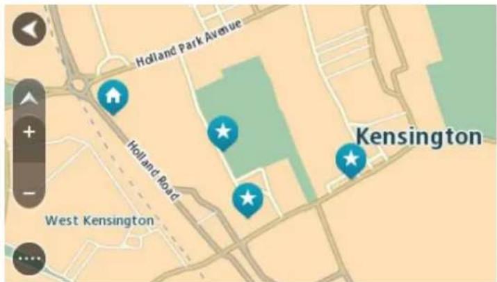
Setting your home location
You can set your home location in the following ways:
Setting your home location using My Places
- In the Main Menu, select My Places.
- Select Home.
- To select a home location, do one of the following:
- Zoom in on the map at the location you want to select. Press and hold to select the location, then select the home location symbol.
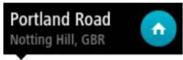
- Select the Search button and search for a location. Select a location to set as home. Select Set home location.
Setting your home location using the map
- In the Map View, move the map and zoom in until you can see your home location.
- Select the location by pressing and holding the screen for about one second.
A pop-up menu shows the nearest address.
- Open the pop-up menu and select Add to My Places.
- In the name bar, enter the name "Home".
Note: "Home" must have a capital letter H.
- Select Add.
Your home location is shown on the map.
Changing your home location
You can change your home location in the following ways.
Changing your home location using My Places
- In the Main Menu, select My Places.
- Select Home.
Your home location is shown on the map, with a pop-up menu.

- Select Edit Location.
-
To select a new home location, do one of the following:
-
Zoom in on the map at the location you want to select. Press and hold to select the location, then select the home location symbol.
- Select the Search button and search for a location. Select a location to set as home. Select Set home location.
Changing your home location using the map
- In the Map View, move the map and zoom in until you can see your home location.
- Select the location by pressing and holding the screen for about one second.
A pop-up menu shows the nearest address.
- Open the pop-up menu and select Add to My Places.
- In the name bar, enter the name "Home".
Note: "Home" must have a capital letter H.
- Select Add.
Your home location is changed to the new location.
Adding a location from My Places
- In the Main Menu, select My Places.
- Select Add a new place.
-
To select a location, do one of the following:
-
Zoom in on the map at the location you want to select. Press and hold to select the location, then select the add location symbol.
- Search for a location. Select Show on Map, then select the add location symbol.

The name of the location appears in the edit screen.
- Edit the name of the location so you can easily recognize it.
- Select Done to save your location in the My Places list.
Add a location to My Places from the map
- Move the map and zoom in until you can see the destination that you want to navigate to.
- Press and hold to select the location.
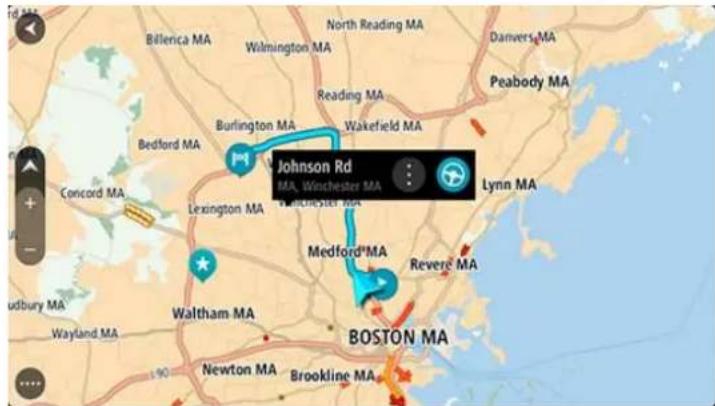
- Select the pop-up menu button.

- Select Add to My Places.
The name of the location is shown in the edit screen.
- Edit the name of the location so you can easily recognize it.
- Select Done to save your location in the My Places list.
The location you added is shown with a marker on the map.
Adding a location to My Places using search
- In the Main Menu, select Search.
- Search for a location.
- Select the location then select Show on map.
- When the map view shows the location, select the pop-up menu button.

- Select Add to My Places.
The name of the location appears in the edit screen. - Edit the name of the location so you can easily recognize it.
- Select Done to save your location in the My Places list.
Deleting a recent destination from My Places
- In the Main Menu, select My Places.
- Select Recent Destinations.
- Select Edit List.
- Select the destinations you want to delete.
- Select Delete.
Deleting a location from My Places
- In the Main Menu, select My Places.
- Select Edit List.
- Select the locations you want to delete.
- Select Delete.
Appearance
Select Settings in the Main Menu, then select Appearance.

On this screen, you can change these settings:
- Switch to night colors when dark
Select this setting to make the device automatically switch to night colors when it gets dark.
■ Show previews of highway exits
Select this setting to control the full screen preview when you approach highway exits.
- Switch map view
By default, automatic changing of views is on. This means, for example, that the device shows the map view when an alternative route is being suggested, along with several other sets of circumstances. Also, for example, that the device shows the guidance view when you start driving and you start to accelerate. Select this setting if you want to turn off automatic changing between guidance view and map view.
■ Show current time
Select this setting to show the current time in the guidance view. When switched on, the current time is shown at the bottom of the route bar.
- Guidance view
Select this setting to choose from 3D or 2D versions of the guidance view. Both the 2D and 3D guidance views move in your direction of travel.
Theme Color
Select Settings in the Main Menu, then select Appearance.

Select Change Theme to change the accent color used in the menus, buttons, and icons on your navigation device.
Size of text and buttons
Select Settings in the Main Menu, then select Appearance.

Select Size of text and buttons to change the size of the text and the buttons you see on the screen.
Note: This feature is only available on devices with a 6 inch / 15 cm or larger screen.
Drag the slider to change the text and button size to small, medium, or large, then select Apply this change. Your device restarts and applies the change.
Brightness
Select Settings in the Main Menu, then select Appearance.

Select Brightness to change the following settings:
Day brightness
Move the slider to adjust the brightness level of the screen during the day.
- Night brightness
Move the slider to adjust the brightness level of the screen during the night.
Arrival information panel
Select Settings in the Main Menu, then select Appearance.

Select Arrival information to change the following settings:
■ Show remaining distance
Select this setting to show the remaining distance left to travel in the arrival information panel during navigation.
- Show remaining time
Select this setting to show the remaining time left to travel in the arrival information panel during navigation.
- Switch between distance and time automatically
Select this setting to control the automatic switching between remaining distance and remaining time in the arrival information panel.
■ Show arrival information for
Use this setting to control whether you want to see information about the destination or the next stop in the arrival information panel.
Tip: To find out where the different panels are in the guidance view or map view, see What's on the screen.
Route Information
Select Settings in the Main Menu, then select Appearance.

Select Route Information to change settings for the route bar.
■ Show wide route bar if possible
The wide route bar is not shown by default. You can select this setting to turn on the wide route bar in the guidance view.
Note: The wide route bar can only be shown if the screen is wide enough.
When the wide route bar is shown, you see more information about your route. For example, you see time and distance to traffic and more.

You can also choose to see any of the following in the route bar:
- Parking Select this setting to see parking lots and parking.
- Gas stations Select this setting to see gas stations on your route.
- Stops Select this setting to see stops on your route.
- Rest areas Select this setting to see rest areas on your route.
Voices
Select Settings in the Main Menu, then select Voices.

Choosing a voice
Select Choose a voice to change the voice that gives spoken directions and other route instructions.
A wide range of voices are available. There are computer voices which can read street names and other information directly from the map and there are recorded voices which have been recorded by actors.
Note: Computer voices are not available in all languages.
If you need a computer voice and your language is unavailable, then you are asked to choose from a list of installed computer voices available for the country you are in.
Instruction settings
- Read aloud early instructions
For example, if you turn on this setting, you could hear early instructions such as "After 2 mi take the exit right" or "Ahead, turn left."
Note: When a recorded voice is chosen, you see only this setting because recorded voices cannot read out road numbers, road signs, etc.
- Read aloud road numbers
Use this setting to control whether road numbers are read aloud as part of navigation instructions. For example, when road numbers are read aloud, you hear "Turn left onto A100."
- Read aloud road sign information
- Use this setting to control whether road sign information is read aloud as part of navigation instructions. For example, "Turn left onto A302 Bridge Street towards Islington."
- Read aloud street names
Use this setting to control whether street names are read aloud as part of navigation instructions. For example, when street names are read aloud, you hear "Turn left Graham Road towards Hackney."
- Read aloud foreign street names
Use this setting to control whether foreign street names are read aloud as part of navigation instructions, such as "Turn right Champs Élysées." For example, an English computer voice can read and pronounce French street names but pronunciation may not be completely accurate.
Maps
Select Settings in the Main Menu, then select Maps.
Changing the map
Select a map that you want to use.
Route Planning
Select Settings in the Main Menu, then select Route Planning.
When a faster route is available
If a faster route is found while you are driving, TomTom Traffic can replan your trip to use the faster route. Select from the following options:
■ Always take the fastest route
- Ask me so I can choose
- Don't ask me
Always plan this type of route
The types of route you can choose from are as follows:
- Fastest route - the route which takes the least time.
- Shortest route - the shortest distance between the locations you set. This may not be the quickest route, especially if the shortest route is through a town or city.
- Most eco-friendly route - the most fuel-efficient route for your trip.
- Avoid interstate highways - this type of route avoids all highways.
- Walking route - a route designed for making the trip on foot.
- Bicycle route - a route designed for making the trip on a bicycle.
Avoid on every route
You can choose to avoid ferries and car shuttle trains, toll roads, carpool lanes, and unpaved roads. Set how your TomTom should manage each of these road features when the device calculates a route.
Carpool lanes are sometimes known as High Occupancy Vehicle Lanes (HOV) and are not present in every country. To travel on these lanes, you may need to have more than one person in the car, for example, or the car may need to use environmentally-friendly fuel.
Sounds and Warnings
Select Settings in the Main Menu, then select Sounds & Warnings.
On this screen, you can change the sounds and warnings settings.
Warning type
Warning type
You can choose the type of warnings you want to hear when you are driving:
- Read-aloud warnings
Hear spoken warnings and warnings sounds. - Warning sounds
Hear only warning sounds.
- None
No warning sounds are given.
Safety camera warnings
Select Settings in the Main Menu, then select Sounds & Warnings.
Select Safety camera warnings. You can then set how you want to be warned for the different types of cameras and safety hazards. You can change settings for advance warning time and whether you want to be warned, never warned or warned only if you are speeding.
Safety warnings
Select Settings in the Main Menu, then select Sounds & Warnings.

Select Safety warnings. You can then set how you want to be warned for the different types of danger zones and safety hazards. You can change settings for advance warning time and whether you want to be warned, never warned or warned only if you are speeding.
- Danger zones
This type of warning is only given in France where you are only warned about danger zones.
- Accident hotspots
This type of warning is given for a place where road traffic accidents have historically been concentrated.
Risk zones
This type of warning is only given in France where you are only warned about danger zones.
- Traffic jams
Traffic jam warnings in the route bar are part of TomTom Traffic. You can choose never to be warned or to be warned when approaching a jam too quickly.
- When speeding
This warning is given as soon as you exceed the speed limit by more than 5 km/h or 3 mph. When you are speeding, the speed panel also turns red in the guidance view.
Units
Select Settings in the Main Menu, then select Language & Units.
On this screen, you can change the following settings:
- Distance
Select this setting to choose the units used on your device for features such as route planning. If you want the units to be set by the GPS, select Automatic.
Language
The language used on TomTom BRIDGE is also used on the apps installed on the device. For example, the language used for buttons and menus in the navigation app is the same as the language you selected in your device settings.
You can change the device language in Language & input in the TomTom BRIDGE Settings app.
If you change the device language, the voice used for spoken directions and other route instructions in the navigation app might not be compatible with the new device language. Go to Voices in the Settings menu and download a compatible voice.
Important: Some voices are large files that can take a long time to download. To prevent excess data charges we recommend you download a voice over a Wi-Fi connection.
Help
Select Help from the Main Menu or the Settings menu.

On this screen, you can see the following information:
Guided tour
Select this option to get a short tutorial on how to use your navigation device.
- About
This is an information screen rather than a setting and shows you information about your TomTom BRIDGE. You may be asked to go to this screen during a call to TomTom Customer Support or you may need to enter information taken from this screen when using the TomTom Shop.
External Camera App
Using the External Camera app
This section explains how to use the External Camera app.
Important: For other TomTom BRIDGE settings and operation instructions, and for instructions about other apps installed on TomTom BRIDGE, please refer to the applicable User Documentation.
The app shows you the live image from the external camera installed on your vehicle.
Note: A rear-view camera usually turns on when you shift into reverse. Other external cameras are turned on by a switch on the vehicle dashboard. The app will not work unless it receives a signal from the camera.
Select the External camera button to start the app. The image from the camera appears automatically.

natural_image
Abstract geometric icon with concentric squares and a central circle (no text or symbols)On some devices the camera image is shown in a widget on the home screen. Select the widget to show the camera image full-screen.
TomTom Music App
Using the TomTom Music app
This section explains how to use the TomTom Music app.
Important: For other TomTom BRIDGE device settings and operation, and for instructions about other apps on the device, please refer to the applicable User Documentation.
Use the Music app to select and play music stored in the device's internal memory, or on the memory card that you have inserted in the TomTom BRIDGE.
Select the Music button to start the app.
natural_image
Icon of a white car with a blue musical note on top, set against a black background (no text or symbols)The app automatically finds your music on the device and on the memory card. The tracks are played in a random order. You can select a music track using the next and previous buttons. Select the play button to play the track.
The album image is shown if it is available.
The music tracks continue to play even when you are using other apps. Adjust the music volume using the volume control in the system bar.
Important Safety Notices and Warnings
Global Positioning System (GPS) and Global Navigation Satellite System (GLONASS)
The Global Positioning System (GPS) and Global Navigation Satellite System (GLONASS) systems are satellite-based systems that provide location and timing information around the globe. GPS is operated and controlled by the Government of the United States of America, which is solely responsible for its availability and accuracy. GLONASS is operated and controlled by the Government of Russia, which is solely responsible for its availability and accuracy. Changes in GPS or GLONASS availability and accuracy, or in environmental conditions may impact the operation of this device. TomTom disclaims any liability for the availability and accuracy of GPS or GLONASS.

Safety messages
Use with care
Use of TomTom products while driving still means that you need to drive with due care and attention.
Your device is intended to serve as a driving aid and is not a substitute for driving with due care and attention. Always obey posted road signs and applicable laws. Distracted driving can be extremely dangerous. Please do not operate this device in any manner that diverts a driver's attention from the road in an unsafe manner. TomTom recommends using the hands-free systems where available and pulling over to a complete stop at a safe location in order to interact with the device.
Notice for oversized/commercial vehicles
This product is intended for use by passenger vehicles and may not provide appropriate routes for oversized and commercial vehicles. If you are operating an oversized or commercial vehicle, please visit tomtom.com to find an appropriate product with maps containing height and weight restrictions.
Aircraft and hospitals
Use of devices with an antenna is prohibited on most aircraft, in many hospitals and in many other locations. This device must not be used in these environments.
Safety messages
Please read and take note of the following important safety advice:
- Check your tire pressures regularly.
■ Service your vehicle regularly.
■ Medication can affect your riding or driving ability.
■ Always use seat belts if available. - Don't drink and drive.
- Most accidents happen less than 5 km / 3 miles from home.
- Obey the rules of the road.
■ Always use your turn signals. - Every 2 hours, take a break for at least 10 minutes.
-
Keep your seat belts on.
-
Keep a safe distance from the vehicle in front.
■ Before setting off on a motorcycle, fasten your helmet correctly. - When riding a motorcycle, always wear protective clothing and equipment.
- When riding a motorcycle, be extra vigilant and always ride defensively.
Rating: 5V DC, 2.0A
How TomTom uses your information
Information regarding the use of personal information can be found at tomtom.com/privacy.
Battery
This product uses a Lithium-Ion battery.
Do not use it in a humid, wet and/or corrosive environment. Do not put, store or leave your product in a high temperature location, in strong direct sunlight, in or near a heat source, in a microwave oven or in a pressurized container, and do not expose it to temperatures over 140^ F / 60^ C. Failure to follow these guidelines may cause the battery to leak acid, become hot, explode or ignite and cause injury and/or damage. Do not pierce, open or disassemble the battery. If the battery leaks and you come into contact with the leaked fluids, rinse thoroughly with water and seek medical attention immediately. For safety reasons, and to prolong the lifetime of the battery, remove your product from your vehicle when you are not driving and keep in a cool, dry place. Charging will not occur at low (below 32^ F / 0^ C) or high (over 140^ F / 60^ C) temperatures.
Temperatures: Standard operation: 32^ F / 0^ C to 140^ F / 60^ C; short period storage: -4^ F / -20^ C to 113^ F / 45^ C; long period storage: -4^ F / -20^ C to 95^ F / 35^ C.
Caution: risk of explosion if battery is replaced with an incorrect type.
Do not remove or attempt to remove the non-user-replaceable battery. If you have a problem with the battery, please contact TomTom customer support.
THE BATTERY CONTAINED IN THE PRODUCT MUST BE RECYCLED OR DISPOSED OF PROPERLY ACCORDING TO THE LOCAL LAWS AND REGULATIONS AND ALWAYS KEPT SEPARATE FROM HOUSEHOLD WASTE. BY DOING THIS YOU WILL HELP CONSERVE THE ENVIRONMENT. USE YOUR TOMTOM DEVICE ONLY WITH THE SUPPLIED DC POWER CORD (CAR CHARGER/BATTERY CABLE), AC ADAPTER (HOME CHARGER), IN AN APPROVED CRADLE OR USING THE SUPPLIED USB CABLE TO CONNECT TO A COMPUTER FOR BATTERY CHARGING.
If your device requires a charger, please use this device with the charger provided. For replacement chargers, go to tomtom.com for information about approved chargers for your device.
The stated battery life is a maximum possible battery life. The maximum battery life will only be achieved under specific atmospheric conditions. The estimated maximum battery life is based on an average usage profile.
For tips on extending the battery life, see this FAQ: tomtom.com/batterytips.
Do not disassemble or crush, bend or deform, puncture or shred your device.
Do not modify or remanufacture, attempt to insert foreign objects into the battery, immerse or expose to water or other liquids, expose to fire, explosion or other hazard.
Only use the battery for a system for which it is specified.
Only use the battery with a charging system that has been qualified for use with the system per this standard. Use of an unqualified battery or charger may present a risk of fire, explosion, leakage or other hazard.
Do not short circuit a battery or allow metallic conductive objects to contact battery terminals.
Replace the battery only with another battery that has been qualified with the system per this standard, IEEE-Std-1725-200x. Use of an unqualified battery may present a risk of fire, explosion, leakage or other hazard.
Promptly dispose of used batteries in accordance with local regulations.
Battery usage by children should be supervised.
Avoid dropping the device. If the device is dropped, especially on a hard surface, and the user suspects damage, please contact customer support.
Improper battery use may result in a fire, explosion or other hazard.
For those host devices that utilize a USB port as a charging source, the host device's user manual shall include a statement that the navigation device shall only be connected to products that bear the USB-IF logo or have completed the USB-IF compliance program.
Pacemakers
Pacemaker manufacturers recommend that a minimum of 15 cm / 6 inches be maintained between a handheld wireless device and a pacemaker to avoid potential interference with the pacemaker. These recommendations are consistent with independent research and recommendations by Wireless Technology Research.
Guidelines for people with pacemakers
- You should ALWAYS keep the device more than 15 cm / 6 inches from your pacemaker.
- You should not carry the device in a breast pocket.
Other medical devices
Please consult your physician or the manufacturer of the medical device, to determine if the operation of your wireless product may interfere with the medical device.
Special Note Regarding Driving in California, Minnesota and Other States
California Vehicle Code Section 26708 which applies to those driving within the State of California restricts the mounting of a navigation device on the windshield to a seven-inch square in the lower corner of the windshield farthest removed from the driver or in a five-inch square in the lower corner of the windshield nearest to the driver and outside of an airbag deployment zone, if the system is used only for door-to-door navigation while the motor vehicle is being operated. Drivers in California should not mount the device on their side or rear windows.
Minnesota State Legislature Statutes Section 169.71, subdivision 1, section 2 restrict any person driving within the State of Minnesota from driving with a device suspended between the driver and the windshield.
Many other states have enacted laws which restrict the placement of any object or material on the windshield or side or rear window that obstructs a driver's clear view of the road. It is incumbent upon the driver to be aware of all applicable laws and to place the device in such a manner that will not interfere with his/her driving.
TomTom, Inc. bears no responsibility for and hereby disclaims all liability for any fines, penalties or damage incurred by a driver for violations of the law. While driving in any state with windshield mounting restrictions, TomTom recommends using the supplied Adhesive Mounting Disk or purchasing an alternative mounting system (for example, dashboard or air vents). See tomtom.com for more information about these mounting options.
FCC information for the user

THE DEVICE COMPLIES WITH PART 15 OF THE FCC RULES
Federal Communications Commission (FCC) Statement
This equipment radiates radio frequency energy and if not used properly - that is, in strict accordance with the instructions in this manual - may cause interference to radio communications and television reception.
Operation is subject to the following two conditions: (1) this device may not cause harmful interference and (2) this device must accept any interference, including interference that may cause undesired operation of the device.
This device has been tested and found to comply with the limits for a Class B digital device, pursuant to part 15 of the FCC rules. These limits are designed to provide reasonable protection against harmful interference in a residential installation. This equipment generates, uses and can radiate radio frequency energy and, if not installed and used in accordance with the instructions, may cause harmful interference to radio communications. However, there is no guarantee that interference will not occur in a particular installation. If this equipment does cause harmful interference to radio or television reception, which can be determined by turning the equipment off and on, the user is encouraged to try to correct the interference by one or more of the following measures:
■ Reorient or relocate the receiving antenna.
- Increase the separation between the equipment and receiver.
- Connect the equipment into an outlet on a circuit different from that to which the receiver is connected.
- Consult the dealer or an experienced radio/TV technician for help.
Changes or modifications not expressly approved by the party responsible for compliance could void the user's authority to operate the equipment.
Important
This equipment was tested for FCC compliance under conditions that included the use of shielded cables and connectors between it and the peripherals. It is important that you use shielded cables and connectors to reduce the possibility of causing radio and television interference. Shielded cables, suitable for the product range, can be obtained from an authorized dealer. If the user modifies the equipment or its peripherals in any way, and these modifications are not approved by TomTom, the FCC may withdraw the user's right to operate the equipment. For customers in the USA, the following booklet prepared by the Federal Communications Commission may be of help: "How to Identify and Resolve Radio-TV Interference Problems." This booklet is available from the US Government Printing Office, Washington, DC 20402. Stock No 004-000-00345-4.
FCC ID: S4L4FI72, S4L4FI73
IC ID: 5767A-4FI72, 5767A-4FI73
FCC RF Radiation Exposure Statement
The transmitters within this device must not be co-located or operating in conjunction with any other antenna or transmitter.
Responsible party in North America
TomTom, Inc., 24 New England Executive Park, Burlington, MA 01803
Tel: 866 486-6866 option 1 (1-866-4-TomTom)
Emissions information for Canada
Operation is subject to the following two conditions:
- This device may not cause interference.
- This device must accept any interference, including interference that may cause undesired operation of the device.
Operation is subject to the condition that this device does not cause harmful interference.
This Class B digital apparatus complies with Canadian ICES-003.
The Country Code Selection feature is disabled for products marketed in the US or Canada.
Equipment is certified to the requirements of RSS-210 for 2.4-GHz.
IMPORTANT NOTE
IC Radiation Exposure Statement:
- This equipment complies with IC RSS-102 radiation exposure limits set forth for an uncontrolled environment.
This device and its antenna(s) must not be co-located or operating in conjunction with any other antenna or transmitter.
This equipment complies with IC radiation exposure limits set forth for an uncontrolled environment. End users must follow the specific operating instructions for satisfying RF exposure compliance. To maintain with IC RF exposure compliance requirements, please follow the operation instructions in this manual.
Specific Absorption Rate (SAR) compliance
THIS WIRELESS DEVICE MODEL MEETS GOVERNMENT REQUIREMENTS FOR EXPOSURE TO RADIO WAVES WHEN USED AS DIRECTED IN THIS SECTION
This GPS Navigation System is a radio transmitter and receiver. It is designed and manufactured not to exceed the emission limits for exposure to radio frequency (RF) energy set by the Federal Communications Commission (FCC) of the U.S. Government, Industry Canada of the Canadian Government (IC).
The SAR limit recommended by the Federal Communications Commission (FCC) of the U.S. Government, Industry Canada of the Canadian Government (IC) is 1.6W/kg averaged over 1 gram of tissue for the body (4.0 W/kg averaged over 10 grams of tissue for the extremities - hands, wrists, ankles and feet). Tests for SAR are conducted using standard operating positions specified by FCC/IC with the device transmitting at its highest certified power level in all tested frequency bands.
Exposure limits
This device complies with radiation exposure limits set forth for an uncontrolled environment. In order to avoid the possibility of exceeding the radio frequency exposure limits, human proximity to the antenna shall not be less than 8 inches (20 cm) during normal operation.
This document
Great care was taken in preparing this document. Constant product development may mean that some information is not entirely up to date. The information in this document is subject to change without notice.
TomTom shall not be liable for technical or editorial errors or omissions contained herein, nor for incidental or consequential damages resulting from the performance or use of this document. This document contains information protected by copyright. No part of this document may be photocopied or reproduced in any form without prior written consent from TomTom N.V.
Model names
4FI70, 4FI72, 4FI73
Copyright notices
© 2014 TomTom. All rights reserved. TomTom and the "two hands" logo are registered trademarks of TomTom N.V. or one of its subsidiaries. Please see tomtom.com/legal for limited warranty and end user license agreements applying to this product.
© 2014 TomTom. All rights reserved. This material is proprietary and the subject of copyright protection and/or database rights protection and/or other intellectual property rights owned by TomTom or its suppliers. The use of this material is subject to the terms of a license agreement. Any unauthorized copying or disclosure of this material will lead to criminal and civil liabilities.
Ordnance Survey © Crown Copyright License number 100026920.
Data Source © 2014 TomTom
All rights reserved.
Data Source
Whereis® map data is © 2014 Telstra® Corporation Limited and its licensors, Whereis® is a registered trademark of Telstra® Corporation Limited, used under license.
Data Source
© 2014 GeoSmart Maps Limited.
SoundClear™ acoustic echo cancellation software © Acoustic Technologies Inc.
The software included in this product contains copyrighted software that is licensed under the GPL. A copy of that license can be viewed in the License section. You can obtain the complete corresponding source code from us for a period of three years after our last shipment of this product. For more information, visit tomtom.com/gpl or contact your local TomTom customer support team via tomtom.com/support. Upon request, we will send you a CD with the corresponding source code.
Linotype, Frutiger and Univers are trademarks of Linotype GmbH registered in the U.S. Patent and Trademark Office and may be registered in certain other jurisdictions.
MHei is a trademark of The Monotype Corporation and may be registered in certain jurisdictions.