
DragonFish - Drone Autel - Free user manual and instructions
Find the device manual for free DragonFish Autel in PDF.


| Product Type | Drone |
| Model | DragonFish |
| Brand | Autel |
| Aircraft Dimensions | 2.2 m × 1.1 m × 0.45 m |
| Aircraft Weight (without battery/gimbal) | 4.4 kg |
| Max Takeoff Weight | 8.5 kg |
| Max Payload | 1.5 kg |
| Max Flight Time | Up to 120 minutes |
| Max Horizontal Speed | 30 m/s |
| Max Ascent Speed (vertical/fixed-wing) | 4 m/s / 5 m/s |
| Max Flight Altitude | 6000 m |
| IP Rating (Aircraft) | IP43 |
| GNSS Support | GPS + GLONASS + BeiDou + Galileo |
| Hover Accuracy (RTK enabled) | Vertical: ±0.1 m; Horizontal: ±0.1 m |
| Flight Battery Capacity | 8200 mAh (93 Wh) |
| Ground Station Screen | 9.7-inch TFT-LCD touchscreen, 2048×1536 resolution |
| Ground Station Battery Life | Approx. 3 hours |
| Base Station Positioning Accuracy (RTK) | 1 cm + 1 ppm horizontal; 1.5 cm + 1 ppm vertical |
| Base Station Operating Time | > 7.5 hours |
| Base Station IP Rating | IP65 |
| Operating Temperature Range | -20°C to 50°C |
| Charging Temperature Range | 0°C to 45°C |
| Maintenance | Regularly clean airspeed tube, dust net, and propellers; check for damage |
| Safety | Perform pre-flight checks; keep distance from people and obstacles; avoid flying in rain or strong wind |
| Spare Parts & Repairability | Wings, propellers, batteries, charger, antennas, and other parts available from Autel |
| General Information | Complies with FCC and IC standards; manual available online |
Frequently Asked Questions - DragonFish Autel
User questions about DragonFish Autel
0 question about this device. Answer the ones you know or ask your own.
Ask a new question about this device
Download the instructions for your Drone in PDF format for free! Find your manual DragonFish - Autel and take your electronic device back in hand. On this page are published all the documents necessary for the use of your device. DragonFish by Autel.
USER MANUAL DragonFish Autel
Dragon Fish Quick Guide
natural_image
Line drawing of a multi-rotor drone with propellers and control panels (no text or symbols)AUTEL ROBOTICS
Item List
 | Fusel age x 1 |  | 9.7-inch ground station x 1 |
 | base station x 1 | 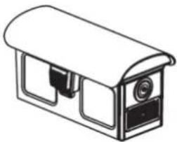 | battery x 4 pieces (the actual quantity is to the subject purchased kit) |
 | Charger + AC line x 1 | 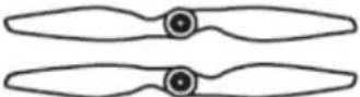 | wingtip propeller x 2 |
 | base station antenna nas x2roots |  | Feeder base x2 article |
 | station tray basex 1 |  | station tripod x1base |
 | charger station x1a | 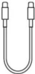 | TYPE C cable x1root |
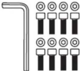 | repair tool set x1 sets |  | head x1a(head models to the actual suit purchase date) |
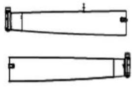 | wingx1 |  | documentx1parts(Dragon Fish,the base station, the ground station, the charger,battery fast guidelines disclaimer) |
 | tailx1 |  | Strap ground stationsx1a |
Recognize vehicle
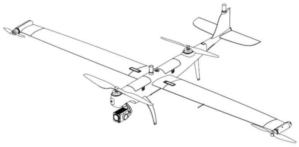
Dragon Fish DANGON FISH (hereinafter referred Dragon Fish) intelligent integrated channel excellence Flight control technology, gimbal technology, imaging technology, using a unique tilt-rotor design, quick release and efficient aerodynamic design of the whole machine, combines the dual advantages of multi-rotor take-off and landing flexibility and fixed-wing long endurance. It can realize one-key automatic take-off and landing, intelligent tracking, pointing flight, terrain following and fast mission flight functions. The protection level of the fuselage structure can reach IP43 during flight (refer to IEC60529 standard). The Dragon Fish takes up to 120 minutes to sail, the high-definition dual-frequency image transmission distance is as far as 30KM, the whole system is self-checked in 5 seconds, and it is quickly assembled in 3 minutes. The high-performance camera has a 240 times hybrid optical variable, a 2000-meter infrared detection capability, combined with Autel's advanced intelligent software and hardware technology, redefines productivity tools and empowers industry applications.
Dragon Fish can be adapted to dual-optical, triple-optical, multi-
spectral and third-party mounting, and supports PSDK to meet the needs of different customers. With Dragon Fish base station, high precision and accurate positioning can be achieved. Dragon Fish battery, IMU, barometer, compass, positioning system are all backed up, multiple redundancy, safe and reliable.

- RTK antenna
- Body paddle
- Smart battery
- Power button/indicator
- Wing lock
- Body motor
- PTZ camera
- Battery removal button
- Front foot stand
- Rear foot Frame
- Wing tip propeller blade
- Wing motor
-
Flat tail
-
Airspeed tube
- Tilting wing tip
- GPS
- Ultrasonic ranging
- Dust net
- PTZ installation interface
Understanding portable ground station
Dragon fish is equipped with a 9.7-inch TFT-LCD capacitive touch screen, which is sensitive to the touch, and has a 2048*1536 ultra-high-definition resolution. The highest brightness reaches 1000cd / m^2 , which is about twice that of ordinary mobile devices. The bright screen can still display images clearly under strong light. Built-in 128G memory is convenient for storing aerial footage in time. The portable ground station has undergone careful signal modulation and innovative antenna design, and the image transmission distance is up to 30 kilometers. The ground station has a battery life of up to 3 hours, which solves the problem of insufficient battery life using mobile devices to monitor.

- Antenna
- Mode switch indicator
- Gimbal pitch control wave wheel
- Manual/auto mode switch key
- Joystick
- Home button
-
Power status indicator
-
Flight status indicator
- Light sensor
10 Touch screen - Hook
- Microphone
- Photo/video button
- Zoom button
- PTZ horizontal control wave
- Tripod mounting interface
- Power button
- Charging interface
wheel19. USB interface - SD card slot
- SIM card slot
- HDMI interface
- Custom buttons
- Headphone jack
- Air outlet to
know the base station
Dragon Fish GNSS base station is a high-precision satellite signal receiver, support GPS, Beidou, Galileo and Glonass navigation System 11 channels [see specifications] satellite signal reception, at the same time built-in carefully adjusted data transmission system, convenient for users to use in different application environments. The Dragon Fish GNSS base station can be used as an RTK base station, which improves the positioning accuracy of aircraft equipped with Autel's intelligent RTK positioning system from meter to centimeter level, and provides strong anti-magnetic interference capability in high-voltage lines, metal buildings and other strong magnetic interference environments Ensure reliable operation flight. Dragon Fish GNSS base station can achieve more precise fixed-point flight.

- WiFi indicator
- Linking indicator
- RTK indicator
- Power indicator
- Charging port
- Linking button
- Power button
- Port cover
-
Antenna interface
-
Turntable mounting hole
use your Dragon Fish
1 Intelligent Flight Battery Charging

natural_image
Line drawing of an electrical outlet connected to a power strip and two charging units (no text or symbols)2 Ground Station Charging
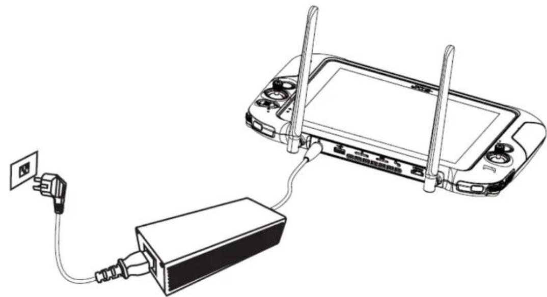
natural_image
Line drawing of a handheld device connected to a battery via cable, with no visible text or symbols3 Base Station Charging

natural_image
Line drawing of a power outlet connected to a device with cable (no text or symbols)Set up the base station
1 Unfold the tripod, install the base station tray, and lock the tray.

2 Install the base station body to the tray, and tighten the lock on the tray nut. Ensure that the base station is level and stable.

natural_image
Technical line drawing of a mechanical device with three legs and a digital display unit, showing a close-up of the component (no text or symbols)3 Install the antenna on the tripod, and connect the antenna feeder to the base station antenna port.

natural_image
Technical line drawing of a mechanical device with two vertical posts and three horizontal rods, showing no text or symbols.Assemble the aircraft
1 Install the left and right wings

natural_image
Line drawing of a drone with two zoomed-in insets showing internal components (no text or symbols)2 Install the tail
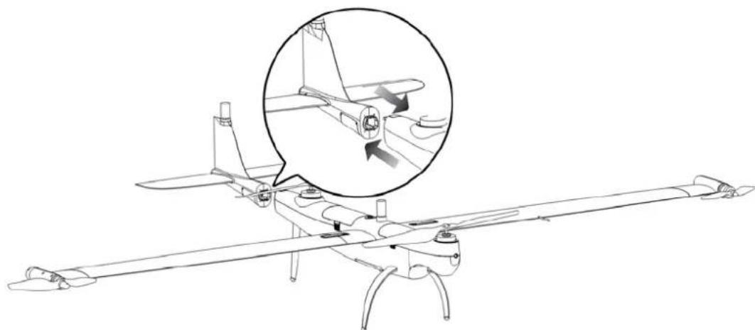
natural_image
Line drawing of a drone with an inset showing a mechanical component (no text or symbols present)3 Install the wingtip propeller
Before installing or removing the propeller, turn off the power switch of the aircraft (the picture shows the installation process of the marked propeller and the marked motor base)

natural_image
Diagram of a propeller with a rotating wheel and directional arrow (no text or symbols)①

natural_image
Diagram of a propeller with directional arrow indicating rotation (no text or symbols)②

natural_image
Line drawing of a propeller with four blades, no text or symbols present③
4 Install and mount
align and mount Rotate the lock ring to the locked position

turn on the power | Activate the aircraft
1 Turn on the power of the base station
Press and hold the power button for 1 second to turn on the base station

natural_image
Line drawing of a portable electric appliance with a button and indicator lights, no text or symbols present.2 Turn on the ground station power
Long press the power button for 3 seconds to turn on the ground station.

natural_image
Line drawing of a computer monitor with a hand inserting a power button to the left panel (no text or symbols present)3 power on the aircraft
long press the fuselage power button for 3 seconds to turn on the aircraft power

natural_image
Line drawing of a drone with an inset showing a cylindrical component and a downward arrow (no text or symbols)4 activate the aircraft to
open the Autel Voyager APP, click the activation button to activate the aircraft.
The flight
enters the Autel Voyager safe flight interface display. Before taking off, please place the aircraft on a flat ground with the tail facing you.
Manual take-off
① Switch the ground station gear to M position (manual mode is not recommended for non-professional aerial photographers)

② Aircraft system status check
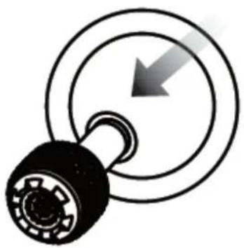
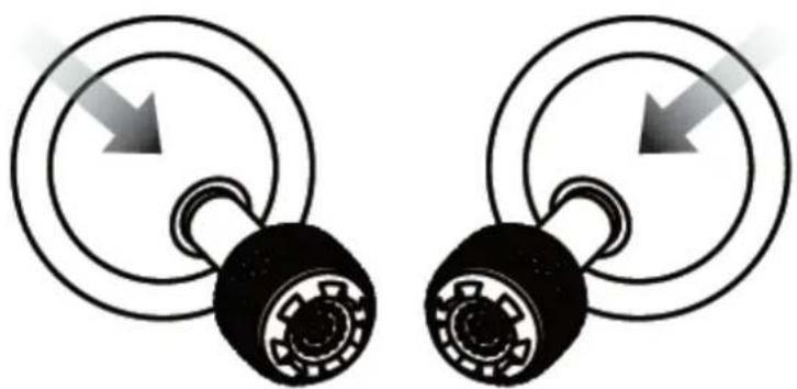
③ Simultaneously move the joystick in inner eight or outer eight ways and hold for 2 seconds to unlock the motor
natural_image
Pure mechanical component diagram without any text, numbers, or symbols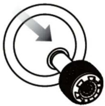
natural_image
Diagram of a pulley system with a downward arrow indicating rotational motion (no text or symbols)or
natural_image
Two identical mechanical pulley systems with circular heads and directional arrows indicating motion (no text or symbols)④ push up to the left Side stick (mode 2) The aircraft rises and

natural_image
Diagram of a mechanical lever with a circular base and central hub, showing upward motion (no text or symbols)automatically takes off
① Switch the ground station position to A position

② Click the Create mission button to plan the flight mission
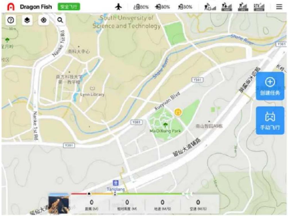
③ Aircraft system status check
④ In-flight flight interface display

| size 2.2*1.1*0.45 | |
| weight (Excluding battery ,gimbal) | 4.4kg |
| maximum load 1.5 kg | |
| maximum take-off weight 8.5 kg | |
| working frequency 900Mhz, 2.4 GHz | |
| transmit power (EIRP) 2.4 GHz | SRRC/CE/MIC/KCC: <20 dBm; FCC/NCC: <30 dBm 900MHz FCC: <30 dBm; Wi-Fi 2.4 GHz SRRC/CE/MIC/KCC: <20 dBm; FCC/NCC: <22 dBm 5.8 GHzSRRC/NCC/FCC: <22 dBmCE: <14 dBm |
| hover Accuracy (P-GPS) | Vertical:±0.1 m (when the visual positioning is working normally)±0.5 m (when the GPS is working normally)±0.1 m (when the RTK positioning is working normally)Horizontal:±0.3 m (when the visual positioning is working normally)± 1.5 m (when GPS is in normal operation)±0.1 m (when RTK positioning is in normal operation) When |
| RTK position accuracy is | at RTK FIX:1 cm + 1 ppm (horizontal)1.5 cm + 1 ppm (vertical) |
| Maximum rotation angular velocity | Pitch axis: 180° /syaw axis: 60°/s |
| Maximum pitch angle 20° | |
| Maximum roll angle 35° | |
| Maximum ascent speed | Vertical flight mode: 4 m/sFixed-wing flight mode: 5 m/s |
| Maximum descent speed (vertical) | Vertical flight mode: 3 m/sfixed-wing flight mode: 5 m/s, |
| maximum horizontal flight speed 30 m/s, | |
| maximum flight altitude 6000 m, | |
| maximum wind speed, | fixed-wing flight: 15 m/s (level 7 wind) during vertical take-off and landing: 12 m / s (stage 6 wind) |
| flight time maximum 120 min | |
| IP rating IP43 | |
| GNSS GPS + GLONASS + BeiDou + working temperature -20 °C to 50 °C | C |
9.7 inch strip Screen ground station
| operating frequency | 902-928 MHz; 2.4-2.4835 GHz |
| maximum signal effective distance (no interference, no obstruction) | NCC / FCC: 10 kmCE / MIC: 5 kmSRRC: 5 km |
| equivalent isotropic radiation power (EIRP) | 902-928 MHz≤30 dBm (FCC)2.4-2.483 5 GHz≤30 dBm (FCC); ≤20 dBm (CE); ≤20 dBm (SRRC) |
| Wi-Fi protocol | Wi-Fi Direct, Wi-Fi Display, 802.11a/g/n/acsupport 2 x 2 MIMO Wi -Fi |
| Wi-Fi operating frequency | 2.4- 2.4835 GHz; 5.725-5.850 GHz |
| Wi-Fi equivalent isotropic radiated power (EIRP) | 2.4-2.4835 GHz≤30 dBm (FCC); ≤20 dBm (CE);≤20 dBm (SRRC); ≤20 dBm (MIC);5.725-5.850 GHz≤30 dBm (FCC); ≤14 dBm (CE);≤26 dBm (SRRC); ≤20 dBm (MIC) |
| Battery | name: Lithium polymer battery capacity: 8200mAh voltage: 11.4 Vbattery type: Li-Po energy: 93 Whcharging time: 180 minutes |
| battery life about 3 hours | |
| storage space | ROM 256GB + expandable (via micro SD card) |
| video output interface | HDMI interface |
| USB-A interface supply voltage / current | 5V / 500m A |
| Working environment temperature | -20°C to 40°C |
| Storage environment temperature | -20°C to 60°C (within one month)-20°C to 45°C (within three months)-20°C to 30°C (within one year) |
| Charging Ambient temperature 0°C | to 45°C |
| Satellite positioning module GPS+GLONASS+Galileo three-mode | |
| size 319×233×74 mm (antenna folded) | 319×398×74 mm (antenna unfolded) |
| Weight 1987g |
Base station
| satellite receiving frequency point | simultaneous reception:GPS: L1, L2, L5BeiDou: B1, B2, B3GLONASS: F1, F2Galileo: E1, E5A, E5B |
| Positioning accuracy single point | level: 1.5 m (RMS)vertical: 3.0 m (RMS)RTKlevel: 1 cm+1 ppm (RMS)Vertical: 1.5 cm + 1 ppm (RMS)1 ppm: For every 1 km increase,the accuracy becomes 1 mm worse.For example, if the distance from the base station is 1 km, the accuracy is 1.1 cm. |
| Positioning update rate 1 Hz, 2 Hz, 5 Hz, 10 Hz and 20Hz | |
| cold start <40 s | |
| hot start <10 s | |
| recapture <1 s | |
| initialization reliability >99.9% | |
| differential data transmission format | RTCM 2.X/3.X |
| data Link | image transmission, Wi-Fi |
| operating frequency | 2.4000-2.4835 GHz; 902-928 MHz |
| equivalent isotropic radiated power (EIRP) | image transmission2.4 GHzSRRC/CE/MIC/KCC: <20 dBmFCC/NCC: <30 dBm900MHzFCC: <30 dBmWi-Fi22.4 GHzSRRC/CE/MIC/KCC: <20 dBm;FCC/NCC: <22 dBm5.8 GHzSRRC/NCC/FCC: <22 dBmCE: <14 dBm |
| communication from the base station and flight | device: 30km (FCC)remote ground station and the base station: 200m(no interference, no blocking; erection of the base station antenna tripod i.e.Height difference between the end of 2m, and in the ground station 10m,height from the ground earth station 1.2 m) |
| power consumption 7.5 W | |
| power supply 5 to 20V DC | |
| battery | type: lithium polymer battery capacity: 4950 mAhenergy: 57.1 WH |
| working time > 7.5 h | |
| size 193 mm×177 mm×73 mm | |
| (base station body + extension pole) weight | 1275g |
| Dustproof and waterproof IP65 | |
| working environment temperature | -20°C to 50°C |
FCC Statement
This equipment has been tested and found to comply with the limits for a Class B digital device, pursuant to Part 15 of the FCC Rules. These limits are designed to provide reasonable protection against harmful interference in a residential installation. This equipment generates uses and can radiate radio frequency energy and, if not installed and used in accordance with the instructions, may cause harmful interference to radio communications. However, there is no guarantee that interference will not occur in a particular installation. If this equipment does cause harmful interference to radio or television reception, which can be determined by turning the equipment off and on, the user is encouraged to try to correct the interference by one or more of the following measures:
-- Reorient or relocate the receiving antenna.
-- Increase the separation between the equipment and receiver.
-- Connect the equipment into an outlet on a circuit different from that to which the receiver is connected.
-- Consult the dealer or an experienced radio/TV technician for help.
§ 15.19 Labeling requirements.
This device complies with part 15 of the FCC Rules. Operation is subject to the following two conditions: (1) This device may not cause harmful interference, and (2) this device must accept any interference received, including interference that may cause undesired operation.
§ 15.21 Information to user.
Any Changes or modifications not expressly approved by the party responsible for compliance could void the user's authority to operate the equipment.
This device complies requirement of FCC part 15.407(c).
The antenna(s) used for this transmitter must be installed to provide a separation distance of at least 20 cm from all persons and must not be co-located or operating in conjunction with any other antenna or transmitter.
IC STATEMENT
This device complies with Industry Canada's licence-exempt RSSs. Operation is subject to the following two conditions:
(1) This device may not cause interference; and
(2) This device must accept any interference, including interference that may cause undesired operation of the device.
In order to avoid the possibility of exceeding the ISEDC radio frequency exposure limits, human proximity to the antenna shall not be less than 20cm (8 inches) during normal operation.
Note: The content is subject to update without notice. You can check the latest version on the official website of Autel Intelligent https://www.autelrobotics.cn/
AUTEL
ROBOTICS
©2020-2021 Autel Robotics Co., Ltd. All Rights Reserved
深圳市道通智能航空技术有限公司
www.auteldrones.com | www.autelrobotics.cn



- Dragon Fish Quick Guide
- Item List
- Recognize vehicle
- Understanding portable ground station
- know the base station
- use your Dragon Fish
- Set up the base station
- Assemble the aircraft
- Install the wingtip propeller
- Install and mount
- turn on the power | Activate the aircraft
- Turn on the ground station power
- power on the aircraft
- The flight
- Manual take-off
- automatically takes off
- FCC Statement
- § 15.19 Labeling requirements.
- § 15.21 Information to user.
- IC STATEMENT
- AUTEL
- ROBOTICS
Brand : Autel
Model : DragonFish
Category : Drone