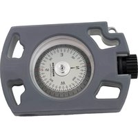
OmniSight - Inclinomètre BRUNTON - Free user manual and instructions
Find the device manual for free OmniSight BRUNTON in PDF.


| Product Type | Compact Monocular/Spotting Scope |
| Magnification | 8x or 10x |
| Objective Lens Diameter | 25 mm or 42 mm |
| Field of View | Approximately 120 m @ 1000 m |
| Optical Coating | Fully multi-coated |
| Prism System | Porro or Roof prism |
| Focus System | Center focus with diopter adjustment |
| Dimensions | Approx. 120 x 60 x 50 mm |
| Weight | Approx. 300 g |
| Power Source | None (manual optical device) |
| Main Functions | Long-distance observation, outdoor activity |
| Eye Relief | Moderate (suitable for eyeglass wearers) |
| Water Resistance | Waterproof and fogproof (nitrogen filled) |
| Body Material | Rubber armored magnesium alloy |
| Included Accessories | Carrying case, neck strap, lens cloth |
| Cleaning | Use lens brush and microfiber cloth |
| Safety | Do not look directly at the sun |
| Spare Parts & Repairability | Limited; contact Brunton for service |
| Warranty | Limited lifetime warranty |
Frequently Asked Questions - OmniSight BRUNTON
User questions about OmniSight BRUNTON
0 question about this device. Answer the ones you know or ask your own.
Ask a new question about this device
Download the instructions for your Inclinomètre in PDF format for free! Find your manual OmniSight - BRUNTON and take your electronic device back in hand. On this page are published all the documents necessary for the use of your device. OmniSight by BRUNTON.
USER MANUAL OmniSight BRUNTON
Thank you for purchasing your Brunton OmniSight compass. Incorporating more than 100 years of excellence in navigation instruments, this compass is built for demanding outdoor professionals who cannot cut corners on accuracy and precision. Please fully understand the use of this product before relying on it in the field.
OWNER'S PURCHASE RECORD
Model
Date of Purchase
Dealer Purchased From
WARRANTY
Please register your OmniSight by visiting www.brunton.com/ register. Brunton has taken every effort to ensure years of trouble-free use from your new product. This product is guaranteed to be free of defect in material and workmanship for 12 months according to local regulatory requirements. This product is not subject to guarantee from third-parties and is subject to change. Brunton will repair or replace with a new equivalent, without charge for parts or labor, per Brunton's discretion. Brunton cannot be held responsible for accidents, damages or injury occasioned by the use of this product. Warranty will be rendered invalid if product is damaged by tampering, negligence, or misuse.
To obtain service, please contact BRUNTON for a return authorization (RA) number. Please be prepared to provide contact name, address and phone number, and a description of the problem.
BRUNTON
7088 Winchester Cir. Boulder CO 80301
307.857.4700
info@bruntongroup.com
BRUNTON
SPECIFICATIONS
- Anodized aluminum housing with rubber bump cover and
leather case. - Aluminum card with 360 degree azimuth, reciprocal bearing, quadrants, and MILS
- 10x magnification adjustable lens.
- 1/2° accuracy
- Sapphire jewel with anti static dampening fluid.
OmniSight
User Manual
1OUR STORY
2 INSTRUCTIONS FOR USE
3 PLOTTING LOCATION
4 BALANCE | INCLINATION
5 DECLINATION
G SPECIFICATIONS
7 WARRANTY
INDESTRUCTABLE SINCE 1894
At Brunton, we come to work with a clear vision: remove any obstacles that stand between our customers and their passion to stay outdoors. It's been this way since 1894, when D.W. Brunton created the now legendary Pocket Transit a compact, precision compass that continues to give outdoorsman the confidence to push beyond the beaten path. Today, this spirit of indestructible innovation lives in the form of professional-grade solutions as tough and diverse as the rugged Rocky Mountains that we've called our laboratory for over 125 years. Our goal is to build products as tough as the people who get to use them and to allow these users to push themselves and our products to extend their adventure.

BALANCE | INCLINATION
Earth's vertical magnetic field has a tendency to incline compasses and therefore instruments are balanced against the magnetic inclination for the location of use. This allows the card to rest horizontally and move without hindrance. Since the balance is made in production, the location of use should correspond to the particular balance of that OmniSight model. Designations for equatorial zones are -ME and for Southern zones are -MS. Northerly zones have no designation in the part number.
DECLINATION
OmniSight compasses are adjusted at the factory to magnetic north with 1/2° precision. Geographic North differs from magnetic North based upon your location on the globe. Bearing obtained with the compass should be corrected with the local declination or variance.
INSTRUCTIONS FOR USE
View through the optical lens and aim at your target object or direction of travel. With both eyes open, the hairline can be seen to 'stand up' from the compass housing making it easy to accurately read the correct bearing toward the object due to optical illusion. (see figure 1). You can focus the lens on your desired scale by turning the eyepiece. Choose between different scales based on the labels in figure 1.
Bearings can also be taken using the OmniSight as an auxiliary compass, but greater accuracy is always achieved when using the optical sighting system. Simply level the compass in position to view the dial from above and read the bearing at the lubber line.
FIGURE 1

CAUTION
Some users who suffer from an eye condition called heterophoria (misalignment of the eye axis) may get incorrect bearing when reading the compass with both eyes. This can be checked as follows: take a bearing to an object with both eyes open. Then close the eye not sighting through the compass. If the bearing does not shift or change dramatically, there is no heterophoria and bearings can be taken with both eyes open.
PLOTTING LOCATION
Aim at two fixed landmarks that likewise are distinguishable on a map/chart for example the lighthouse at direction 20° and landmark at 330° (as pictured in figure 2). Then draw straight lines along the reverse bearings of 20° and 330° ( 200° and 150° ) from the lighthouse and the landmark on the chart. The intersection point of these lines indicates your location. Your distance from above mentioned fixed points can be determined either from measuring on the chart or with trigonometric calculations.
FIGURE 2


Brand : BRUNTON
Model : OmniSight
Category : Inclinomètre