
Moto Pilot Ver.3.2 - Gps BLAUPUNKT - Free user manual and instructions
Find the device manual for free Moto Pilot Ver.3.2 BLAUPUNKT in PDF.


| Product Type | GPS Navigation Device for Motorcycles |
| Brand | Blaupunkt |
| Model | Moto Pilot Ver.3.2 |
| Display Size | 4.3 inches (diagonal) |
| Display Resolution | 480 x 272 pixels |
| Dimensions (W x H x D) | 130 x 80 x 25 mm |
| Weight | 200 g |
| Power Source | Built-in rechargeable lithium-ion battery, 12V vehicle adapter |
| Battery Life | Up to 4 hours of continuous use |
| GPS Chipset | High-sensitivity GPS receiver |
| Maps | Preloaded maps of Europe, lifetime map updates |
| Navigation Features | Turn-by-turn voice guidance, lane assist, speed limit alerts |
| Connectivity | USB 2.0 for data transfer and charging, Bluetooth (optional) |
| Storage | 4 GB internal memory, microSD card slot (up to 32 GB) |
| Water Resistance | IPX7 (waterproof up to 1 meter for 30 minutes) |
| Operating Temperature | -10°C to 60°C |
| Mounting | Motorcycle handlebar mount included |
| Languages | Multilingual interface (English, French, German, Italian, Spanish, etc.) |
| Maintenance | Clean with a soft dry cloth; avoid abrasive cleaners |
| Safety Warnings | Do not use while driving; mount securely; avoid direct sunlight |
| Spare Parts Availability | Replacement mounts and chargers available from Blaupunkt |
| Repairability | Battery and screen replaceable by authorized service centers |
Frequently Asked Questions - Moto Pilot Ver.3.2 BLAUPUNKT
User questions about Moto Pilot Ver.3.2 BLAUPUNKT
0 question about this device. Answer the ones you know or ask your own.
Ask a new question about this device
Download the instructions for your Gps in PDF format for free! Find your manual Moto Pilot Ver.3.2 - BLAUPUNKT and take your electronic device back in hand. On this page are published all the documents necessary for the use of your device. Moto Pilot Ver.3.2 by BLAUPUNKT.
USER MANUAL Moto Pilot Ver.3.2 BLAUPUNKT
Thank you for buying the Blaupunkt navigation system.
Good choice. We wish you a lot of fun and congestion-free kilometres with your new Blaupunkt navigation system.
In the worst case we will help you.
For technical questions and / or problems, please contact us by phone at 0511 / 123 83 506 or via E-Mail to support@first-servicecenter.de
If you need additional accessories, e.g. a 220V power supply and / or a bag? Please order via our website www.blaupunkt.de
Manuals for other languages can be downloaded also on www.blaupunkt.de
Updates and additional maps, you can also order over our website www.blaupunkt.de
The use and operation of navigation systems
Attention! Don't operate with the device while driving. Even the smallest and shortest distractions from road traffic for you and other road users - even at slow speeds - have devastating consequences.
Type in the destination before starting your journey and start the navigation system before you start driving. If you have to change the route or the settings while driving, you should better stop for it.
Please attach the navigation system in the vehicle, that it not restricts the driver's visual field, or as little as possible. Turn the screen that you have a minimal glare (light from outside). The mount can be rotated and swiveled in any vehicle and provides an optimal position.
Please adjust the volume to a comfortable level you: loud enough to understand it with a normal radio volume and not too loud to get shocked on an advice.
After switch on the device it could take a few moments to find the required minimum number of navigation satellites. Depending on the environment, it may go faster or longer. Under the open sky, it is the fastest. In inner cities with relatively narrow streets and tall buildings, this process may take longer, because the view to the "the field of view up" is very narrow and that cause reflections of the satellite signals. In metallised windscreens it is possible that you need additional GPS antennas.
After you the address input and the start of the navigation you can start driving. The device will advice you imidiatly after it get a gps fix.
In tunnels, parking garages, homes, etc. The system does not working! Once you exit the tunnel or parking garage, the connection to the satellites will be built as quickly as possible.
The map data is up to date in time of production of your navigation system. Nevertheless, it may happen that you may have long-known streets, house numbers, roundabouts, etc. are not included. This is not a fault, but due to the fact that municipalities do not report all changes in street guides to manufacturers of digital data. They also drive along the road network itself to update the map data. Nevertheless, it can ever happen in priority order that such changes are only incorporated into the following versions.
Updates and Enhancements / Actual-Map / Map36 / u.a.
Your navigation system uses the latest software (Operating system, navigation software and maps), which was the newest in time of production of the device. To receive free updates and enhancements, please go to www.blaupunk.de Please go to "Service" an register (even for free updates, you must register!). After that you get always the latest (s) information, software, maps, etc. around your Blaupunkt navigation system.
Table of Contents
A Navigation Software User"s Guide ....4
1 Main Window....5
1.1 Speed....7
1.2 Zoom....8
1.3 Quick-Menu....9
1.3.1 Driving direction / 3D /2D North ....10
1.3.2 Volume 11
1.3.3 Route....12
1.3.4 Zoom....13
1.3.5 Pan....13
1.3.6 Day/Night 13
1.3.7 Block Ahead....14
1.3.8 Favorites....15
1.3.9 Destination 16
1.3.10 Position 16
1.4 While on Road....17
1.4.1 Arrow, Repeat last announcement....17
1.4.2 Street name....18
1.4.3 Driving information....19
1.4.4 Highway e.g. street signs....20
1.4.5 Lane information / Lane assistant....21
2 Enter destination 23
2.1 Address....25
2.2 Favorites ....32
2.3 Recent....34
2.4 Tour....35
2.4.1 New Tour....36
2.4.2 Load Tour / GPX tour....41
2.4.3 Edit Tour....42
2.4.4 Show Tour....42
2.5 Zip-Code 43
2.6 POI (Points of Interest)....45
2.7 Map 49
2.8 Coordinates....50
2.9 Route overview 51
3 Settings ....52
3.1 Map 53
3.1.1 Map 53
3.1.2 Autozoom....53
3.1.3 Crossway zoom....53
3.1.4 Day/Night 54
3.1.5 POI display....54
3.2 Routing....55
3.2.1 Route....55
3.2.2 Vehicle 56
3.2.3 Low emission zone....57
3.2.4 Highways....57
3.2.5 Toll roads 57
3.2.6 Ferries 57
3.3 Warnings....58
3.4 Quick-POI....60
3.5 Hardware....62
3.5.1 Brightness 62
3.5.2 Volume 62
3.5.3 Timezone 63
3.5.4 GPS....64
3.5.5 USB Mode....65
3.5.6 Calibration....65
3.6 General 66
3.7 Laguage / Text-To-Speech 67
3.1 Bluetooth....68
3.1.1 Pair....69
3.1.2 Search....70
3.1.3 Paired Device List....71
3.1.4 Settings 72
3.2 Configuration Wizard....72
B Urhebervermerk 73
A Navigation Software User's Guide
IMPORTANT: When employing a navigation system in a vehicle, i.e., this software and the accompanying hardware, it is your responsibility to set up, secure and use the system in a manner that does not restrict your vision in any way and will not lead to accidents, injuries or material damages. You, as the user of this product, are solely responsible for driving safely. Do not handle this product while driving—always park the car first.
1 Main Window
After first start you will see following phrase:

Please read this carefully. Then confirm with "OK" to enter to the navigation software.
The software starts directly with the map:

In the upper of the screen is current speed.

In the upper right corner there is the speed limit on your road.
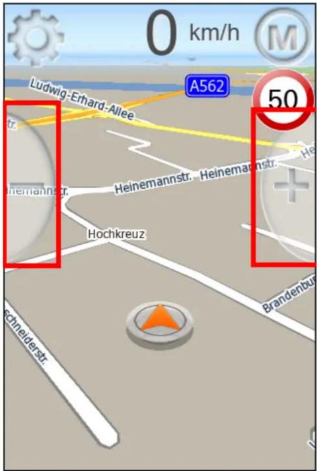
1.2 Zoom
The two zoom buttons in the middle of the map, you can zoom the map. This also works in the navigation. In 3D mode, the zoom out is limited at a certain zoom level.
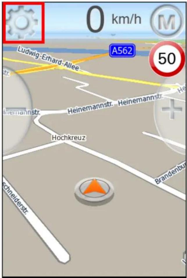
The Quick menu button is on the upper left side. With the Quick Menu gives you direct access to key functions and settings.
Depending on whether the navigation has been started or not, some features are not available.
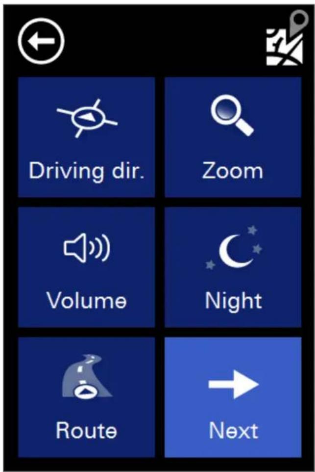
1.3.1 Driving direction / 3D /2D North
With this Button you can switch between 2D north ,2D in direction and 3D view on map.
1.3.2 Volume
With this button you can adjust the volume of announcements. Click on the loudspeakers on the navigation screen to mute / silent.

In Bottom right of the map an icon appears if the navigation is muted. Clicking on this icon activate the announcements again.
1.3.3 Route
This feature allows you to enter to the route overview. This button is only active in the navigation otherwise it is gray and not clickable.

Like in the destination view appears a vehicle icon on the left side of the map. A click on this button brings you back to the actual position and the navigation view.
1.3.4 Zoom
If this feature is enabled, you can drag a rectangle on the map, the map scale to temporarily change, for example for an increased oversight.

If you draw a box around the target form the upper left to the lower right (green), the map viewer zooms in the selected area. If you draw a box from the lower right to the upper left (red) the map viewer will zoom out.
1.3.5 Pan
Click the button with the four arrows to activate the scroll mode. You can now move the map with your finger.
1.3.6 Day/Night
With this function you can switch between the day and night view. Please also look at Geo-Daylight.
1.3.7 Block Ahead

The purpose of the Block KM function is to block the upcoming road section for a certain number of kilometers during active navigation. The navigation system will determine an alternative route bypassing the blocked section.
This function is useful for circumventing traffic jams or blocked roads.
When you have blocked a road, a button "Reset" appears in the Options Menu. Use this button to free the blocked road.
1.3.8 Favorites
With the favorites you can directly navigate to the selected favorite. After selecting the favorite the navigation will start immediately from the actual position.

You can open this dialog also with the star on the below.
1.3.9 Destination
This feature allows you to enter to the destination view. This button is only active in the navigation otherwise it is gray and not clickable.

In the destination view appears a vehicle icon on the right side of the map. A click on this button brings you back to the actual position and the navigation view.
1.3.10 Position
Clicking this button saves the current GPS position to your favorites. This allows you to approach the current position later or save it for further use if needed.
For each the stored position, date and time are stored and displayed so that you can possibly differentiate multiple saved records.
1.4 While on Road
1.4.1 Arrow, Repeat last announcement
While navigation you get the upcoming maneuver and distance on the lower left side.

The next street name and maneuver is displayed in the upper middle.

On the navigation bar, you can find the driving information.

By clicking one of the driving information you can change your actual tour.
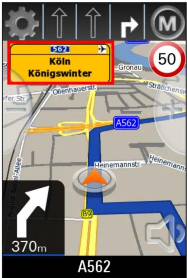
1.4.4 Highway e.g. street signs
If you get onto a freeway or highway the road signs are displayed in the upper middle, with the direction in which you have to drive.
1.4.5 Lane information / Lane assistant
If there are lane information in the map data and your device supports this feature, you can see the lane information at the bottom in the middle. The tracks, which you can use are color coded.

On highways you can see the reality views.

With de Address Button you get to the address destination input window.
Enter the city name with the screen keyboard. Possible matches are presented to you on the list. If the searched city is displayed in list you can click directly on the list to select your city. You can open the whole list by clicking on the list icon to the right.
Depending on the version of your software and depending on the map material you may see the pre-select for the country at the left above. The last settings will be saved. If you select "All Countries", you can enter places without knowing the country. This is helpful in border areas sometimes.

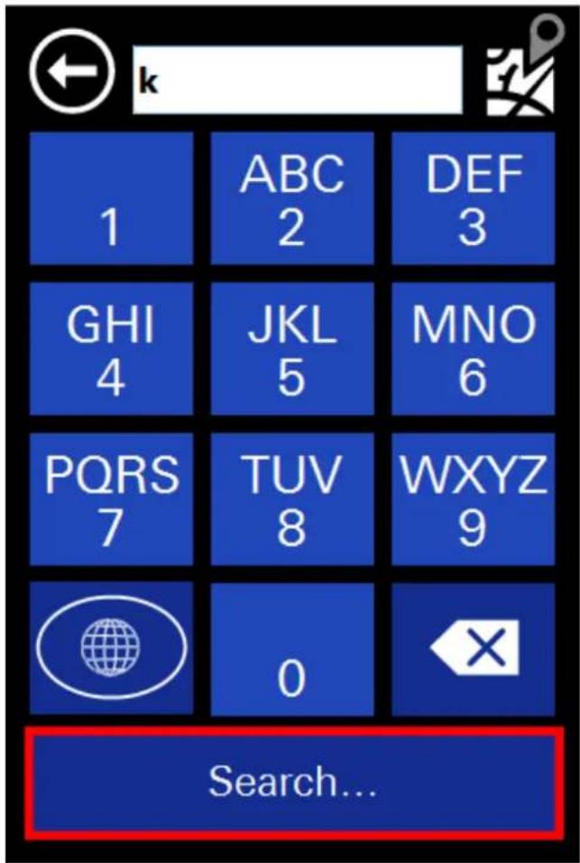
To open the list of possible cities, streets or house numbers, please click on the Search Button.

bar
Select city: | City | Value | | :--- | :--- | | Kölbingen (D-56459) | 100 | | Kölleda (D-99625) | 100 | | Kölln-Reisiek (D-25337) | 100 | | Köln (D-50259-51467) | 100 | | Kölzin (D-17506) | 100 |The previously entered letters are displayed in the top row of the screen. While you tap some letters may hidden on the keyboard.
You do not need to enter „umlauts☐. In place of an „Ä | simply enter „A☐, instead of „Ö☐ enter „O☐, instead of „Ü☐ enter „U☐. For example, if your destination is located in „Köln, | Germany, just enter „K O L N☐.
You do not need to enter spaces and hyphens. Instead, simply click the empty field to the left of the white triangle (at the bottom, third button from the right).
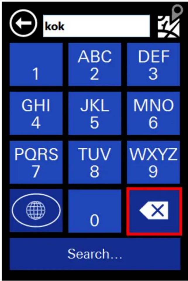
If you make a mistake, click the backspace key to delete the wrong entry.
After selection of the cities you will see the road selection.
The street name will entered as in the city input window.
Alternatively you can also choose "Center" if you want to drive into the center of the city.
In large cities it is possible that streets with the same name exist in different districts.
In this case, choose the desired destination based on the zip code or the district indicated in the list.

bar
Select street: | Street | Value | | :--- | :--- | | Godorfer Hauptstr. | 50997 | | Hauptstr. | 50996 | | Hauptstr. | 50859 | | Hauptstr. | 51143 | | Immendorfer Hauptstr. | 50997 |Now you can enter the house number. If the house number in the database should not be present, your navigation software suggests an alternative in the vicinity. If you do not know the house number, you can right click on "Center" Your navigation system will then guide you to the center of the chosen road. Use "back" at the upper left to return back to street search.

2.2 Favorites
Favorites are frequently used addresses you can store in a list. This facilitates quick access to these destinations.
When you start up the system for the first time, the favorites list is empty.
You can add addresses, pois and coordinates.

By clicking on one of the arrows on the right you get the details of it:

You have the following options:
- Click on the name to start a route to the destination you chose
- Use the "Map" button to display the destination on the map
- Use the stylus to edit the name
- Use the trash to delete the favorite
Use "Add new favorite" to create new favorite.
2.3 Recent
Under "Recent" you can find the latest targets approached.
This can be addresses, pois and coordinates.
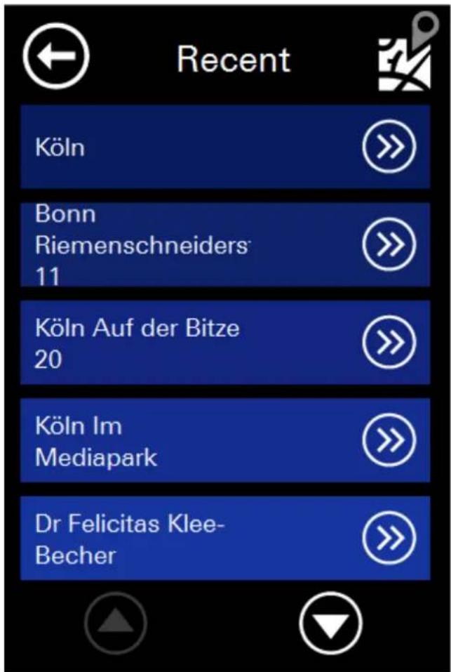
You have the following options:
- Click on the name to start a route to the destination you chose
- Use the "Map" button to display the destination on the map
- Press the save icon to save the recent destination under favorites
- Use the trash to delete the recent destination
2.4 Tour
With the tour function you can define Itineraries and save them.
Depending on whether the navigation is active or not, some buttons are gray and not clickable.
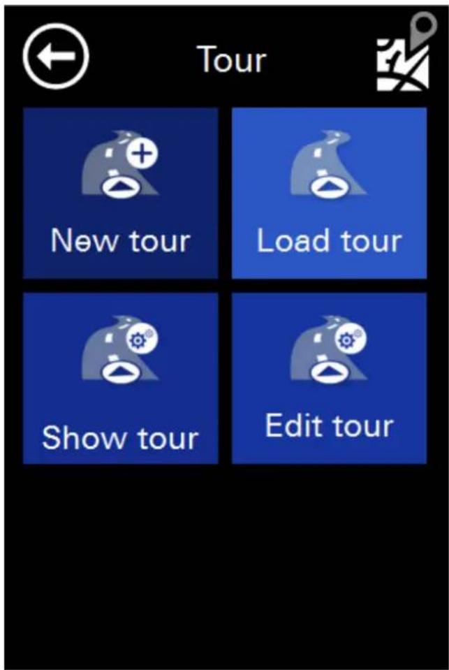
2.4.1 New Tour
With this function you can create a new tour.
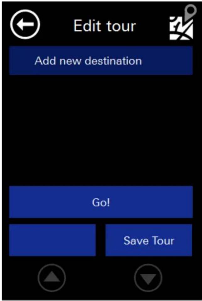
With the button „new destination“ you kann successively add different addresses, POIs or coordinates.
After entering some destinations, for example, the list looks like this:

Each destinations can be marked as an intermediate destination or as a via point. To do this, click on the flag in front of it.
Here the "Mediapark" is marked as a via point.

Via-points are destinations on which the route leads along, without informing the user about it. This is for example useful if you want to go from "location A" over "location B" to "location C" because it's a scenic route, but "location B" is not a particular destination.
When you select a location you can switch the order or delete it.

Click "GO" to start the route guidance to the first destination or via point. When you reach an intermediate destination, please confirming the route guidance to the next station. When you reach a via point, no message is issued.
Attention! If you click directly on "GO", the route will not be saved. Please make use of the "Save Tour" and enter a name for this tour.

With the „Simulation“ button you can simulate the Route in da Demo.

In this case, you need to define a start point to start the simulation.
2.4.2 Load Tour / GPX tour
If you saved a tour before, you can use "Load Tour" to call and use it again.
You can also load GPX routes on your device. You can download GPX routes from different websites or build a GPX tour with a special program by yourself. After that copy the GPS file to maptrip/routes on the device or in the root folder on your SD Card.
The GPX tour will be shown on load tour to use it.
You can also generate your own GPS Logs as GPX. After that you can load them as a Tour to use it in the navigation.
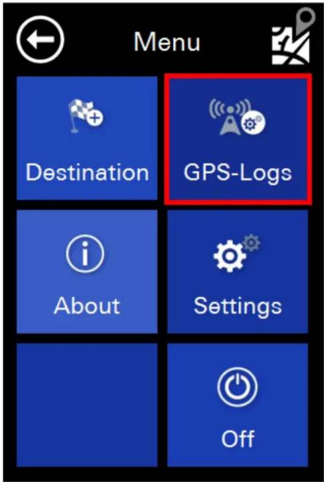
2.4.3 Edit Tour
During navigation, you can edit and change the current tour.
2.4.4 Show Tour
During Navigation the current tour can be shown.
2.5 Zip-Code
With this function you can enter zip codes for finding your destination.

The input is nearly the same like in the address input. By clicking on the search button on the upper right side, you will get the whole list too.

After choosing a zip code you will see the street and house number input dialog like in the address input.
2.6 POI (Points of Interest)
POIs are special destinations like restaurants, gas stations, railway stations and so on.
You can input them on different ways. If no navigation is started, the buttons "POI near route" and "POI near destination" are hidden and not clickable.

Please select a search method. After that, you can choose a category form the list. Please select a one of it.

Here you can see the category restaurants for example:

The POIs are sorted by distance (direct distance). When you click on an arrow behind a POI, you get the detail information:

You have the following options:
- Click on the name to start a route to the POI you chose
- Use the "Map" button to display the POI on the map
- Press the save icon to save the POI under favorites
2.7 Map
With the map function you can choose a destination via map:

Like in the main window you have three several ways for choosing a destination:
- Take position directly
- Nearest Address Search
- POI take on the marked position
2.8 Coordinates
On the coordinate input, you can enter exact WGS 84 coordinates. These consist of W / O or N / S as well as a decimal number with 1-2 and 0-7 digits before the decimal point.

2.9 Route overview
After destination input you will see an overview over the route Pleas commit the route on the Button in the below.

If you want you can calculate an alternative route. Just click on the alternative button on the below.
If no alternative was calculated the navigation starts automatically if you start driving.
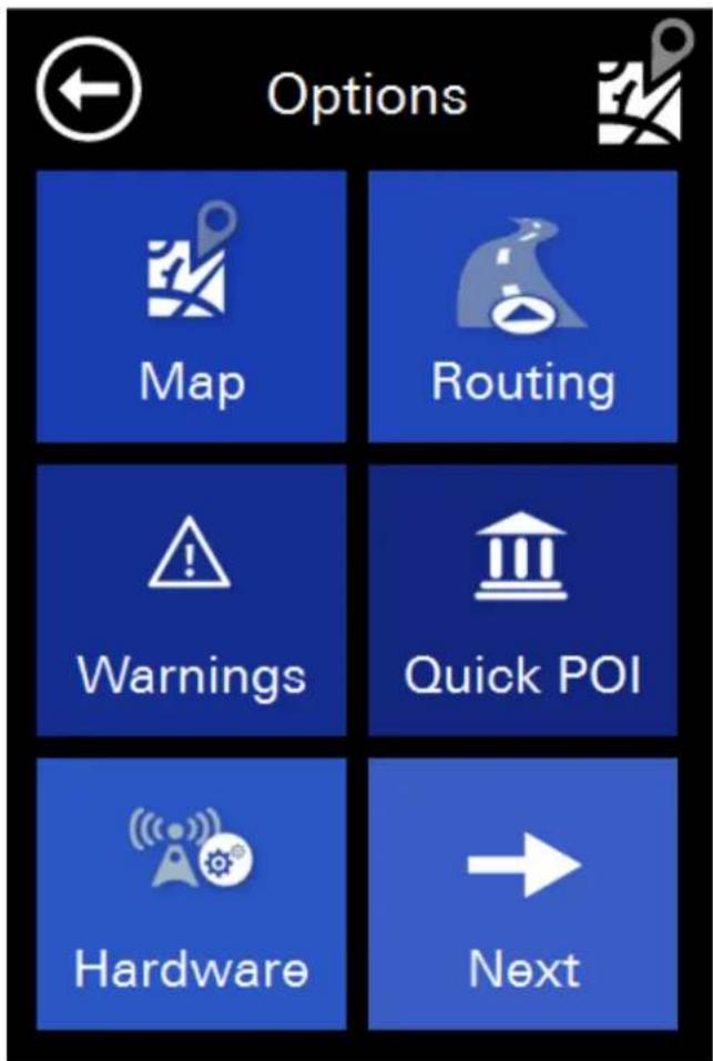
3 Settings
In the settings you have all necessary menus for the navigation.
#
3.1 Map
In this menu you find all settings regarding the map.

3.1.1 Map
The map can be used in 3 different views:
- 3D direction (The camera angle behind the vehicle position icon and the map is turned in the direction of the vehicle icon)
- 2D Northwards (map will remain pointing North)
- In the direction of 2D (map rotates in driving direction))
3.1.2 Autozoom
With this panel you can turn off the automatic zoom into the ma. When it is on, the map is automatically reduced at higher velocities, so the driver has a better view. As soon as the vehicle slows down again, the mapview is also increasing again.
3.1.3 Crossway zoom
With this panel you can switch the crossway zoom on and off. If it's switched on, the map zooms into the crossways where maneuver are included.
3.1.4 Day/Night
The day/night view can be changed in addition to the quick menu here:
There is a day view, a night view which is not blinding so much at night and there is the function Geo-Daylight. In this day and the night view automatically switches to the actual sun setting and rising. For this function the date, time and the GPS position will be considered correct. This function is much more accurate than for example a fixed switching at certain times.
3.1.5 POI display
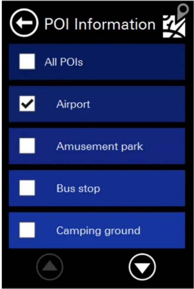
In the POI (Point of interest) display settings menu you can choose the pois with are displayed in map.
It is not recommended to display all POIs, because in metropolitan areas the mapviewer will show too much to get a good overview.
3.2 Routing
In this setting menu, all settings are made concerning the route:

3.2.1 Route
This setting determines by witch criteria the route will be calculated.
The fastest route is mostly on the existing highways and is the default. The shortest route is the shortest route from the path.
The economic route is the route with the lowest expected fuel economy.
3.2.2 Vehicle
Here you can select a vehicle profile. This has an impact on the routes and the calculated travel and arrival times. Depending on model and equipment you will find different options.

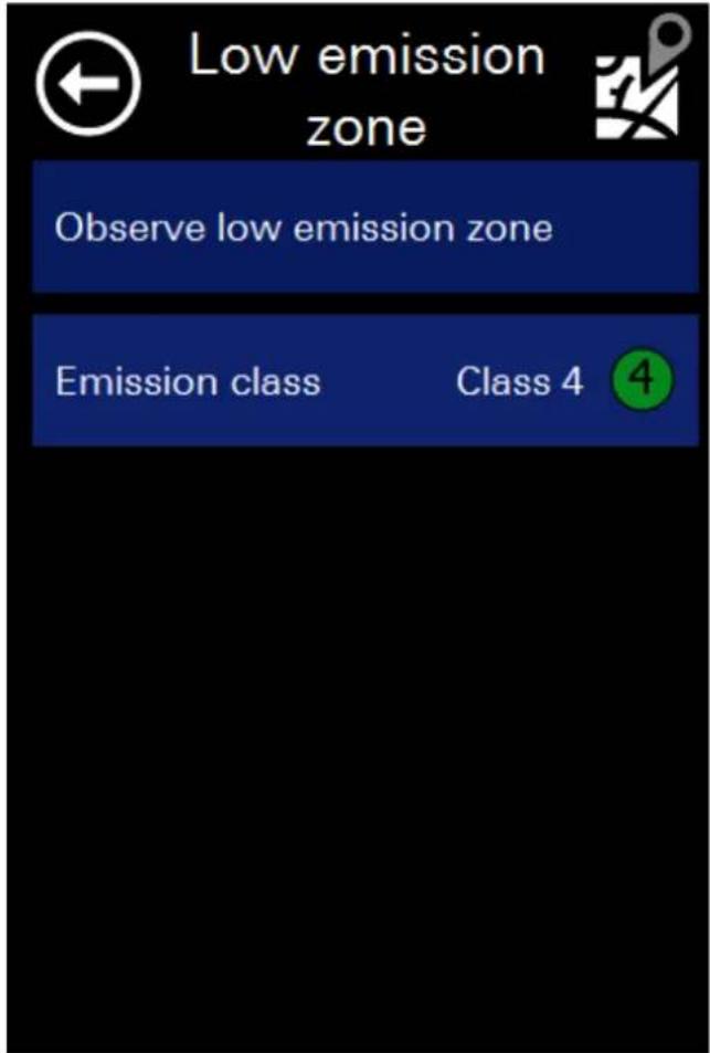
3.2.3 Low emission zone
You can also select your Emission class. This may have an effect on the route calculation.
3.2.4 Highways
You can avoid highways, if you wish.
3.2.5 Toll roads
You can avoid toll roads, if you wish.
3.2.6 Ferries
Also ferries can be avoided, if you wish.
Attention: All these settings have an affect on the routes (roads into consideration) and the calculated travel and arrival times.
3.3 Warnings
In the warning settings you can set the settings for he speed and speed cam warnings.
Attention!
The camera database is installed and enabled only for those countries in which these warnings are allowed by law! Cameras for other countries (eg Germany, Austria, Switzerland, etc.) If required you can conveniently and easily downloaded from the Blaupunkt website and install.

The option „display maximum allowed speed“ switch on the speed signs in navigation.
ATTENTION: Please note that not in all countries speed restrictions are covered and that there is no guarantee of a complete or error-free recording of all road classes. The signs on the road always take precedence over the details of your navigation system.
The "faster then" function is the allowed rate of over the allowed speed till it warns.
The alerts can be switched on or off as follows:
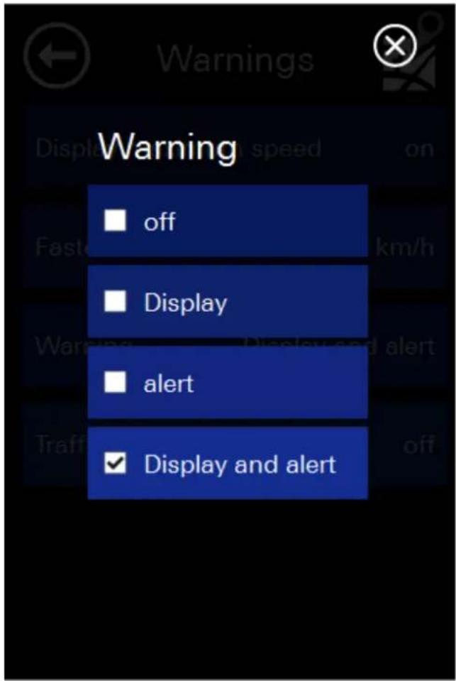
The speed camera detector can be independently turned on and off. His warnings are issued by a different tone and a display screen.
Warnings for speed, red light speed cameras etc. issued.
ATTENTION: Please note that not in all countries speed restrictions are covered and that there is no guarantee of a complete or error-free recording of all road classes. The signs on the road and the law always take precedence over the details of your navigation system.
3.4 Quick-POI
In the Quick POI menu, the selected POIs which can later be selected in the Quick Menu.
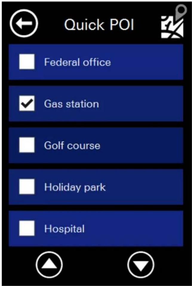
The two selected POI from the POI Quick Setup menu are displayed in the Quick Menu.
You can select a maximum of 2 Quick-POI categories. In the following example, only 2 categories (Gas station and Parking Garage) are selected.

3.5 Hardware
In the Hardware settings menu you can configure all hardware settings:

3.5.1 Brightness
Here you can select the brightness of the display.
3.5.2 Volume
Here you can change the volume.
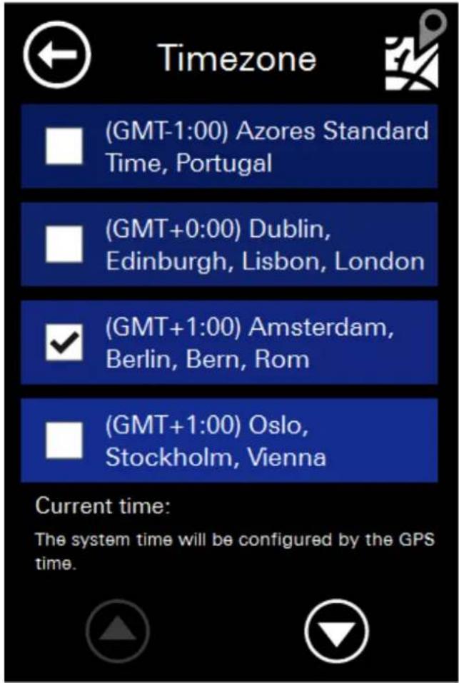
3.5.3 Timezone
Here you can select your specific timezone:
3.5.4 GPS
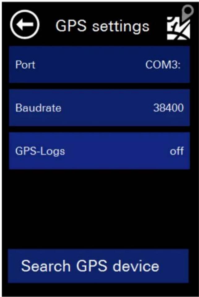
Please note: The values for GPS are already set correctly for your system and should not be changed! Other settings may cause malfunction or failure of the system or parts of it!
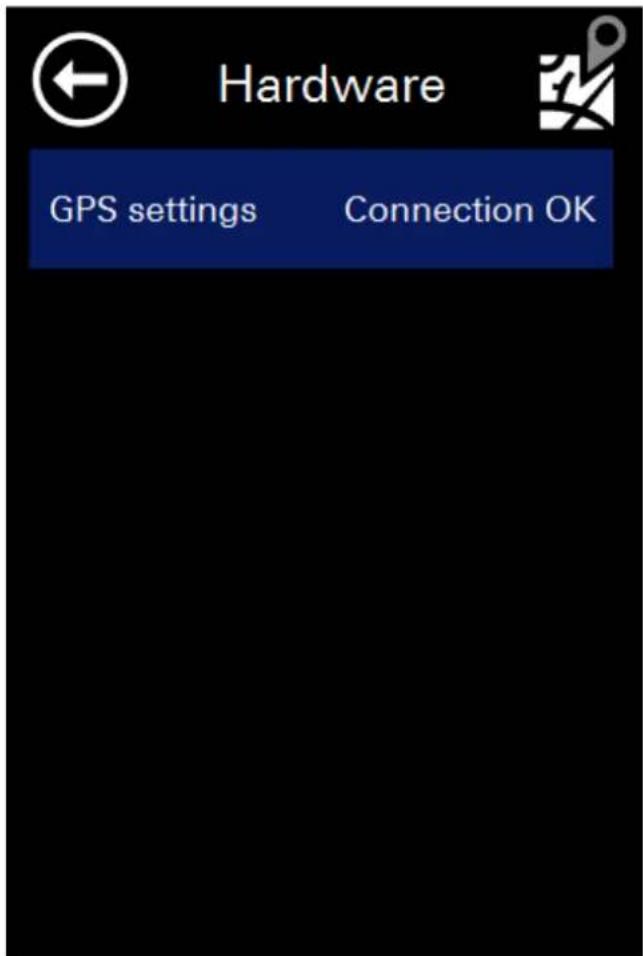
The GPS can be set either manually by clicking on the Com port and baud rate, or simply search by clicking on the Button in the bottom right.
3.5.5 USB Mode
In this setting you can set the device in Active Sync or Mass Storage Mode.
This will be necessary if you want to update your device.
3.5.6 Calibration
In this setting you can calibrate the display. This may be necessary if the panel doesn't react normally on clicks.
3.6 General
In this dialogue you can find the general settings:
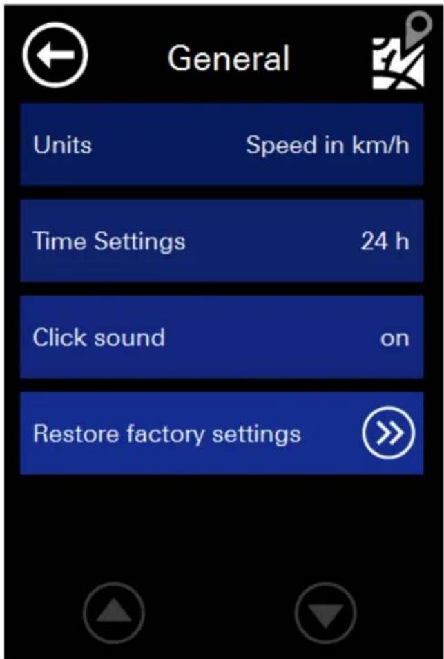
The units setting is for setting the speed from km / h to mph.
The time setting is used to switch from 12 - (AM / PM) on the 24-hour format.
You can also switch the click sounds on and off.
Use the "Restore Factory Settings" to reset all settings. This can be helpful if the navigation system was used by another user or you have forgotten witch settings were changed.
3.7 Laguage / Text-To-Speech
In the language dialogue you can choose between different languages. The voice and the language changed will be changed. The languages in the system menu of the hardware (see Hardware Manual) is not affected.
The software must be restarted after this adjustment to take effect.
Languages with the addition of "TTS" or "with street announcements" contain text-to-speech data. With these data, for example street names are not only displayed but also read out. This makes navigation easier, because you can look at the left turn maneuver on the roadway.

3.1 Bluetooth
In this dialog you can find all necessary functions to connect your device with other Bluetooth devices.

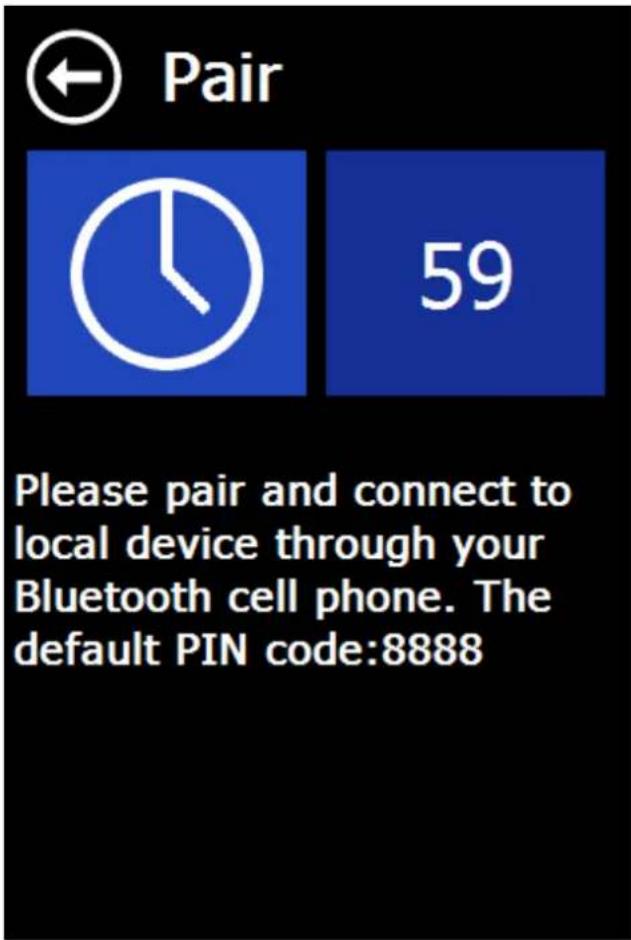
3.1.1 Pair
This function will make your device visible of other devices.
Other devices can see and connect to MotoPilot.
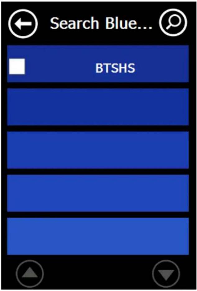
3.1.2 Search
With this function you can see other Bluetooth devices to connect with them.
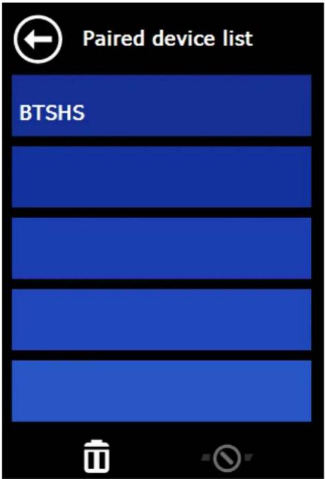
3.1.3 Paired Device List
Here you can see devices with was connected before to connect faster.
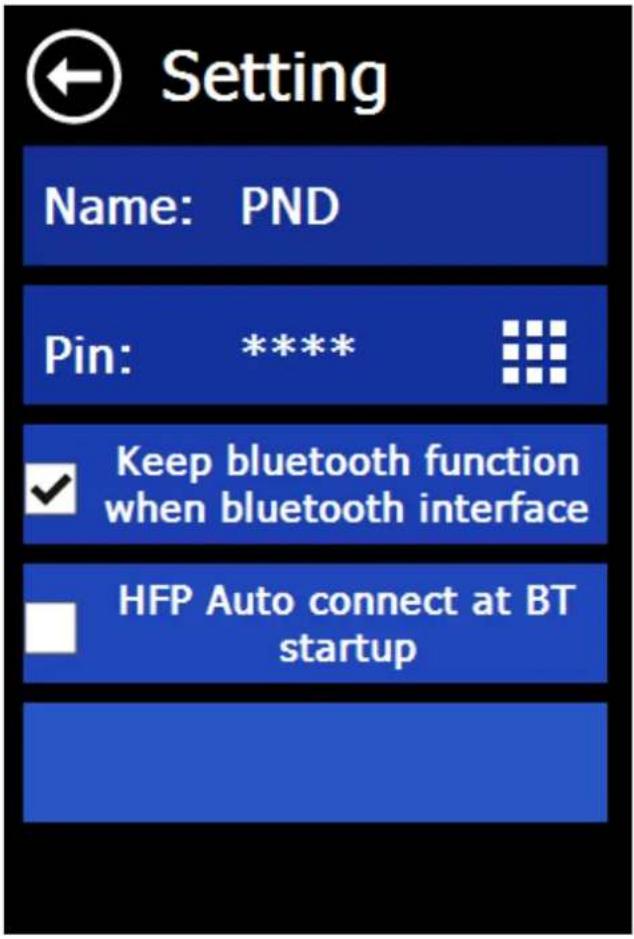
3.1.4 Settings
In the settings you can set your device name, password and set the auto connect mode.
3.2 Configuration Wizard
Here you can run the configuration wizard, which appears when you first start the navigation software again if necessary.
He will guide you through the language, the general settings, routing settings, and help you to create a home address.
B Copyright Notice
The product and the information contained in this document are subject to change without prior notification.
This manual or any parts thereof may not be modified or duplicated without the express written permission of infoware GmbH.
| Data Source | © <2012> Tele Atlas |
| Austria | © BEV, GZ 1368/2011. |
Denmark © DAV
France © IGN France Michelin data © Michelin 2012
Great Britain This product includes mapping data licensed from Ordnance Survey with the permission of the Controller of Her Majesty's Stationery Office. © Crown copyright and/or database right 2012. All rights reserved. Licence number 100026920 GREAT BRITAIN TMC codes The RDS-TMC traffic information with TMC location table version number (6G) 3.4, 4.5 and 4.6 from Trafficmaster contained in this product is derived of the Trafficmaster TMC location table and is subject to the terms of limitation or exclusion of liability of the license agreement between Tele Atlas and Trafficmaster. © Trafficmaster. All Rights Reserved".
Northern Ireland © Ordnance Survey of Northern Ireland
Norway © Norwegian Mapping Authority, Public Roads Administration / © Mapsolutions.
Switzerland © Swisstopo
Turkey This data has been approved by Turkish Military Forces by the given authority from Councils of Ministers of Turkey.
All rights reserved.
D End-User License Agreement („EULA“)
This End-User License Agreement ("EULA") is a legal agreement between you (either an individual natural person or a single legal entity) the "End User", and infoware Gesellschaft für Informationstechnik mbH, Riemenschneiderstrasse 11, 53175 Bonn, Germany) ("infoware"). This EULA applies to software, pre-installed software on any hardware devices as well as cd-rom, floppy disk, memory card, download package or any other data carriers and all contents and contents programs ("Software"). The use of our Software is subject to this EULA including the Limited Warranty terms as set forth below.
BY BREAKING THE SEAL OF THE CD-ROM/FLOPPY DISK/MEMORY CARD, PRESSING THE "I AGREE" BUTTON FOR A DOWNLOAD, OR BY USING THE SOFTWARE YOU ARE AGREEING TO BE BOUND BY THE TERMS OF THIS EULA AS WELL AS THE APPLICABLE GENERAL SALE TERMS AND CONDITIONS.
YOU REPRESENT AND WARRANTY THAT YOU HAVE THE RIGHT AND THE AUTHORITY TO ENTER INTO THIS EULA AND THAT YOU HAVE REACHED THE AGE OF MAJORITY. IF NOT, YOU MAY NOT USE THE SOFTWARE.
The EULA is subject to Laws of Germany and the Court of Bonn is the only competent court for disputes related to this EULA or the use of the Software or otherwise. The United Nations Convention on Contracts for the International Sales of Goods is hereby excluded from application to this EULA.
1) GRANT OF LICENSE: This EULA grants a license ("License") that permits you to use the infoware Software if and as rightfully obtained (including the digital (map) data, either downloaded, or included in the accompanying package acquired with this EULA) on any single computer or (Hardware) device, provided the Software is installed and/or the Service is used on only one computer or (Hardware) device at any time and provided the Software is combined only with one (1) navigation system. This License is non-exclusive and non-transferable. This License does not imply any rights to future upgrades or updates of the Software. The use of any upgrades or updates of the Software is governed by this EULA and its amendments and may be subject to additional payments and conditions. This License does not imply any rights to future delivery of free or paid Service or any other services.
2) COPYRIGHT: The copyrights and other intellectual, industrial and/or proprietary rights to the Software are owned by infoware or its suppliers. You may either (a) make one copy of the Software solely for backup or archival purposes, or (b) transfer the Software to a single medium provided you keep the original solely for backup or archival purposes. You may not copy the product manual(s) or written materials accompanying the Software, except for own use. You only become the owner of the material data carrier and you do not acquire the ownership of the Software.
3) OTHER RESTRICTIONS: The hiring, lending, public presentation, performance or broadcasting of the Software is prohibited. You, - or anyone else, whether or not in your assignment -, are not permitted to fully or partly modify the Software, to analyze it by means of reverse-engineering, to decompile or disassemble the Software, or to make products derived from it. You are explicitly prohibited from downloading the digital maps and programs contained in the Software or from transferring these to any other software and/or hardware, including another data carrier, computer or (hardware) device.
4) CONFIDENTIALITY: You acknowledge and agree that the Software were developed at considerable time and expense by infoware and are confidential to and a trade secret of infoware and/or third parties. You agree to maintain the Software in strict confidence and not to disclose or provide access thereto to any person. If you would nevertheless grant another person (unauthorized) access to the Software, you guarantee that such person accepts the terms and conditions of this EULA and you will indemnify infoware and its authorized distributors against any claim of such person.
5) LIMITED WARRANTY AND LIMITATION OF LIABILITY: a) You may only use the Software after having read the instructions supplied with it before you use it. If you have any difficulty using the Software, consult the instructions to check you are using it correctly. b) The use of the Software in a navigation system means that calculation errors can occur, for instance caused by local environmental conditions and/or incomplete data. infoware cannot warrant that the infoware Software operates error-free.
c) Some countries may not allow the exclusion or limitation of damages. If this Limited Warranty is held to be invalid or unenforceable, such invalidity or unenforceability shall not invalidate or render unenforceable the entire Limited Warranty, but rather the Limited Warranty shall be construed as if not containing the particular invalid or unenforceable provision or provisions, and the rights and obligations of each party shall be construed and enforced accordingly.
d) Notwithstanding any damages that you might incur for any reason whatsoever (including, without limitation, all damages referenced herein and all direct or general damages in contract or anything else), the entire liability of infoware and any of its suppliers under any provision of this EULA and your exclusive remedy hereunder (except for any remedy of repair or replacement elected by infoware with respect to any breach of the Limited Warranty) shall be limited to the amount actually paid by you for the Software.
e) Although suppliers of software or other data (“Suppliers”) are not a party to this EULA and shall have no obligations hereunder, any such supplier is a third party beneficiary of the End User's rights under this EULA. Suppliers shall not, to the extent permitted by applicable law, in any way be liable for any damages, or loss of any kind, whether special, direct, indirect, incidental, or consequential, arising from the use of the Software. Suppliers do not warrant, whether express or implied, including but not limited to, the implied warranties of non-infringement, merchantability, completeness, accuracy, and fitness for a particular purpose of Supplier's data used in the Software.
6) TERMINATION: Without prejudice to any other rights, infoware may terminate this EULA if you fail to comply with the terms and conditions of this EULA. In such event, you must destroy all copies of the Software and all of its component parts.
7) ADDITIONAL SOFTWARE/SERVICES: this EULA applies to updates, supplements, add-on components, or Internet-based services components, of the Software that infoware may provide to you or make available to you after the date you obtain your initial copy of the Software, unless they are accompanied by separate terms. infoware reserves the right to discontinue Internet-based services provided to you or made available to you through the use of the Software.
8) LINKS TO THIRD PARTY SITES: infoware is not responsible for the contents of any third-party sites or services, any links contained in third-party sites or services, or any changes or updates to third-party sites or services. infoware is providing these links and access to third-party sites and services to you only as a convenience, and the inclusion of any link or access does not imply an endorsement by infoware of the third-party site or service.
9) DISCLAIMER OF WARRANTIES: The Limited Warranty that appears above is the only express warranty made to you and is provided in lieu of any other express warranties or similar obligations (if any) created by any advertising, documentation, packaging, or other communications. Except for the Limited Warranty and to the maximum extent permitted by applicable law, infoware and its suppliers provide the Software and support services (if any) AS IS AND WITH ALL FAULTS, and hereby disclaim all other warranties and conditions, whether express, implied or statutory, including, but not limited to, any (if any) implied warranties, duties or conditions of merchantability, of fitness for a particular purpose, of reliability or availability, of accuracy or completeness of responses, of results, of workmanlike effort, of lack of viruses, and of lack of negligence, all with regard to the Software, and the provision of or failure to provide support or other services, information, software, and related content through the Software or otherwise arising out of the use of the Software. Also, there is no warranty or condition of title, quiet enjoyment, quiet possession, correspondence to description or non-infringement with regard to the Software.
10) ENTIRE AGREEMENT; SEVERABILITY: This EULA (including any addendum or amendment to this EULA which is included with the accompanying package of the Hardware, the Software and/or is downloaded through the Service) is the entire agreement between you and infoware relating to the Software and/or the Service and the support services (if any) and they supersede all prior or contemporaneous oral or written communications, proposals and representations with respect to the Software or any other subject matter covered by this EULA. To the extent the terms of any infoware policies or programs for support services conflict with the terms of this EULA, the terms of this EULA shall control. If any provision of this EULA is held to be void, invalid, unenforceable or illegal, the other provisions shall continue in full force and effect.


- The use and operation of navigation systems
- Updates and Enhancements / Actual-Map / Map36 / u.a.
- Table of Contents
- A Navigation Software User"s Guide ....4
- Main Window....5
- While on Road....17
- Enter destination 23
- Zip-Code 43
- Settings ....52
- Map 53
- A Navigation Software User's Guide
- Main Window
- Zoom
- Driving direction / 3D /2D North
- Volume
- Route
- Zoom
- Pan
- Day/Night
- Block Ahead
- Favorites
- Destination
- Position
- While on Road
- Arrow, Repeat last announcement
- Highway e.g. street signs
- Lane information / Lane assistant
- Favorites
- Recent
- Tour
- New Tour
- Load Tour / GPX tour
- Edit Tour
- Show Tour
- Zip-Code
- POI (Points of Interest)
- Map
- Coordinates
- Route overview
- Settings
- Map
- Map
- Autozoom
- Crossway zoom
- Day/Night
- POI display
- Routing
- Route
- Vehicle
- Low emission zone
- Highways
- Toll roads
- Ferries
- Warnings
- Attention!
- Quick-POI
- Hardware
- Brightness
- Volume
- Timezone
- GPS
- USB Mode
- Calibration
- General
- Laguage / Text-To-Speech
- Bluetooth
- Pair
- Search
- Paired Device List
- Settings
- Configuration Wizard
- B Copyright Notice
- D End-User License Agreement („EULA“)
Brand : BLAUPUNKT
Model : Moto Pilot Ver.3.2
Category : Gps